Images
-
Dalby Söderskog -
Knivsåsen -
Risen -

Krankesjön -
Skrylle -
Nöbbelövs mosse -
Höjeådalen -
Rinnebäcksravinen -

Häckeberga naturreservat -

Trollskogen


Top 10 in Lund
Dalby Söderskog
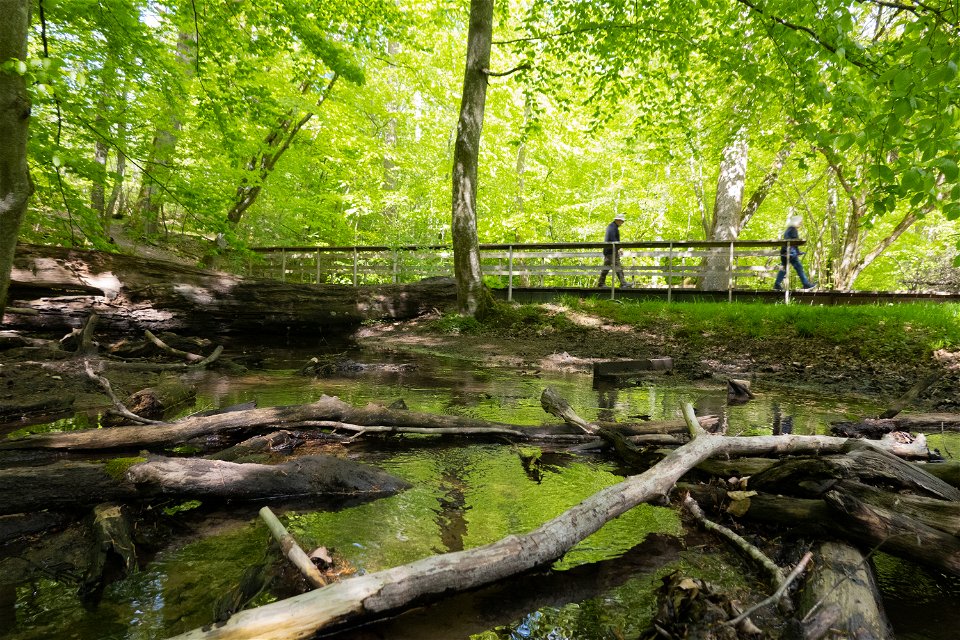
Dalby Söderskog is one of three national parks in Skåne and is Sweden´s smallest national park, cobering 36 hectares. Here you can take a walk om one of the trails, enjoy the birdsong, look at the majestic oaks or have lunch at one of the picnic areas in the woodland.
Dalby Söderskog is one of three national parks
in Skåne and a rarity in the landscape of this region. The woodland history of
the area has been documented since the Middle Ages and has historically been
used for collecting firewood, grazing and for hunting. Evidence from the past
can still be seen, such as in the form of an embankment that surrounds part of
the woodland. The embankment is visible all year round thanks to the fact that
it is kept free of vegetation. Most of the woodland has been left to develop with
only minimum intervention.
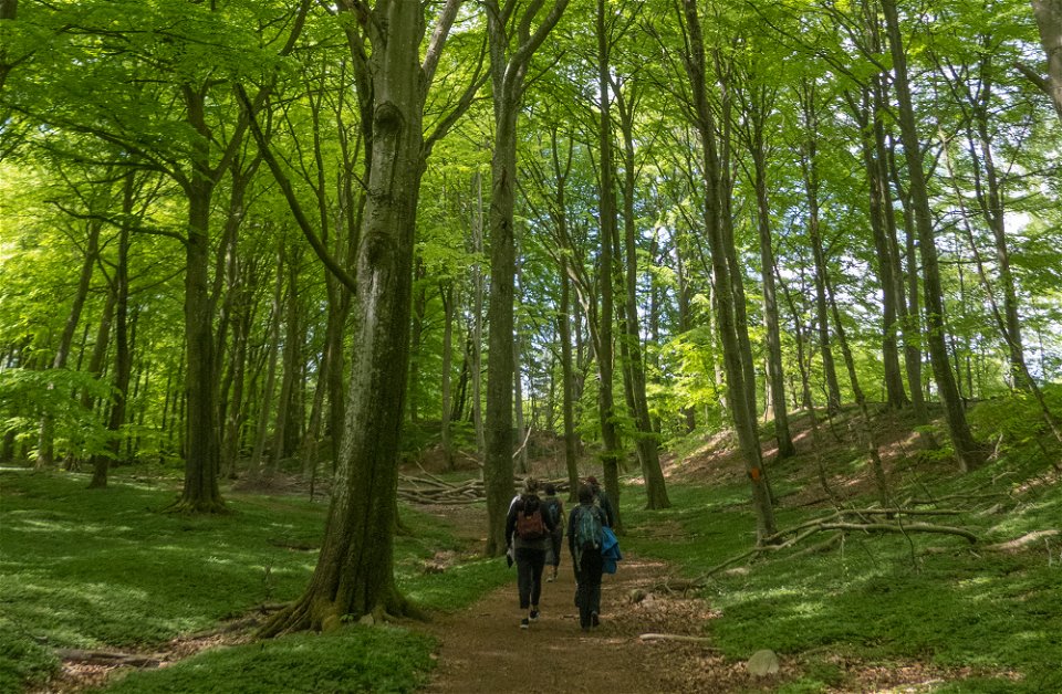
There are three waymarked trails in the
woodland: Kroppekärrsrundan Trail (2.3 km) takes you around the entire National
Park. On this route you will see both dense and more open parts of the woodland
and you will also reach the pasture area in the north-east (don’t forget to
take a walk out in the pasture for a look). Skryllestigen Trail (3.5 km) leads
you from Dalby Söderskog, through Dalby Norreskog Nature Reserve with pasture
and woodland and finally towards Skrylle Recreation Area. Bökebackeslingan Trail
(600 m) is surfaced with compacted stone dust, which makes it accessible for
wheelchairs. Be aware that the path slopes in some places, which means that
assistance with the wheelchair may be necessary.
There is a large car park in the southern part
of the National Park – the easiest way to reach it is to follow the signs for Dalby
Söderskog from Norrevångsvägen.
The National Park has its own bus stop, which
is naturally called Dalby Söderskog – you can search for connections here on Skånetrafiken’s
website or app. Another option is to travel to Dalby Bus Station and then walk
about 1.5 km to the National Park. By bike, the best way to get to the National
Park is the from the east via Dalby – which means you can avoid cycling along Norrevångsvägen,
although you do need to cross this road.
Knivsåsen
Knivsås-Borelund,
or just Knivsåsen as the area is often called, offers a varied landscape of
lush beech woodland, open pastures, and juniper wood pastures. In the southern
part of the Nature Reserve, Lovéns quarry is situated, often called Dalby
Quarry, which is now filled with water. At the quarry there are benches,
barbeque areas, dustbins, and toilets.
Knivsåsen (the
knife ridge) is named after its narrow, sharp crest and is one of several
hundred eskers in the area. In the eastern part, grazing animals keep the
landscape open, and up on the ridge in the centre of the Reserve, the juniper
wood pasture takes over, which is then replaced by beech woodland in the south-west.
Smaller areas of mixed broadleaved woodland can be found in the northern,
eastern, and western parts.
There are
several well-trodden paths in the area, and you can put together a nice walk
through all the landscape types. Section 13A of the SkåneledenTrail,
Skrylleslingan, also runs through the area.
Botanical
enthusiasts visit the rich fen in the early summer when several species of
orchid are in bloom. You do not have to be a botanist to appreciate when the
wood anemones flower in the woods and the protected pasqueflower blooms in
abundance on the ridge in the spring, while the yellowhammer sings its
characteristic song over the pastures: “a-little-bit-of-bread-and-no-cheeeeese……..”.
There are
three car parks around the area: one by the quarry in the south-west, on Borelundsvägen
in the north and on Veberödsvägen close to the Road 102.
The nearest
bus stop is called Knivsås and is located south of the area, about a 12 minute
walk from the entrance at the quarry.
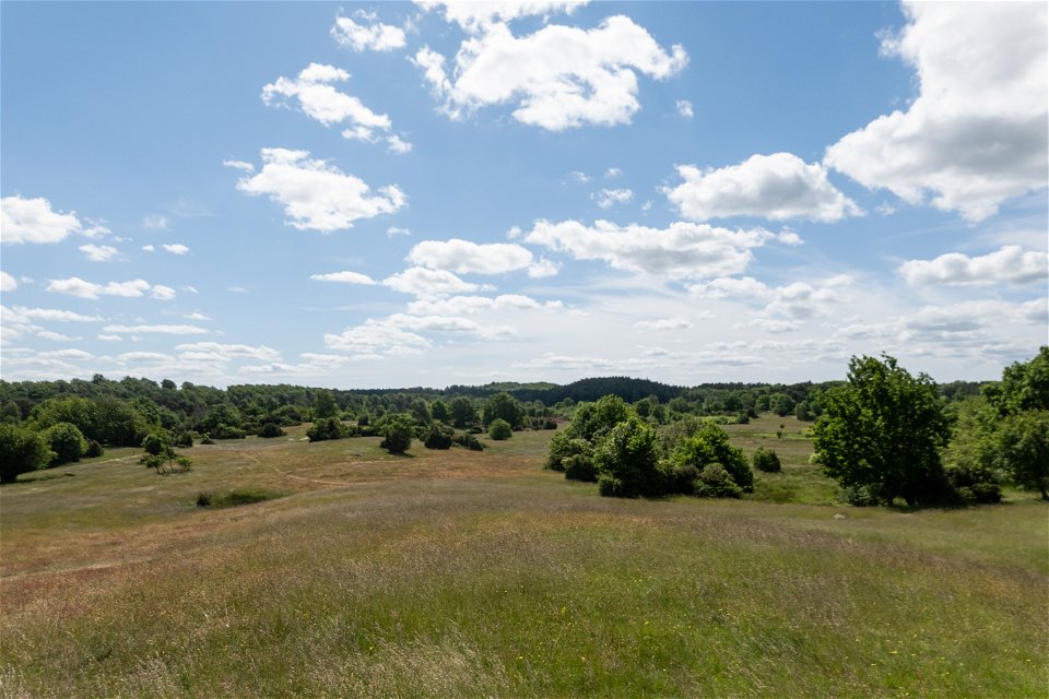
Risen
Right next
to Genarp is Risen Nature Reserve. The Reserve consists of pastures in the
eastern part and woodland in the west. To the south, the area borders
Häckeberga Nature Reserve.
For those
wanting to take a walk or a hike, there are several trails of varying length.
To make everyone feel welcome and safe, cycling and horseriding are only allowed
on the specially marked trails.
In Risen
Nature Reserve you will find many different types of habitats and it is
precisely this variety, which has led to the high biodiversity in the area. The
north-eastern part, closest to the car park at the Medborgahuset (town hall) in
Genarp, consists of open pastures. Here you can experience a splendid flowering
of, for example, the pasqueflower in spring. In addition to the species that
are common in pastures, you can find rarities such as the plant eyebright and
even the large blue butterfly has been found here. The western parts consist of
varied woodland where you can walk under the canopy of the trees and listen to
the sounds of different woodpeckers. Risen also has wetlands where you can find
several species of orchids.
If you take
your car to Risen, there are a few different parking options:
Medborgarhuset
in Genarp has a larger car park - from here you can enter the Reserve from the
pastures to the north.
Sandvägen -
here there is a smaller car park from which you can enter the wooded area of
Risen in the north-west.
In the
southern part, between Risen and Häckeberga-Skoggård, there is also a car park.
From here you can enter the southern wooded areas of the Reserve.
If you want
to take a longer walk, you can park at Ekevallen's sports ground - from here
you can follow the Skåneleden Trail to Risen.
The nearest
bus stop is Genarp Bus Station.
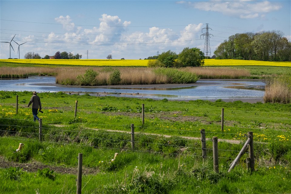
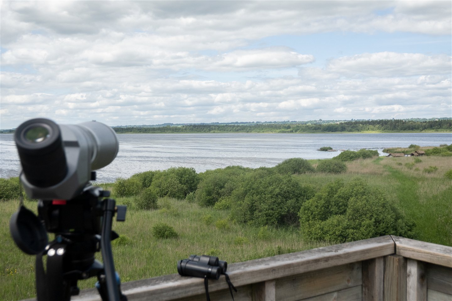
Krankesjön
Krankesjön is
a shallow lake in an agricultural landscape and is one of Skåne’s most
important bird lakes. Krankesjön offers good birdwatching all year round – a
large number of bird species nest here and during migration, many birds rest up
at the lake.
There are
two bird towers around the lake and a hide where you can comfortably stand or
sit with your binoculars (see the map).
At
Silvåkratornet bird tower, there is a car park – from here you can also reach
the boardwalk to the hide "Ivassen" (in the reeds). If you want to
get to the bird tower called Almen, the best place to park is at the Stensoffa Research
Station (about a 20 minute walk through the woods).
Skrylle
Skrylle is
one of Skåne’s most visited nature and recreation areas. There are several
running tracks, mountain bike trails, barbeque areas, an information centre
(Naturum), fishing ponds and several areas with activities for children. Naturum
Skrylle has activities for both children and adults.
On the Skrylle
website, you can read more about the area, check the upcoming activities or
book barbeque sites and shelters.
When Skrylle
became designated as a nature reserve in the early 1990s, the area was
dominated by coniferous woodland. Today, large parts of the area are still dark
spruce plantations, but the majority of these are gradually being converted to
broadleaved woodland, according to the long-term strategies outlined in the
management plan. This will result in lighter, more pleasant woodlands that will
eventually benefit both recreation and biodiversity.
If you need
to take your car to Skrylle, there are several car parks around the area - see
the map to find a suitable spot.
During
spring, summer, and autumn you can take the Naturbuss (line 159) to
Skryllegården and other places - the bus stops at several places around the
Skrylle area. When the Naturbuss stops running, you can take line 175 to the
Skrylle stop. On Skånetrafiken’s website or app you can search for a suitable
route.
Nöbbelövs mosse
Nöbbelövs Mosse
is an oasis close to the city for both people and wildlife. Here, birdwatchers
mix with those who want to take a walk or use one of the area’s barbeque spots.
There is also a cosy shelter by the western barbeque site.
Once down
by the mire (mosse), there are unmarked footpaths to follow – the route around
the mire itself makes for a 2 km walk, with the road to and from the car park
making the round trip just over 3 km.
Nöbbelövs Mosse
is one of Lund’s nature areas close to the city. The Nature Reserve attracts
both those who want to be fascinated by nature and those who want to take a
walk or use one of the barbeque areas. The area consists of meadows and
pastures, ponds, and wetlands, and thanks to the varied landscape it is has a
rich animal and plant life.
The Nature
Reserve is a well-known bird site and has long been a favourite with
birdwatchers. One of the typical birds for the area is the red-necked grebe – you
can see it diving for food in the ponds and hear its distinctive call in the
spring. Other bird species you may be lucky enough to see and hear include the marsh
warbler, reed bunting, and water rail. Waders such as ruff, wood sandpiper, and
snipe rest at the mire during the spring and autumn migrations to rest and feed
up for their migration.
If you take
the car, park in the car park which runs along the village road in Nöbbelöv in
the southern part of the Reserve. From the car park it is about 500 metres walk
down to the first pond where there is a picnic area, barbeque area, and a
shelter.
From Lund
you can reach the mire by both bicycle and public transport. The nearest bus
stops are Nöbbelövs kyrkoväg and Fornborgen, about 400 metres south or south-east
of the mire respectively.
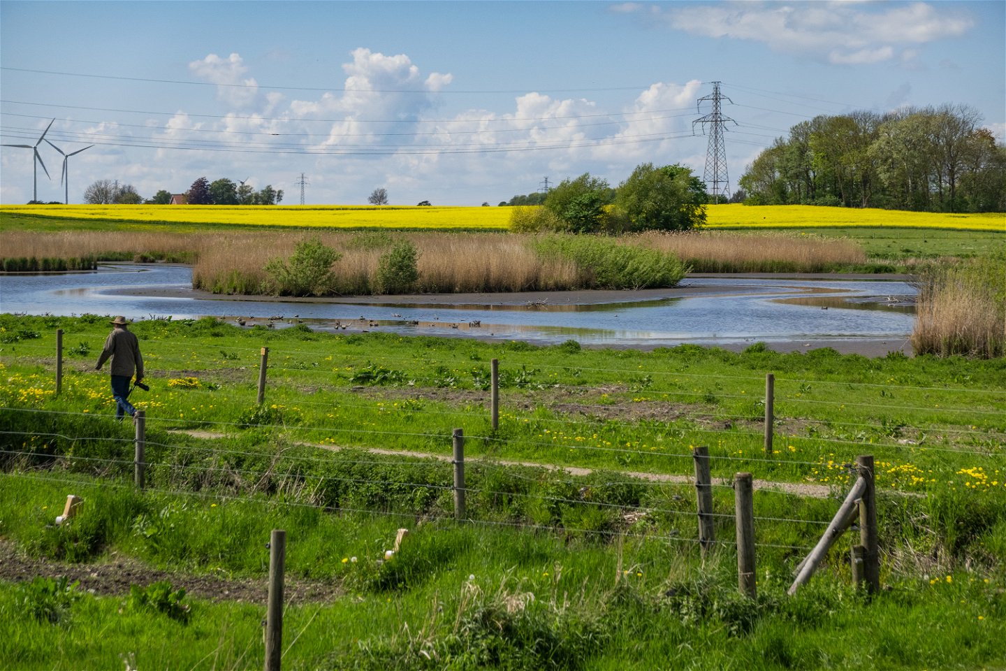
Höjeådalen
Between Värpinge
and St Lars, on the southern outskirts of Lund, lies Höjeådalen. The area
provides the residents of Lund, with the chance to get close to nature. Sea
trout migrate up the river to spawn and the treatment ponds, like the river,
contribute to a rich bird life.
The area
has several walking trails, a bird tower, picnic areas and several barbecue
sites.
The stretch
of the River Höje Å between St Hans and Värpinge is valuable not only for
recreation for the residents of Lund, but also for many bird species, all year
round. This has made the area popular with bird watchers. Here you are quite likely
to see species including grey wagtail, red-necked grebe and several species of
duck. The River Höje Å is also important for sea trout which migrates up the river
to spawn. The river and ponds also provide habitat for several species of frog,
dragonflies, and fish.
From the
bird tower, you can get a good view of the ponds. Below the tower, there are
also picnic areas with benches and tables. There are also several barbeque
places in the site – see the map for more information.
Höjeådalen is
easily reached by bike if you start from Lund. If you want to take the bus, you
can go to either Värpinge or St Lars and if you want to walk along the river,
you can easily get there and back from various stops.
Rinnebäcksravinen
When the
last ice sheet melted, the meltwater carved out the winding shape of the
Rinnebäcksravin. Historically, the ravine was used as a drove road to bring
grazing animals to and from the pastures. Today the area is used for recreation
and for enjoying nature, although visitors still have to share the site with
the grazing animals. Once down in the valley, it is easy to be transported back
to ancient times and enjoy the babbling sound of the water and the flowers on
the slopes.
The terrain
is steep and difficult to access, but the adjacent cycle path on the south side
and a mown grass strip on the north side allow most people to experience the
area's charm. For those descending into the valley itself, proper footwear is
recommended - after rain, welly boots or sturdy walking boots are recommended.
The
Rinnebäcksravinen is a remnant from historic grazing practices. The valley was
used for a long time as a drove road to bring grazing animals to and from the
pastures, and grazing has left its mark on the flora. The area is still grazed
today, maintaining the species composition of plants such as meadow saxifrage,
dwarf thistle, and spiny restharrow. The shrubs and trees are also typical of
historic pastures, with scattered specimens of crab apple, wild cherry,
hawthorn, and oak. This vegetation, in turn favours birds such as common
whitethroat and linnet. Parts of the site are dominated by nutrient-rich flora
including false oat grass, cock’s foot, common mouse-ear, and white clover.
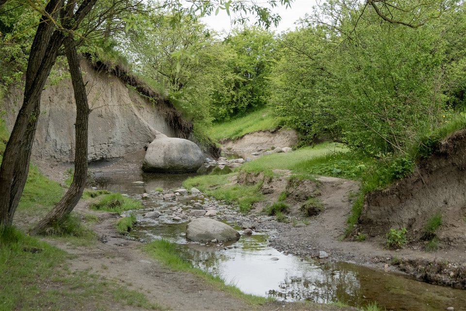
The area is
also of geological interest. Down in the ravine, clay-rich moraine is exposed
and kept visible by natural erosion - this is one of the few areas in Southwestern
Skåne where this type of material is naturally exposed.
The nearest
bus stops are Ministervägen and Excellensen.
Häckeberga
Häckeberga Nature
Reserve, together with several other reserves, forms a large, coherent nature
conservation area. In this Reserve, you will find, among other things,
species-rich woodlands and pastures, babbling brooks and an old ruin of a mill.
The Reserve has several walking trails, and the area is popular with mountain
bikers.
Both the
woodland and pastures in Häckeberga have very high nature conservation values.
Thanks to the old trees, the hermit beetle can be found in the area and the dry
pastures are home to rarities such as the little white bird’s-foot. The River Höje
Å runs through the Reserve and the tree-climbing common tree frog lives in a
pond next to the river.
Ekevallen
(Genarp’s sports ground) has a large car park if you choose to bring your car
here.
It is a
good place to start whether you want to walk, mountain bike or something else.
Trollskogen
Gryteskog’s
most famous visitor attraction, Trollskogen, is shared with Prästaskogen Nature
Reserve, which is right next door. The woodland is home to dwarf or twisted
beech, which, with their unique growth form easily capture the imagination. A
visit to Gryteskog can be combined with a visit to Prästaskogen and if you want
to go for a long walk, you can also walk the Skrylleslingan on the Skåneleden
Trail. Skrylleslingan is 15 km long and runs through several beautiful natural
and cultural environments and nature reserves.
Contact
Address
Visiting address: Brotorget 1, 221 00 Lund. Phone number: 046-359 50 00.
Civic Center in Lund
Email address
Medborgarcenter Lunds kommun
