Images
-
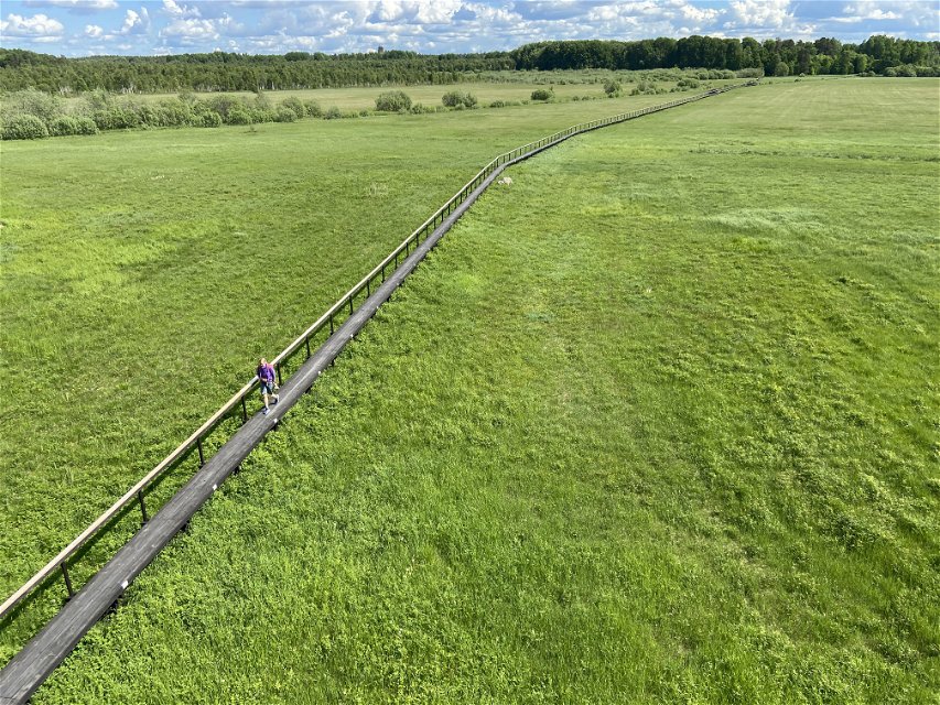
Kyrkspången

8. Skekarsbo-Nora Church, 9,5 kilometres
Suitable for: Those who are looking for a stretch with plenty of cultural history, or those who want to take a shorter two-day hike with children.
Distance: 9.5 kilometres Start: Skekarsbo End: Nora Church Facilities: Shelter with fireplace at Skekarsbo, Messkog, Ӧsterbo and Hagudden. Break and overnight cottage by Ӧsterbo Fäbodar, bird tower at Ӧsterbo Water: Pump at Ӧsterbo Fäbodar, available all year round, drinkable but infrequent testing Terrain: Forest paths, gravel roads, footbridges Nature type: Coniferous forests, bogs, farmland
People used to walk this route on their way to the churches in Nora and Tärnsjö, which is why the stretch is also called the ‘Tärnsjö Church Path’. It’s an easy-to-walk stretch that will take you through a historical landscape that people have farmed for a very long time. Don’t miss the 700-metres-long footbridge across the Nordmyran bog.
If you’d like to turn the hike into a two-day one, with two brief day stretches, you can. The stretch is suitable for families, as there are many exciting places to explore along the way. You can stay the night at Ӧsterbo Fäbodar. There is one cottage that can be rented, one open cottage, a shelter, and nice surfaces if you want to pitch a tent.
Part of the Upplandsleden Trail: Section 19
Find it Skekarsbo is located by the River Dalälven in north-western Uppland.
By car: To reach Skekarsbo, drive into Tärnsjö, and follow the main street (Storgatan) northward. At the edge of the town, turn towards Gäddsjö. From here, there are signs towards Kyrkstigen (the church path) and Skekarsbo.
By bus: There is no public transport to the start at Skekarsbo. There is a bus from the centre of Tärnsjö. The town centre is 500 metres from the end of the stretch by Nora Church.
Categories
-
 Hiking
Contact
Email address
Upplandsstiftelsen
Organization logotype
![]()