-

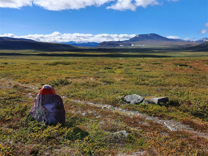
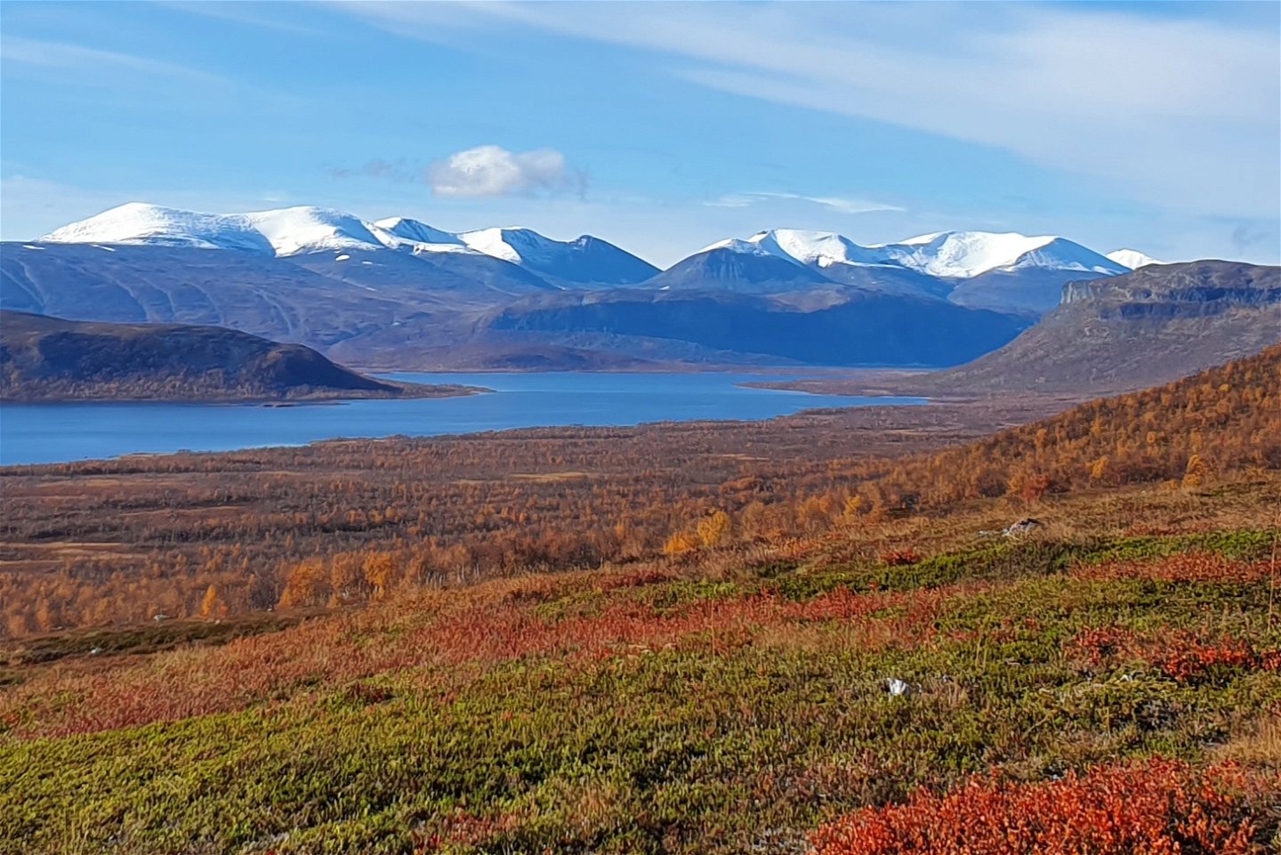
Sjön Vuolep Kaitumjärvi med toppar som Kårsatjåkka (1 703 m ö.h.) i bakgrunden. -

Paittasjärvi -
-
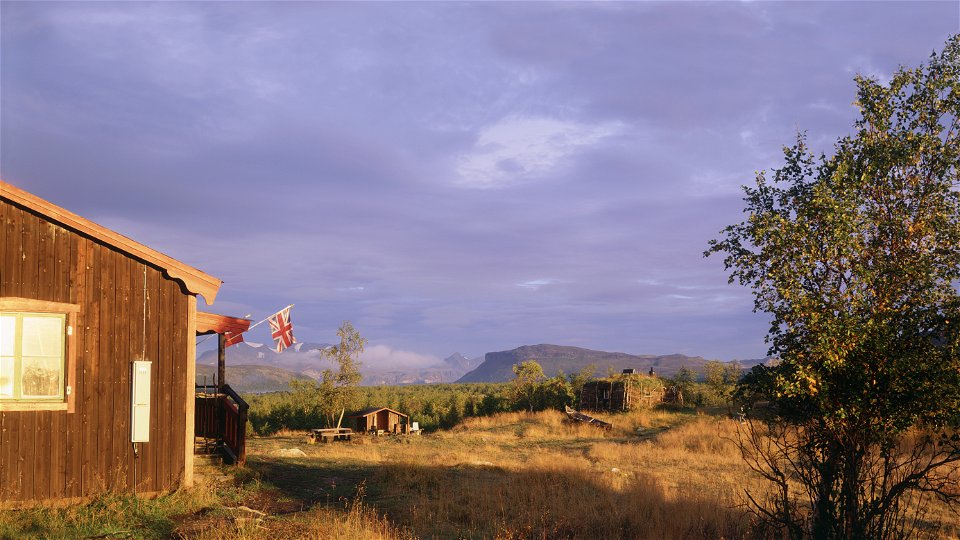
Photo: Tomas Utsi -
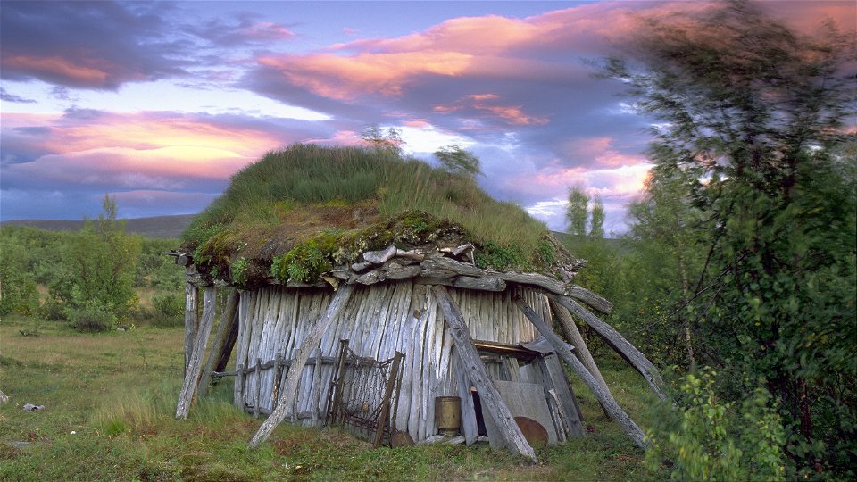
Photo: Tomas Utsi


Borrásgorsa/Pårraskårsa-Tjuonajåkk
Hiking
- County: Länsstyrelsen Norrbottens län
- 6418.71 km away from you
Trail details
- Length 27.0 km
- Time 11 h 30 min
Actions
Description
The route takes you through an unspoiled, easily-hiked and beautiful area offering a vast panorama in clear weather. You will not be meeting many other hikers here. Much of the trail crosses a high plateau at 750–900 metres above sea level. The plateau is exposed to the elements and it is important to have suitable clothing and equipment. The trail is however well marked and the summer and winter trails mostly run parallel. There are no overnight cabins, so the tour requires a tent.
Borrásgorsa-Vuoktajohka, 15 km
The climb becomes increasingly steep through the birch forest towards the mountain plateau around an elevation of 900 m. The wide trail is easy to hike and is well marked. After just over a kilometre, the mountain birch forest becomes sparser and you climb above the tree line at 700 m above sea level. Look back! The view south is powerful, overlooking Lake Paittasjärvi and on into Visttasvággi valley.
The hike continues steeply upwards, but after just over 1 km, at 850 above sea level, the incline becomes less steep. The view is still magnificent and now also includes a glimpse of the deep Borrásgorsa ravine on the right. Soon you will have reached the top of the long slope and what waits now is a fantastically pleasant stretch across easily-hiked ground down towards the suspension bridge across Girjásjohka stream. The mountain summits in the west are wonderful to see.
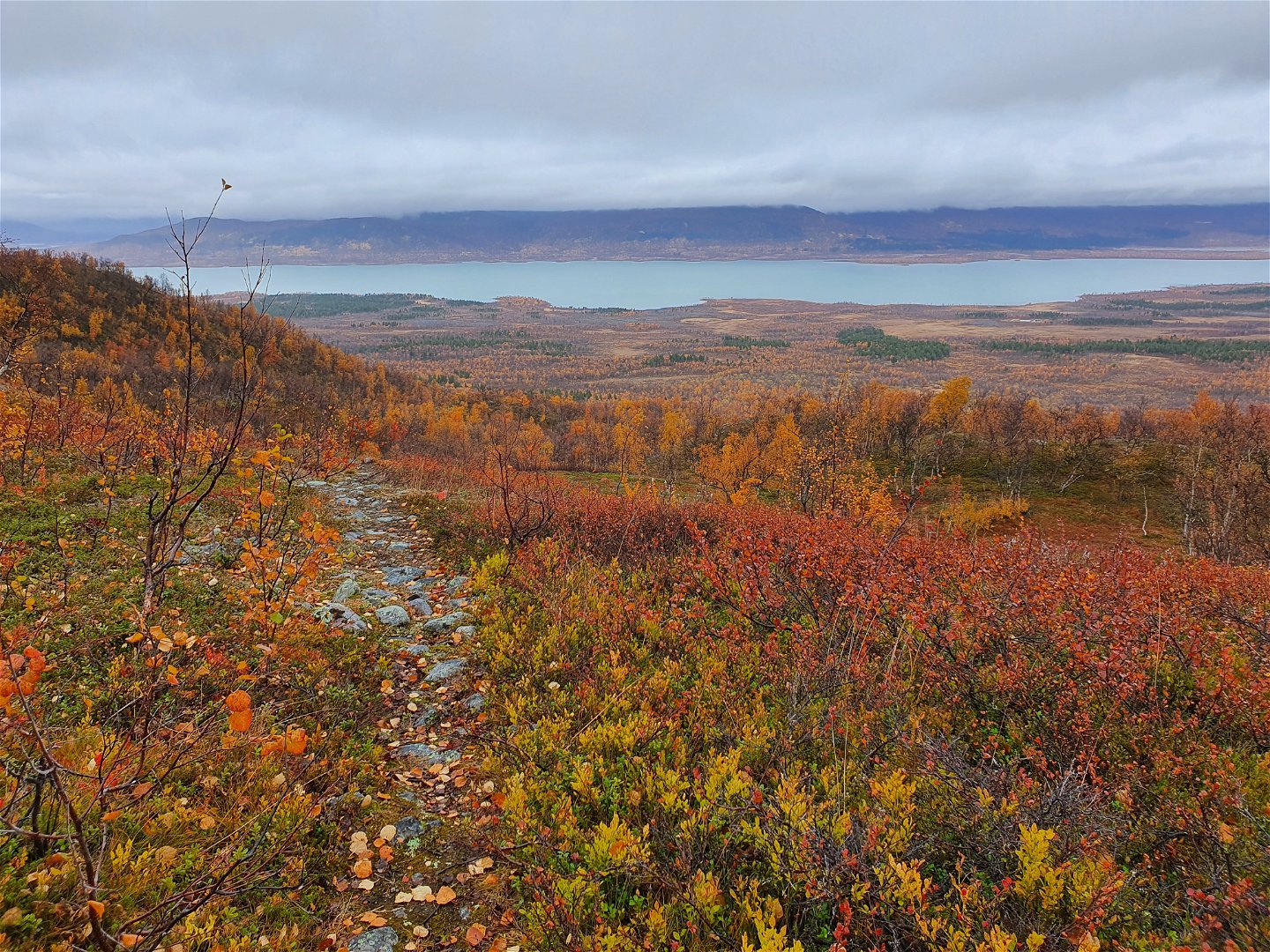
After the suspension bridge comes a fairly long stretch of osier undergrowth and waterlogged ground. The plankways are incomplete in places. It can be slippery, so be careful. However, it is not difficult to find your way because the winter trail cross-markings follow the summer trail.
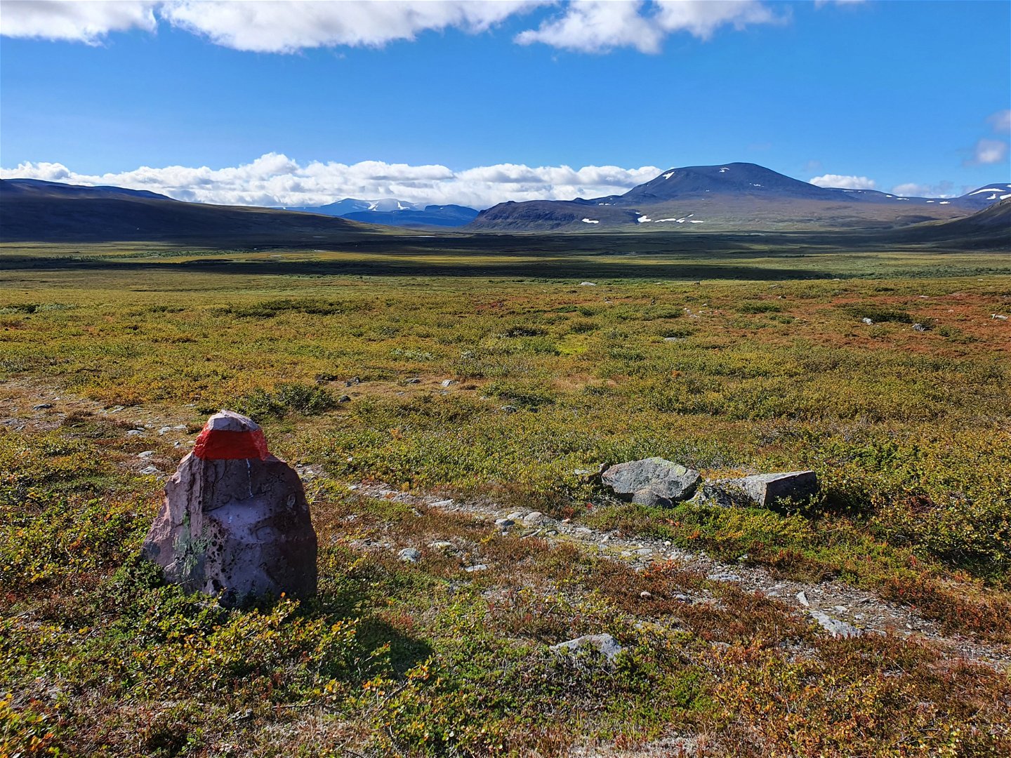
After the wetland area, the trail gains 150 m in elevation and reaches Skuolliláhku plain. The views are enjoyable and the hiking is easy on even ground and you reach a stream that requires a short, simple wade. After the stream, the plain is rocky and boulder strewn. On the downhill slope just under 1 km before the rest cabin at Vuoktajohka stream, the summer and winter trails go different ways. In poor weather, the summer trail can be difficult to follow on the upper parts of the hill. The trail is indistinct and the red-painted stones can be difficult to see in fog. One tip can be instead to follow the cross-marked winter trail.
The rest cabin is beautifully situated at the stream, and there are good tent pitches in the surroundings.
Vuoktajohka-Tjuonajåkk, 12 km
Right after the rest cabin a small stream is waded. After a further couple of hundred metres you cross a somewhat bigger stream with a wade that needs planning if the water is high. The trail climbs slowly up towards a plane with several lakes and wet stretches. The trail follows the east side of a large wetland, where there are no plankways. Up on a plateau you then reached the highest point of the trail, 960 metres above sea level. Now the fells in the south begin to become visible, above all the view of the Kebnekaise massif and the mountains in the west is stunning. There is little drinking water to be found on the plateau, so fill your water bottle before you begin the climb after the rest cabin.
The downhill hike towards the hollow between the mountains Rovás and Guovdaoaivi is wonderful. But down in the hollow await stretches of waterlogged ground and low osier shrubbery. The plankways are old and in places both broken and slippery. Sometimes the path is invisible – it is evident that few hikers pass this area. However, the trail is clearly marked with red paint on the rocks.
And now the view of Lake Vuolip Kaitumjaure opens up! The 3 km long downhill slope to Tjuonajåkk begins. It is a gorgeously scenic downhill hike against the backdrop of the mountain summits in Sjaunja/Sjávnja Nature Reserve. Soon after you reach the mountain birch forest, the summer and winter trails go different ways. Follow the trail to the southwest (left). Just after passing a stream just under a kilometre before Tjuonajåkk, you past an ancient Sámi settlement with goahti hut sites and a storage structure. The settlement lies to the left of the trail a little way into the mountain birch forest.
After you pass a reindeer fence that has wooden barriers you arrive at Tjuonajåkk. Tjuonajåkk contains an angling camp that only offers pre-booked angling packages and is not open to hikers. From here you hike the same way back to Borrásgorsa and on to Nikkaluokta.
Activities And Facilities
-
Hiking
Surface
Mostly easy-to-hike moorland, with stretches of plankway across stretches of waterlogged ground.
Communications
No boat transport can be booked from Tjuonajåkk along the Kaitum river, but you can book helicopter transport to or from the angling camp. Remember that there is no mobile coverage in the area, so transport must be booked in advance.
Contact
Email address
Länsstyrelsen Norrbotten
Organization logotype
![]()
Questions & Answers
Ask a question to other Naturkartan users.