


Fagersta — Landsbergstriangeln (the Landsberg Triangle)
Hiking
- County: Trails of Västmanland
- 6696.32 km away from you
Trail details
- Length 16.0 km
- Difficulty Red - demanding
Actions
Currently
På grund av att en damm har brustit vid Sågsjön så finns det ingen broövergång kvar på platsen. Var försiktiga vid passage på den av allmänheten upprättade övergången.
Description
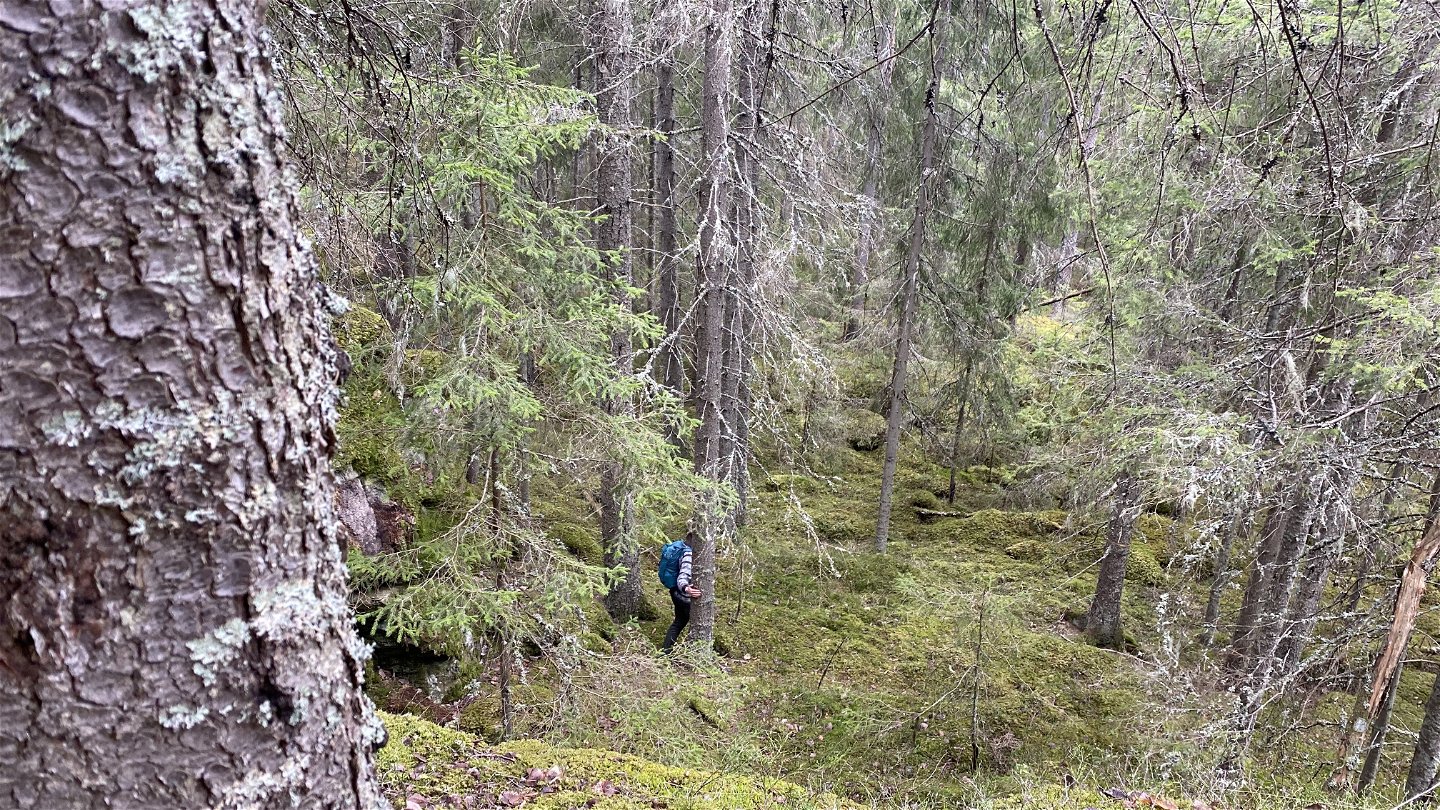
Caves from the ice age, dreamy forests, and magnificent views
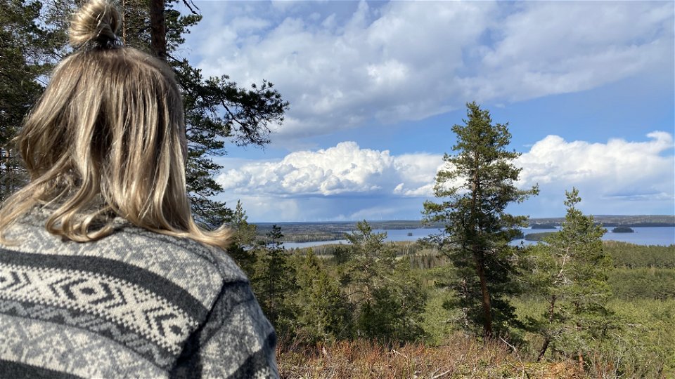
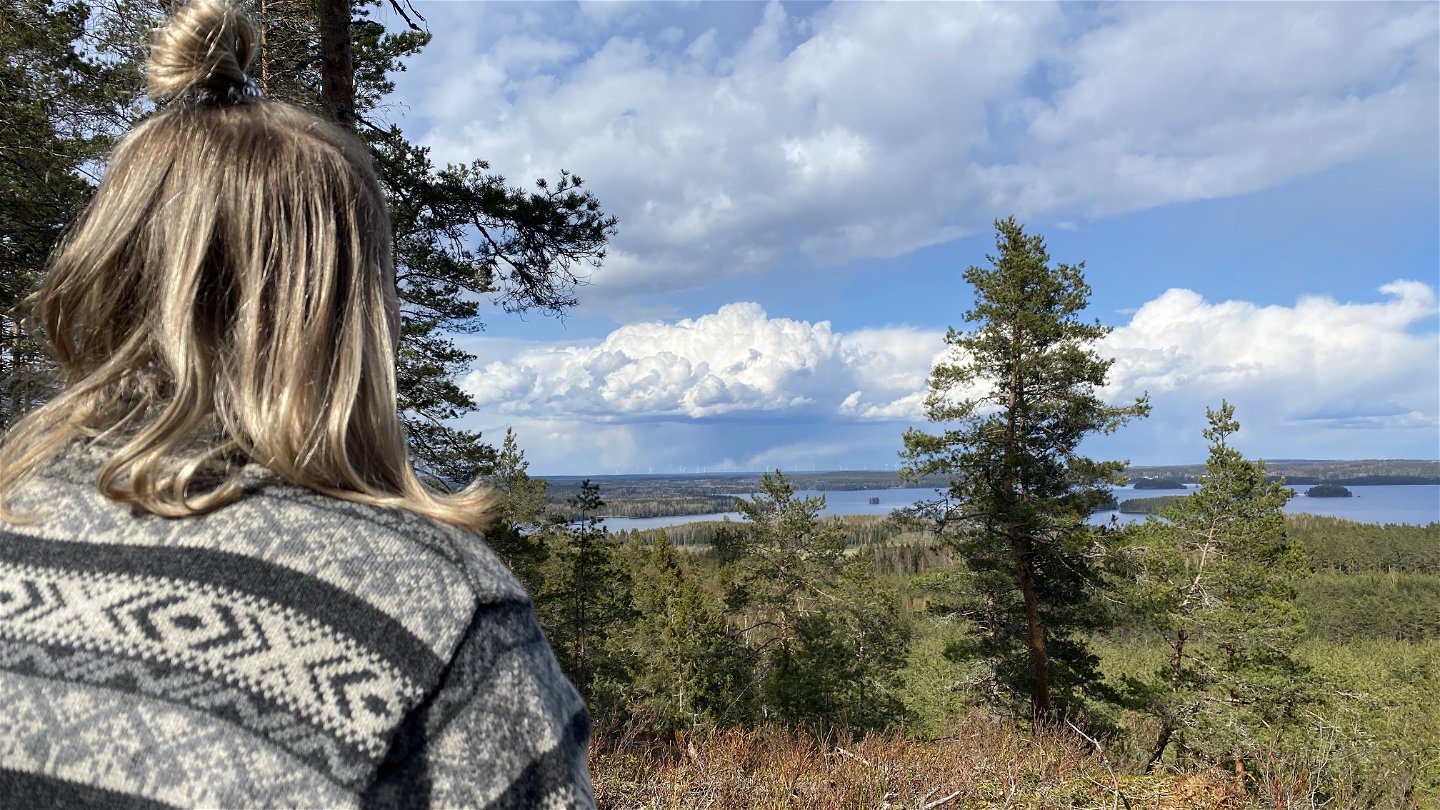
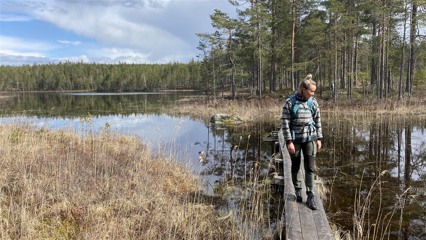
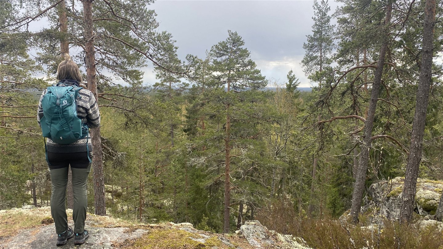
The very popular Landsbergstriangeln (the Landsberg Triangle) hiking trail is a 16-km route that includes sections of the famous (and much longer) Bruksleden hiking trail. It leads through a dreamy forest and along beautiful lakes and streams. Remnants of iron mines and foundries from hundreds of years ago line the path and add a sense of wonder. A detour down the short Issjöstigen trail leads to a beautiful canyon and impressive talus caves formed by ice age glaciers. It’s well worth the extra kilometre! But the big highlight is, of course, Landsberget hill with its magnificent view of the area — with the best spot for views at a scenic overview 300 m from the main trail down the Issjöstigen trail and lower Landsberget parking area.
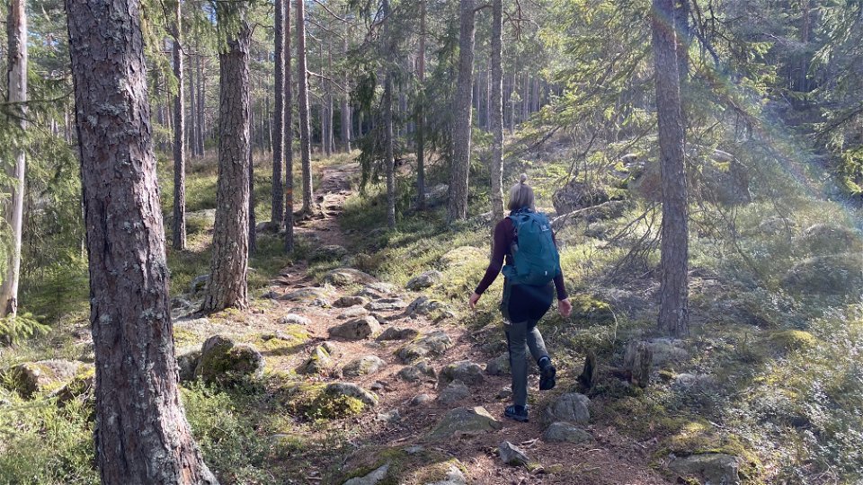
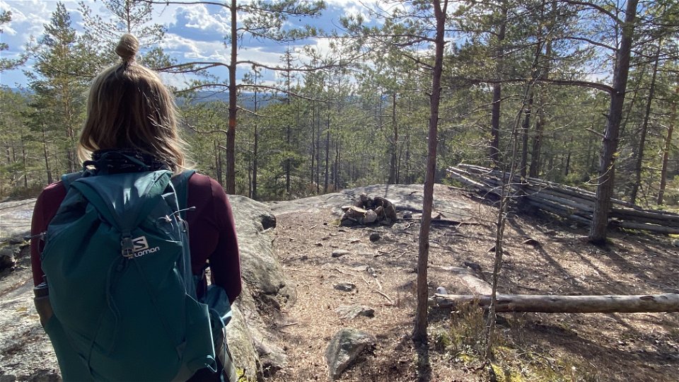
The Landsberget Triangle is a well-marked trail that’s very easy to follow. Trailheads with maps are located at the upper Landsberget parking area and the Trummelsberg parking area. The route mainly runs along natural forest paths with some rocks and roots throughout. The terrain is hilly in some stages, especially around Landsberget hill. Walkways and bridges allow hikers to safely cross over water and marshy ground. For overnight stays, there’s a wind shelter with a fire pit at the top of Landsberget hill and a small cabin with a firepit at Stora Trehörningen lake. There are also many spots to rest and take a break around the lakes and at various lookout points. The whole hike takes 5-6 hours, depending on the number of breaks.
Hikers can begin the Landsberg Triangle at the parking lot next to the historic Trummelsberg iron foundry, as well as the upper or lower parking areas north of Landsberget hill. Once at a trailhead, hikers can choose to go along the trail clockwise or counterclockwise. The small detour down the Issjöstigen trail is well worth a visit, and there are markings to find the path along the main trail around Landsberget hill. Issjöstigen trail is about 500 m long and extends from an intersection on the main trail that’s 150 m northwest of the top of Landsberget’s hill and then runs down to the path between the top of Landsberget hill and the lower parking area.
Any trip to the Landsberg Triangle will naturally entice you to make an extended visit to the surrounding area. In nearby Fagersta, there are several nice cafes and eateries, options for accommodation, and, of course, a large selection of outdoor activities. Feel free to visit the municipality's website for more information about what you can experience and do in Fagersta.
Activities And Facilities
-
Hiking
-
 Trail running
-
 Circular trail
Facts
Because a dam has burst at lake Sågsjön, there is no bridge crossing the lake at the site. Use caution when walking over the crossing, built by the public.
If you come to Trummelsberg by car and want to continue towards Bockhammar/Skinnskatteberg, you can do so, as usual it is general traffic sense that prevails. It is also possible to get to the barbecue and swimming areas in Trummelsberg.
Be attentive to the prevailing conditions, surroundings and residents in the area.
Surface
Natural forest paths with some roots and stones with some hilly terrain.
Parking
At Landsberget hill, there are two parking lots, the upper and the lower.
Parking is also available at the historic iron foundry at Trummelsberg.
Communications
Directions
Parking is available at Landsberget hill or the Trummelsberg historic iron foundry.
At Landsberget hill, there are two parking lots, the upper and the lower. These can be reached via the exit to Landsberget from highway 66, about 10 km south of Fagersta. Follow the exit road for about 500 m for the lower car park and about 1.5 km to the upper car park.
The parking lot at Trummelsberg can be reached at the exit onto Trummelsbergsvägen road from highway 66, about 14 km south of Fagersta. Follow the gravel road for 4.5 km until you reach the parking lot in the old foundry area.
Regulations
Please be attentive of "Allemansrätten" - the Swedish right of public access. You can read more about your rights and obligations when in the Swedish nature on Visit Swedens website HERE.
Please be attentive to prevailing conditions, surroundings, and residents of the area. Exercise caution and comply with any instructions from local authorities, such as prohibiting the use of campfires or barbeques for example.
Downloads
Contact
Email address
Questions & Answers
Ask a question to other Naturkartan users.
