-

-

-
-
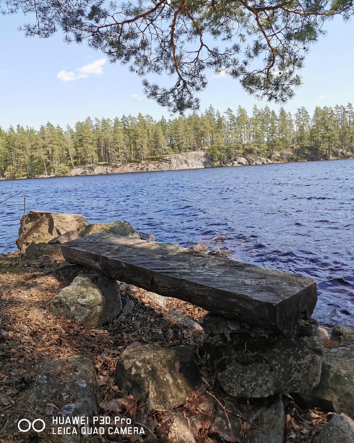
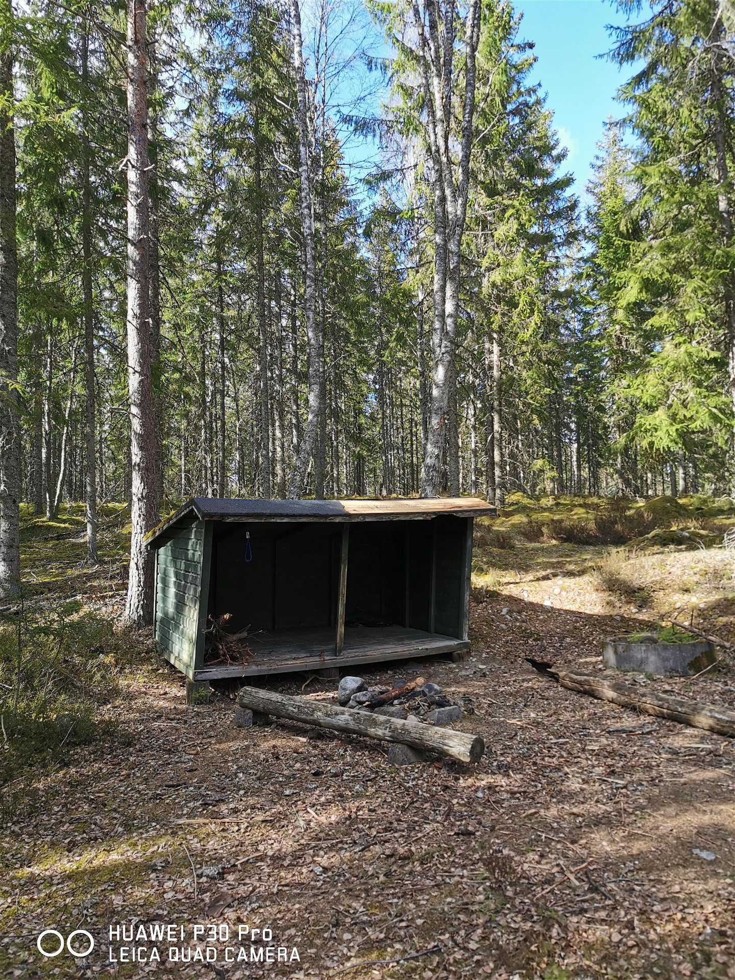
Kolvesjös rastplats -
-
-


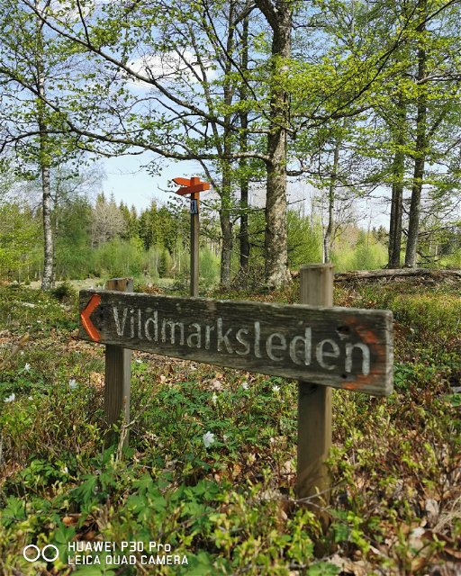
The wilderness hike (Vildmarksleden)
Hiking
- County: Uppvidinge municipality
- 6495.04 km away from you
Trail details
- Length 37.0 km
- Difficulty Red - demanding
Actions
Description
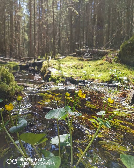
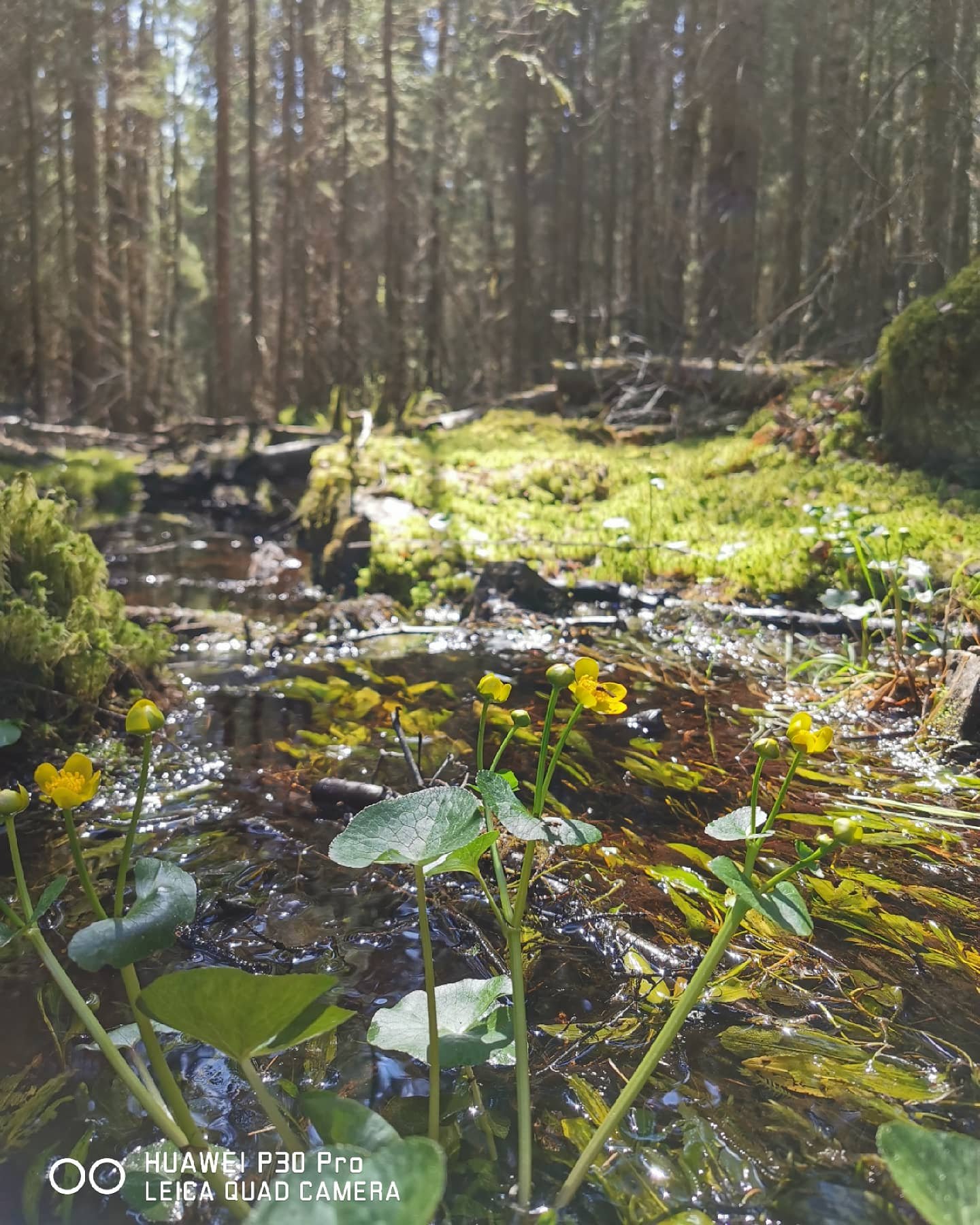
Vildmarksleden (roughly translates to “The wilderness hike”) goes on small forests paths and gravel roads. The hiking trail is 37 km long and goes in a circular from Norrhult in the south to Lindshammar in the north. The hike gives you a sample of all the different nature types you can find in Uppvidinge. There is marshes, deep woods, open meadows, and fields. During the hike will you also pass through several nature reserves with different types of protected nature.
Klavreström - Kolvesjö 13 kilometres
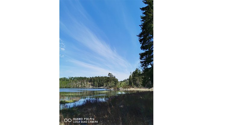
If you start your hike on Vildmarksleden in Klavreström will you begin with passing over Mörrumsån and pass by the old mill. After a 45 minutes hike will you reach the nature reserve Libbhult’s ängar. The path goes through the nature reserves meadows that are rich with flowers and insects. After a short walk through the woods can you catch a glimpse of Änghultasjön through the trees. The area is home to different birds like European green woodpecker, mistle thrush and wren. By the lake Änghultasjön can you if you're lucky see osprey and white-tailed eagle.
After almost 3 kilometres walk next to Änghultasjön will the path lead unto a gravel road and head towards Evemossen and sparse pine forest. The path the continues into Getaryggarna’s nature reserve. This is a part where the hike gets a little challenging. The hike up on Getaryggarna is partially quite steep, but the view at the top makes it all worth it! This is a perfect stop for eating lunch or drinking your coffee. The rest of the hike in Getaryggarna’s nature reserve makes you think of Astrid Lindgren’s book Ronia, the Robber's Daughter (Ronja Rövardotter). This area is also rich with wildlife.
After Getaryggarna’s nature reserve will you head towards the Zipline where there is plenty to do. The hike then continues north to Vargöl and Kolvesjö.
Kolvesjö - Lindshammar 5,5 kilometres
From the rest area at Kolvesjö will you go up on a height with nice views over Kolvesjö. After about 30 minutes hike through the woods will you reach a gravel road with drug eyebright (Euphrasia stricta) next to the road. After another 20 minutes can you catch a glimpse of the torp Dalen to your right before the path turns left towards Kulla. If you want can you take a break at the rest area next to Hedasjön. The hike the continues with another climb, but this one’s easier than Getaryggarna! After about 30 minutes will the landscape open and you’ve reached the beautiful villages of Kulla and Björnhult. Then is it mostly downhill until you reach Lindshammar. The old glasswork from 1905 is no longer in use but during the summer can you stay at Sergel B&B or just enjoy a cup of coffee before you continue your hike.
Lindshammar - Horshaga 10,4 kilometres
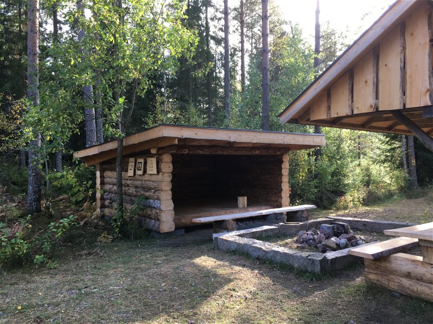
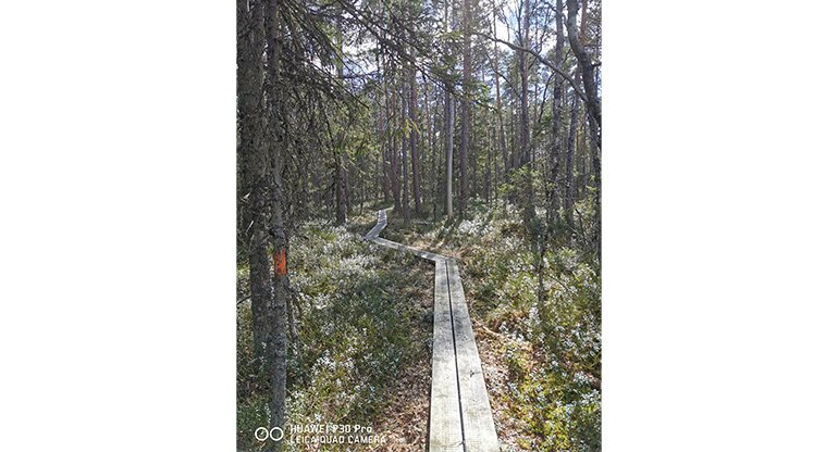
The section between Lindshammar and Horshaga starts with crossing the road and then going uphill. The path goes through a deep pine forest and passes by a big stone wall. Listen and might be able to hear, or maybe see, the great spotted woodpecker (Dendrocopos major). You'll then reach Sissebäck where the path heads south. After about 40-60 minutes hike the path takes a turn onto a small forest path. After about 2 kilometres does intersect with the bigger road that goes to Ösjöbol. Turn left and follow the road for 75 meters and then continue into the woods again. This part of the path is a bit tricky to follow so check often that you're on the right path (look for the markings!). You'll soon reach Svartegöl which is an area that are rich with birds. Keep walking and you'll soon pass Burlagga rest place. Here is a wind shield and a fireplace you can use for resting or staying overnight. The path then turns southwest and passes over the mire on wooden footbridges towards Horshagaflyet och Horshagasjön
Horshaga - Klavreström 8 kilometres
After Horshagasjön will you hike on gravel roads for a while. You'll pass Modala and Jonemåla with impressive stonewalls and interesting flora. The section of the path from Jonemåla to road 28 goes both through the woods on smaller paths but also on gravel roads and forest roads. After you’ve crossed road 28 will you reach the small village Erikslund. The path passes some fields and meadows before it, for one last time, continues into the woods. After about 1 km the forest will open up again and you’ve reached Uppvidinge golf course. Now is it only a short walk and you're back in Klavreström!
Activities And Facilities
-
 Biking
-
Hiking
-
 Circular trail
-
 Culture trail
Surface
Woods paths, gravel roads
Vegetation
Varying: woods, mires, meadows
Communications
There is buses that goes to Norrhult/Klavreström from nearby bigger communities.
Directions
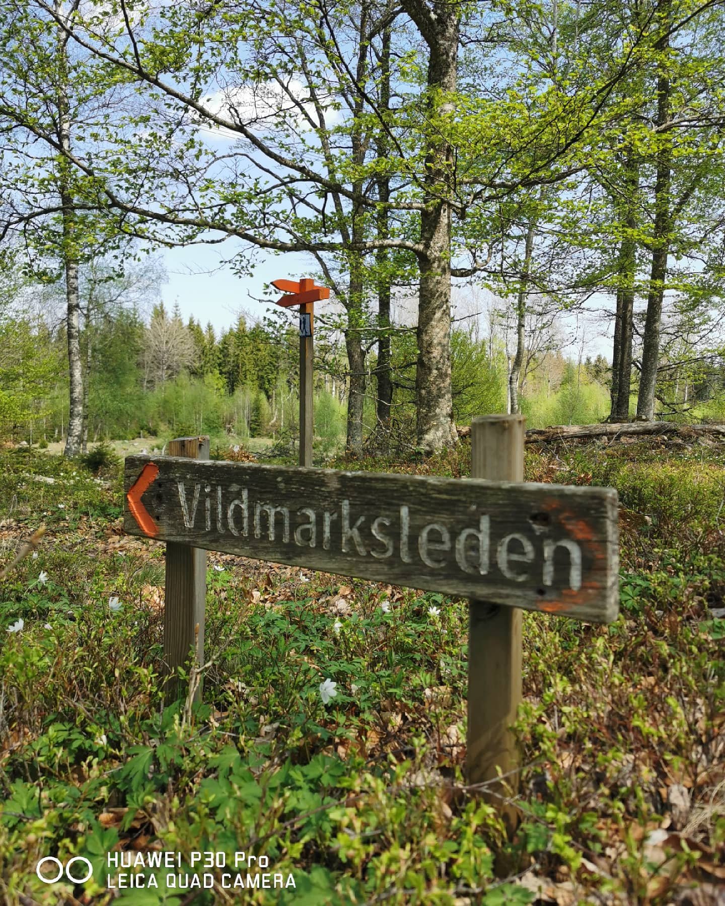
Vildmarksleden is marked on Uppvidinge's map that's for sale in e.g. the reception of the municipality house in Åseda. The path is also marked with signs and orange markings on trees.
Contact
Email address
Kultur- och fritidsavdelningen i Uppvidinge kommun
Questions & Answers
Ask a question to other Naturkartan users.
