-

Photo: Frida Björkelid -

Photo: Per-Anders Blomqvist -
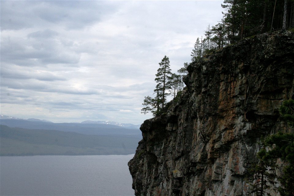
Photo: Per-Anders Blomqvist -
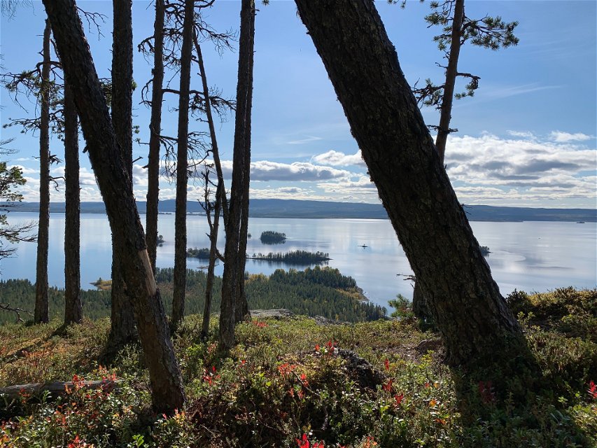
Photo: Frida Björkelid

Kyrkberget
Nature reserve
- County: Västerbottens län
- 7381.31 km away from you
Actions
Currently
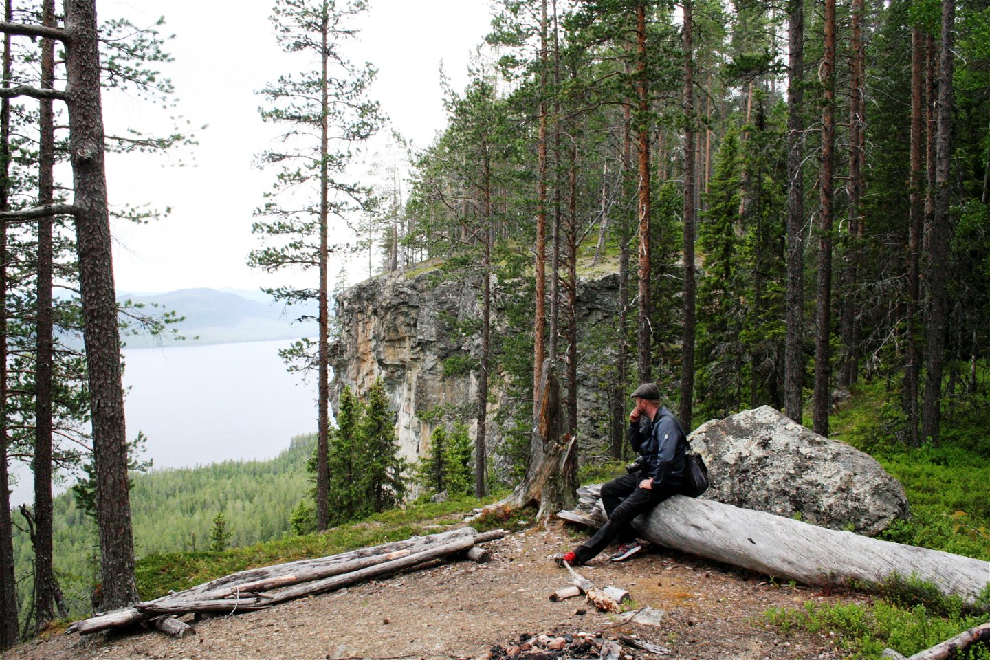
The trail and fire pit are very close to the cliff. Be careful and keep an eye on your children.
Description
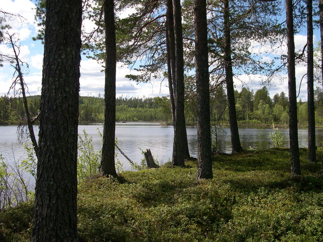
The old men of the spruce forest can be found there. They are covered with lichens and their beards flutter in the wind. Some of them are old and grey. And some have fallen to the ground.
You may catch a slight aroma of liquorice. This is the Haploporus odorus, which can be smelt at a distance of more than 10 metres. In open areas, tall plants such as the alpine sow-thistle and the wolfsbane rise up. The wolfsbane is one of Sweden’s most poisonous plants, by the way. The pines spread out in drier areas, some as much as 300 years old. Many of the pines and spruces bear traces of fires in times past.
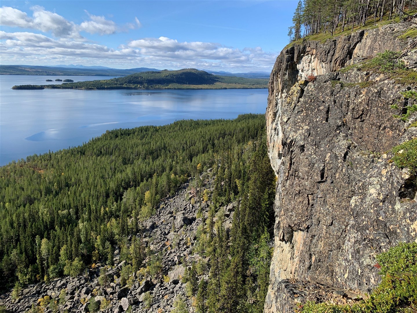
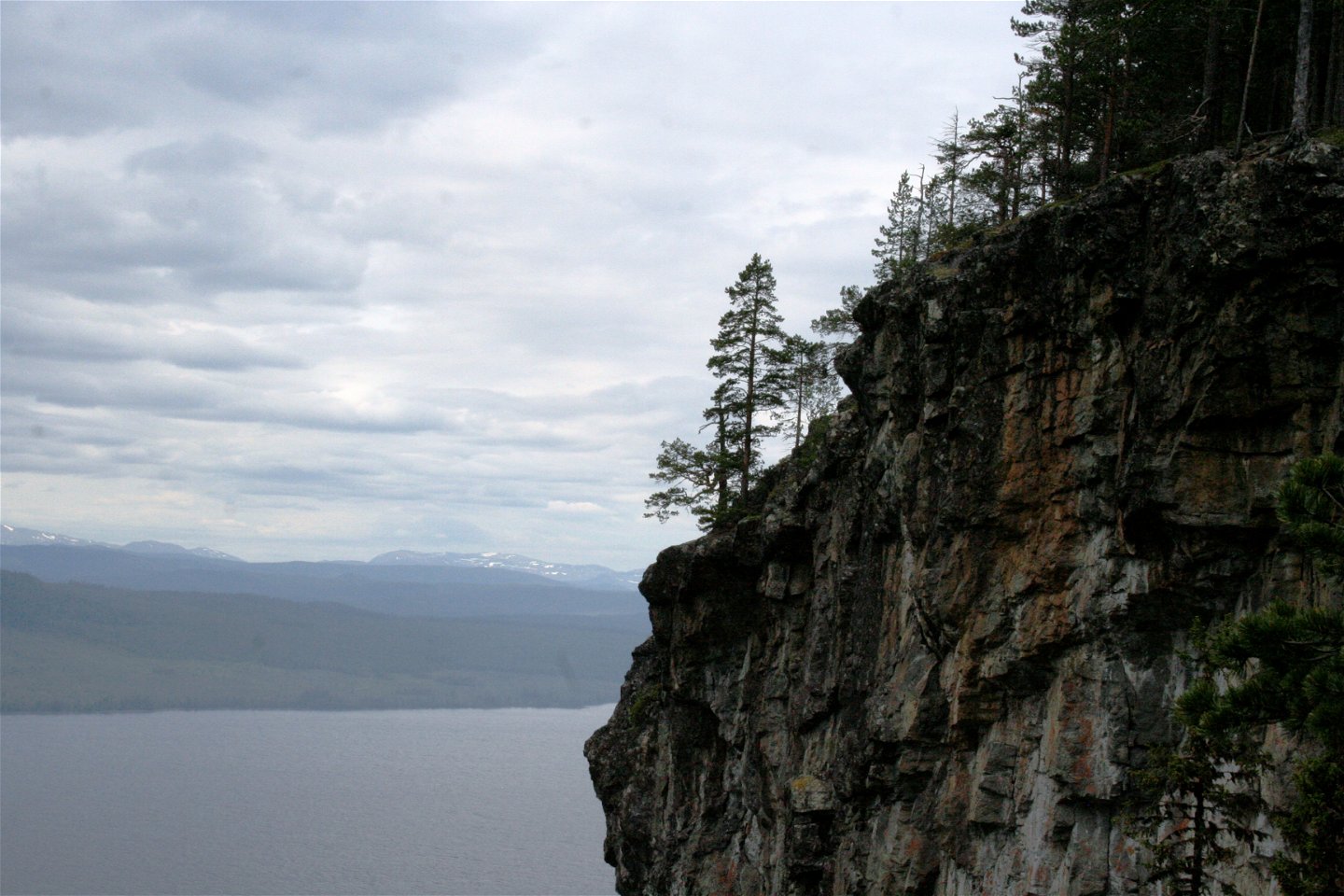
The precipice
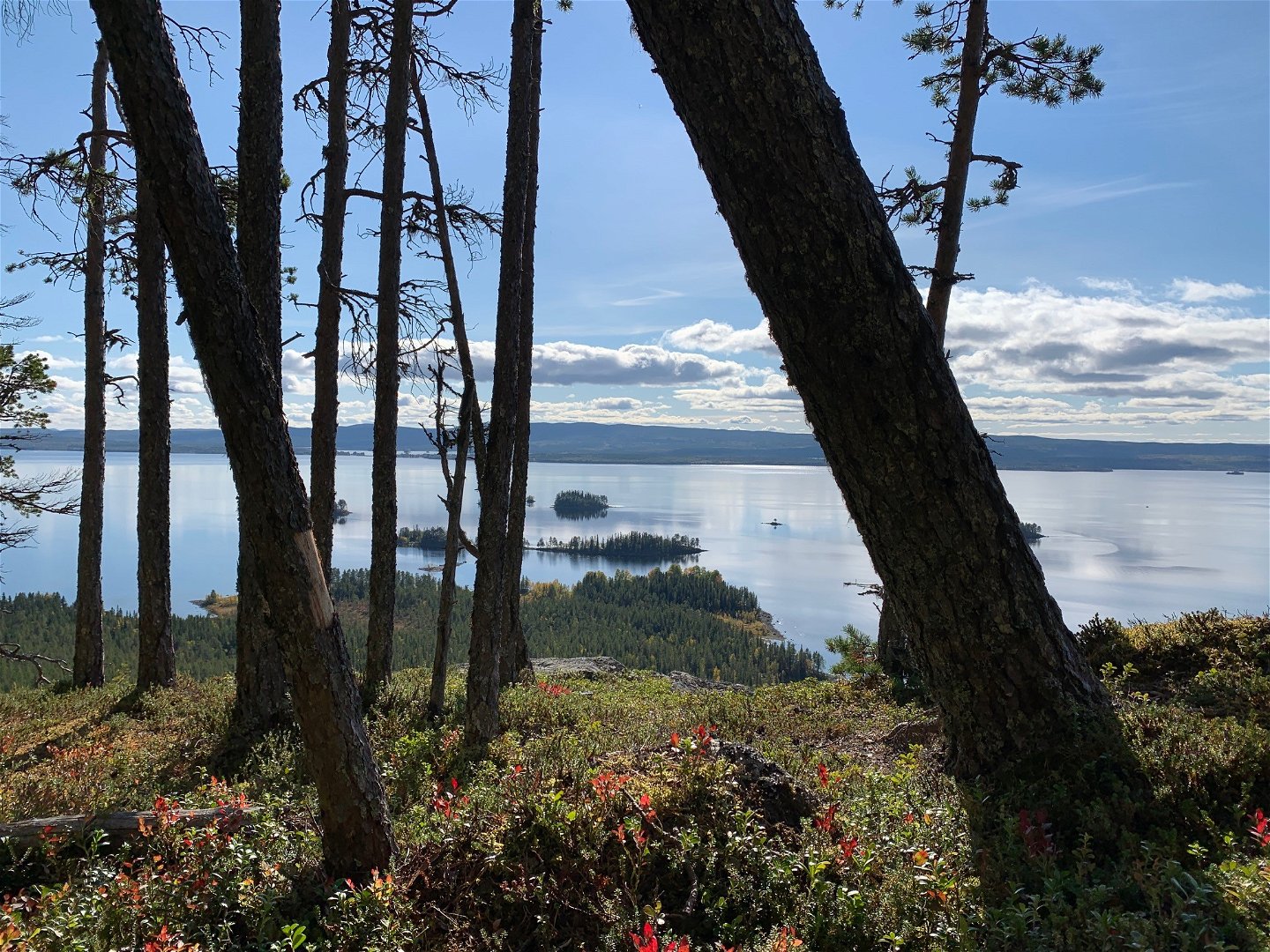
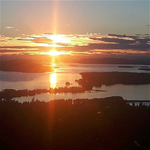
The steep mountain is clearly visible for the town of Storuman, and is something of a landmark on the Umeälven river. The feeling by the steep precipice is dizzying. This is where the mountain chain finishes – or starts, for that matter.
Kyrkberget is the final outpost before the landscape changes into hills and forests. Some of the mountain chain’s only fossils have been found here, hidden away in the mountain’s walls. The mountain not only offers extensive views, but also good habitats for plants and a challenge for climbers. Climbing is allowed on some of the mountain’s cliffs.
Southern mountain plants
It can become warm below the cliff when the sun shines on the mountain. Many southerly species flourish at the foot of the mountain. The beautiful yet poisonous February daphne flowers on bare branches in early May. Other plants that thrive here include the enchanter's nightshade and the deflexed bur forget-me-not.
Activities And Facilities
-
Nature reserve
Accessibility
-
 Near parking
Directions
Kyrkberget is situated 26 km north-west of Storuman. Follow the E12 highway towards Tärnaby. Take the road to the left and follow it for 1.5 km. Then turn right and follow the road for a further 500 metres until you see the car park. From here, a path goes to the lookout point. The path is extremely steep at certain points.
Contact
Email address
Länsstyrelsen Västerbotten
Organization logotype
![]()
Please be aware that some of these texts have been automatically translated.
Questions & Answers
Ask a question to other Naturkartan users.