

-
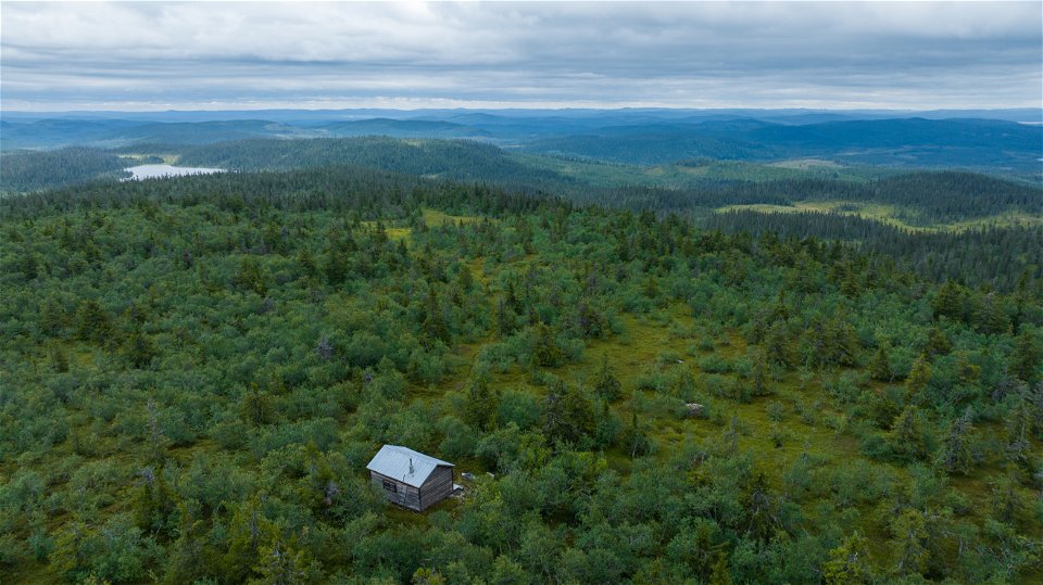
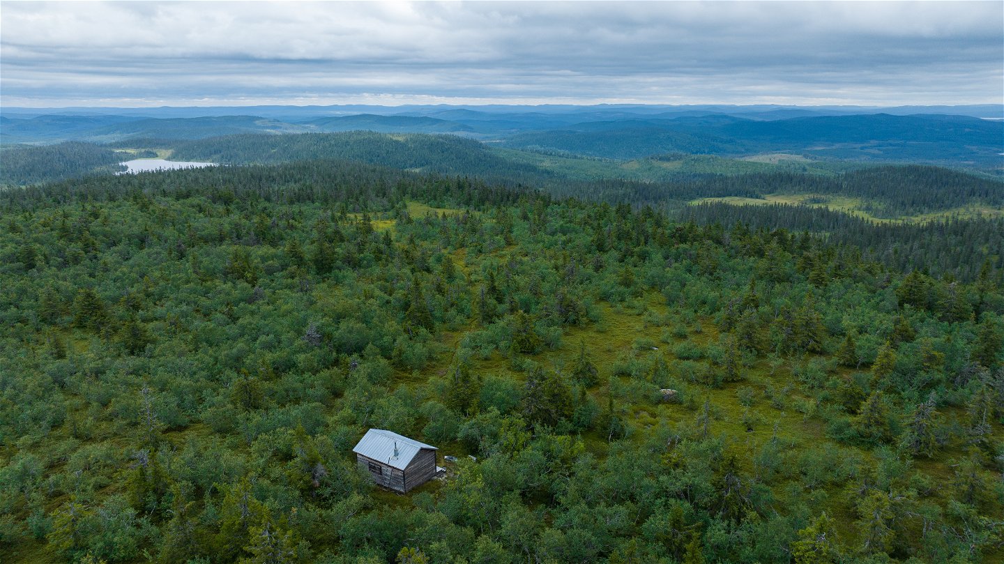
Vy över Stenbithöjdens kuperade landskap. I förgrunden syns Stenbitkojan/Toppstugan.
Photo: Linus Beimo -

Photo: Länsstyrelsen Västerbotten -
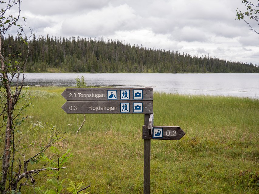
Photo: Linus Beimo -
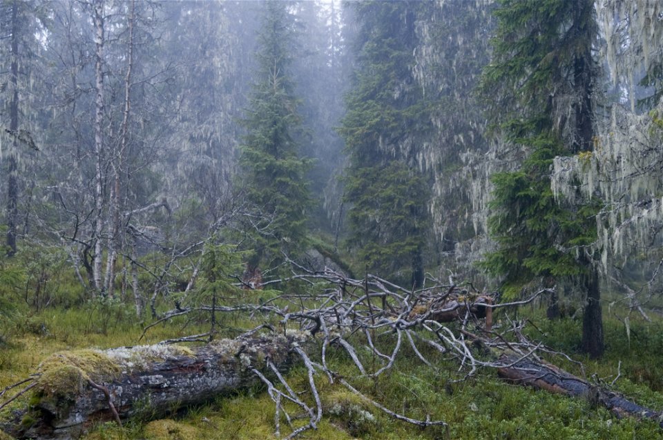
Photo: Andreas Garpebring -

Photo: Linus Beimo

Stenbithöjden
Nature reserve
- County: Västerbottens län
- 6522.61 km away from you
Actions
Description
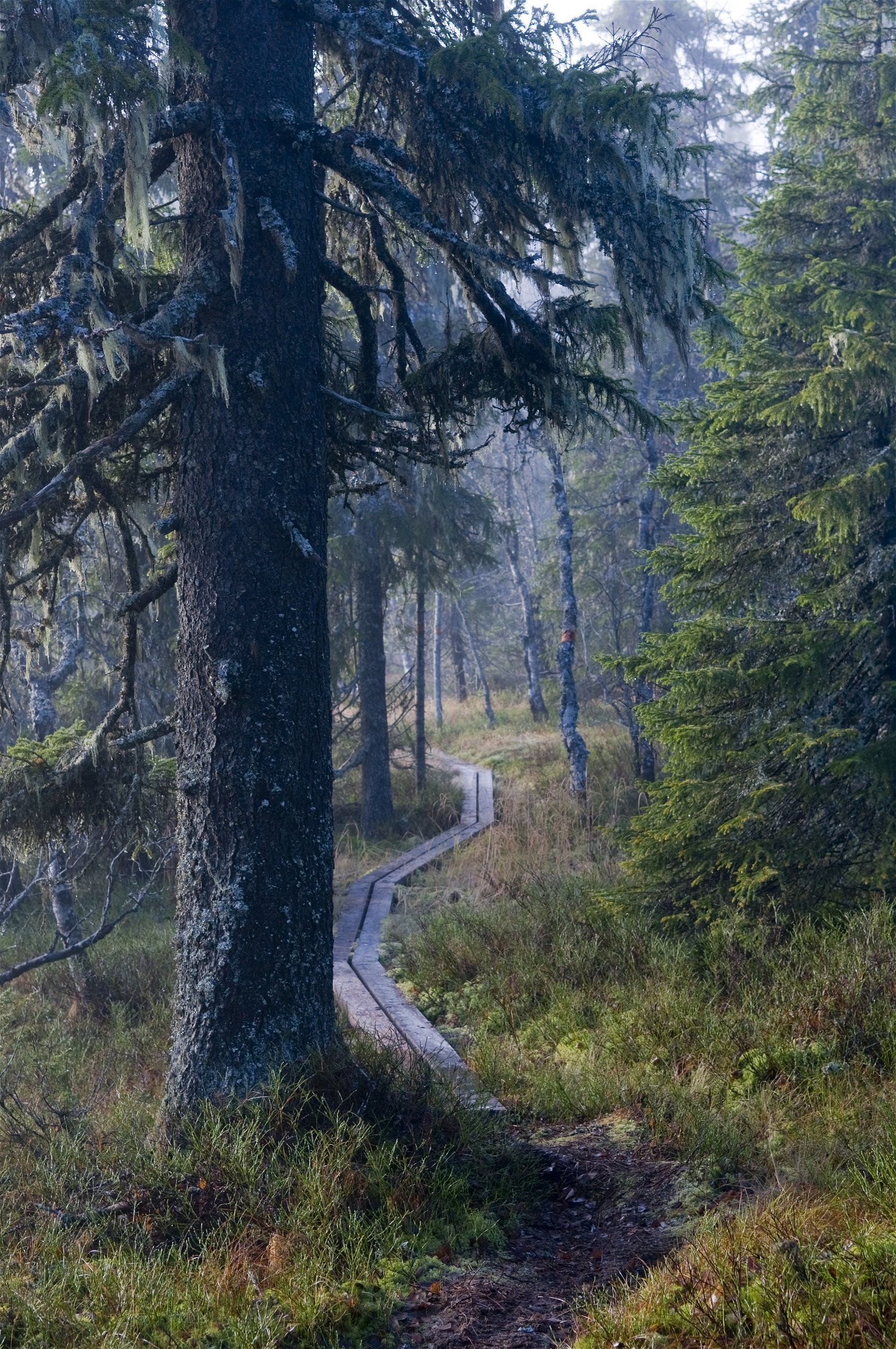
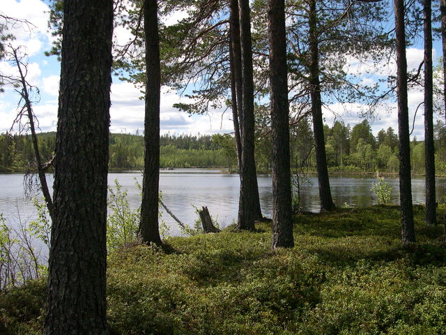
Stenbithöjden is an area of wilderness comprising spruce forest on an undulating landscape. Desolate mires and lakes lie between the forest-clad heights. Stenbithöjden’s forests live and die for the benefit of all the old forest’s inhabitants.
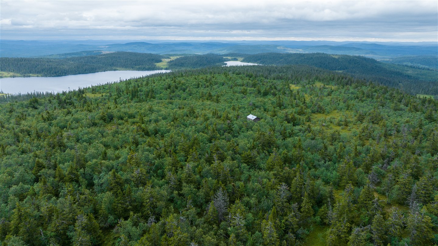
Windswept birches
The highest parts of Stenbithöjden are almost 600 metres above sea level. Up there, the spruce forest is sparse and gnarled, while windswept birches form a mountain birch forest. In the northern part of the reserve, between Western and Eastern Stenbitsjön, is the beautifully situated Höjdakojan hut, where visitors can spend the night. North-west of Western Stenbitsjön is the old Höjdavallen pasture, although this is not part of the reserve.
The forests
The spruces in Stenbithöjden are located in an upland virgin forest. The forest is sparse and, despite its considerable age, the trees are not that thick. The spruces are shaped by heavy snow loads, with downward-pointing, short branches that form a skirt against the ground at the bottom. There are plenty of dead trees on the ground. The virgin forest’s rare fungi and insects thrive in these dead trees.
Birds and mammals in Stenbithöjden
The capercaillie is a characteristic species of Stenbithöjden. It thrives in this landscape, which is a mosaic of ancient forests and mires. Stenbithöjden and the surrounding landscape are exactly what the capercaillie needs. If you are lucky, you may also spot the Siberian jay, the three-toed woodpecker and the hazel grouse during a visit. Pine martens, elks, bears and lynxes all regularly spend time in the reserve.
Activities And Facilities
-
Nature reserve
Accessibility
-
 Near parking
-
 Near toilet
Directions
Travel westwards on Route 92 from Åsele. After approximately 20 km, turn off to the left towards Lomsjö, and then left towards Forsnäs. Once you have passed Forsnäs and Granliden, you will soon arrive at the first car park. There are two suitable paths heading towards the Stenbitsjöarna lakes and the Höjdakojan hut.
If you continue southwards and follow the signs, you will come to the southern entrance. The roads to the southern entrance are not cleared of snow during the winter.
Contact
Email address
Länsstyrelsen Västerbotten
Organization logotype
![]()
Questions & Answers
Ask a question to other Naturkartan users.
Reviews
You might also be interested in