-
LED-belysning till 22.00 -

Ny sträckning 2023 -

-
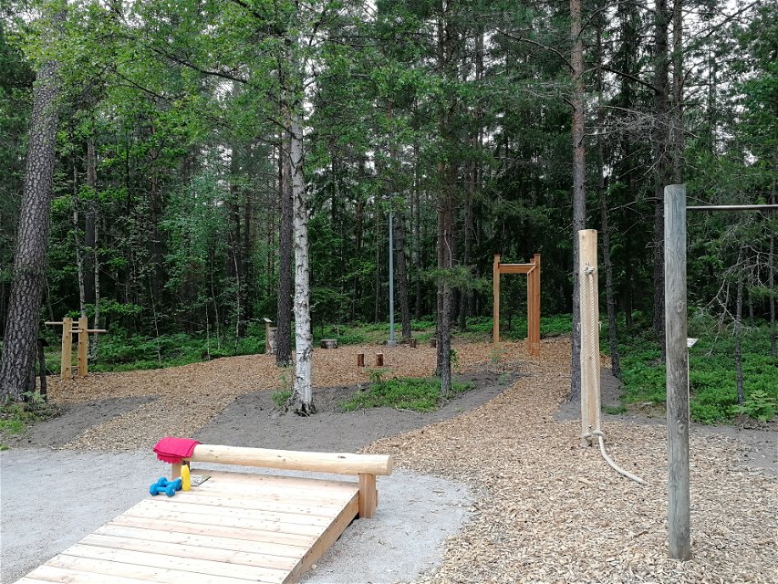
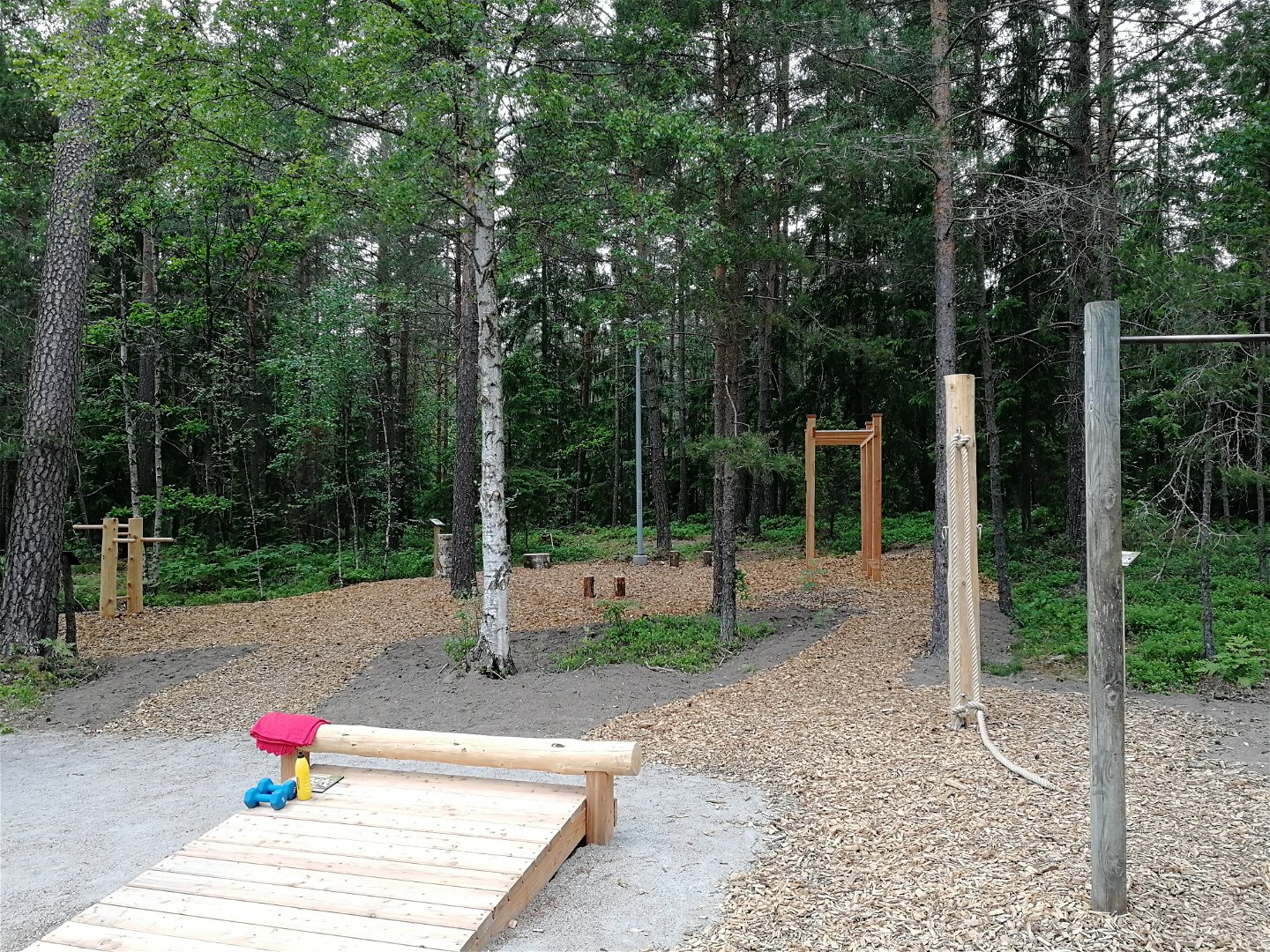
Utegym VAIS-torpet -
-
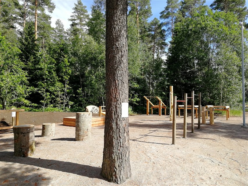
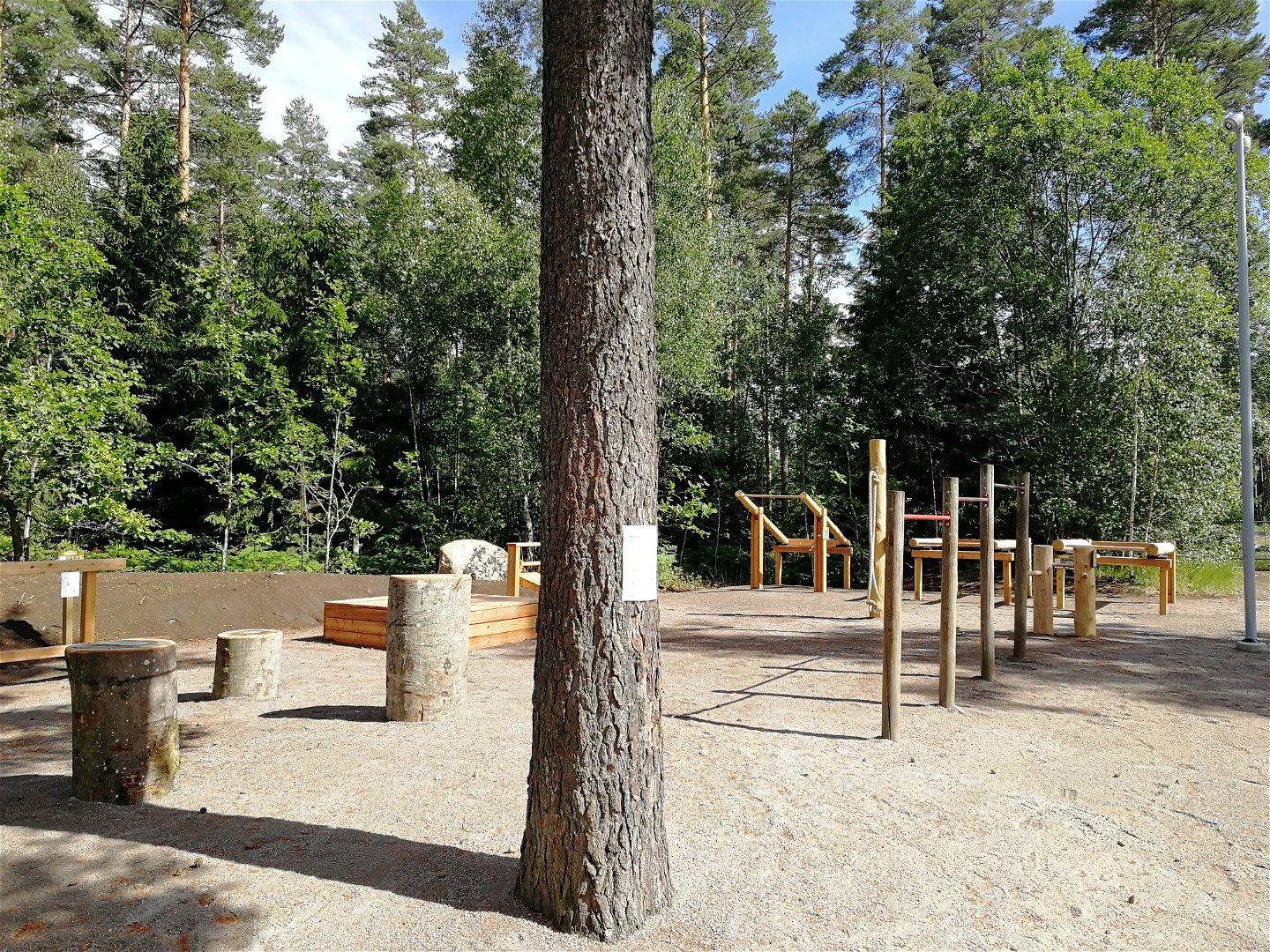
Utegym Norrastugan -
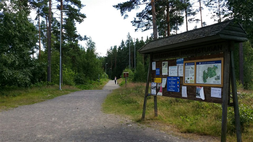

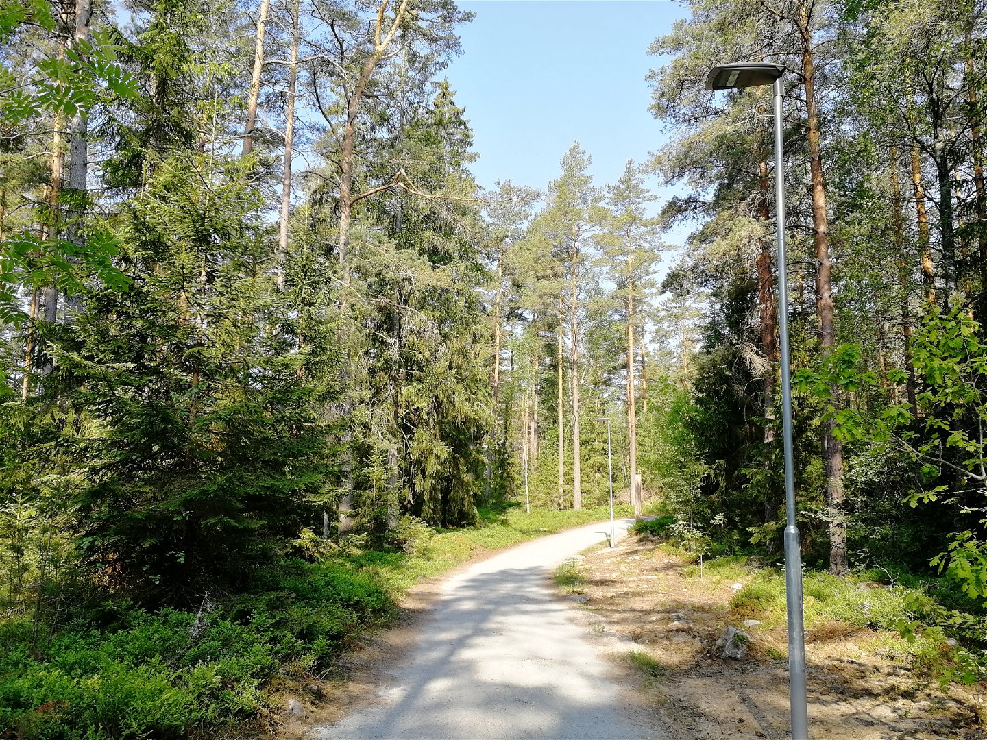
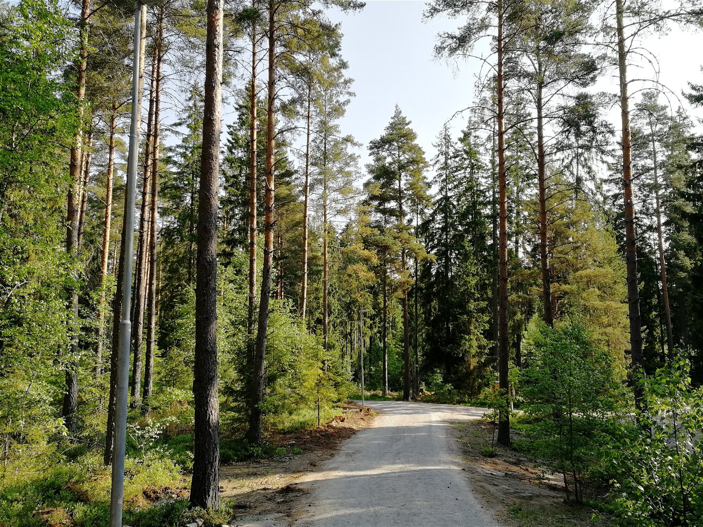


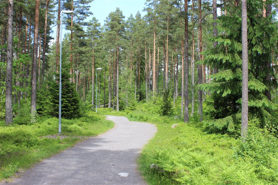
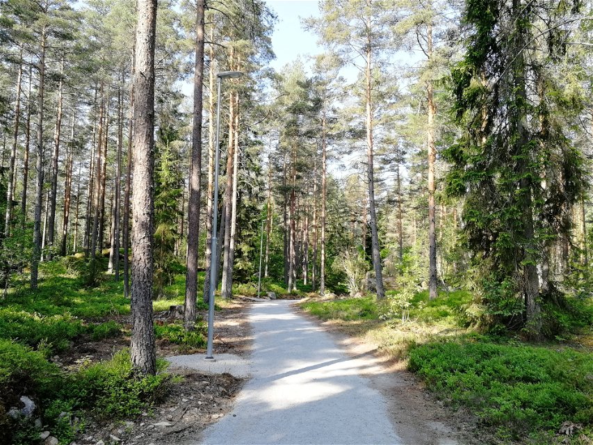
Fylleryds elljusspår
Elljusspår
- Landkreis: Kronobergs län
- 6810.48 km von Ihnen entfernt
Details zum Weg
- Länge 5.0 km
- Schwierigkeit Blau - mittel
Aktionen
Beschreibung
This is the primary and longest illuminated trail in the municipality, it passes through gently hilly terrain. The loop is about 5 kilometres long and connects with the 11-kilometre long Trestugespåret (three cottage track) with its black and white marking. For families with children, there is the educational Hitta Vilse trail (which teaches kids what to do if they get lost) that starts from Norrastugan. In the winter, ski tracks are prepared after snowfall, with the help of scooters.
Aktivitäten und Einrichtungen
-
 Running
-
 Skifahren
-
 Promenad
-
 Rundslinga
-
Elljusspår
Zugänglichkeit
-
 Nähe eines Parkplatzes
-
 Nähe einer Toilette
-
 Kinderwagen zugänglich
Oberfläche
Gravel with stone meal as surface layer
Hügel
Some hilly sections on the western part
Parking
Good parking facilities at the VAIS-torpet and Norrastugan entrances.
Anleitung
For motorists, directions from road 25 to VAIS-torpet, as well as from the Norremark junction in the north.
Kontakt
Adresse
Telefon 0470-410 00
E-Mail-Adresse
Kontaktcenter
Logotyp der Organisation
![]()
Bitte beachten Sie, dass einige dieser Texte automatisch übersetzt worden sind.
Fragen & Antworten
Stellen Sie eine Frage an andere Naturkartan-Nutzer.
