-

-

-
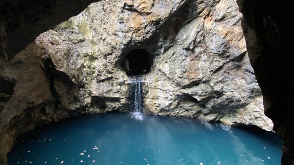
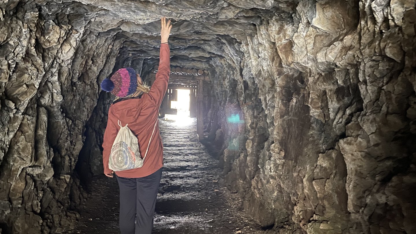
Blå grottan vid Klackberg -

-

-
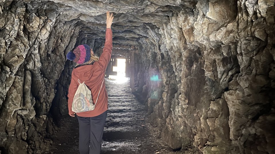
Gruvort vid Klackberg -

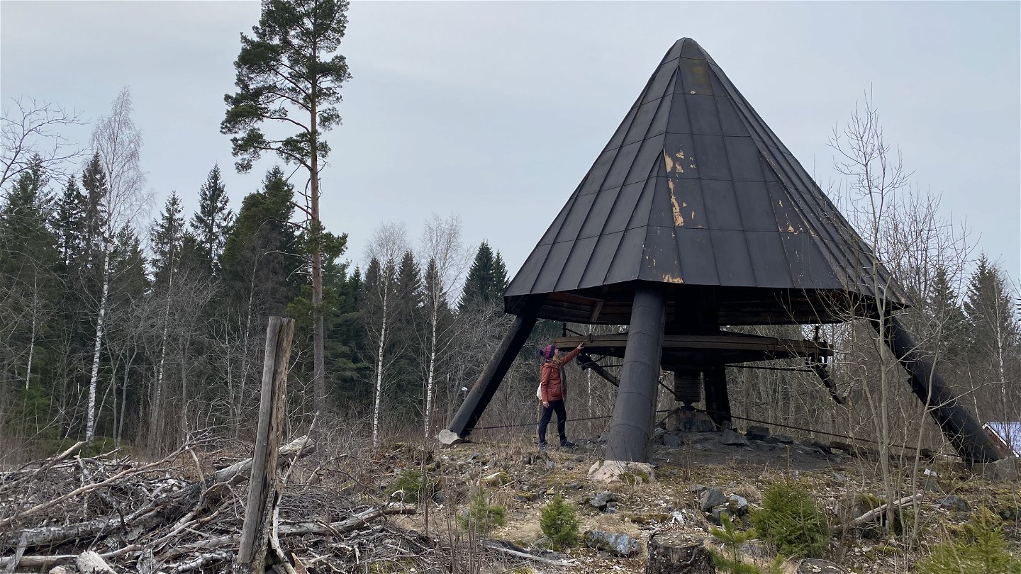
Vändhjul till stånggångar -
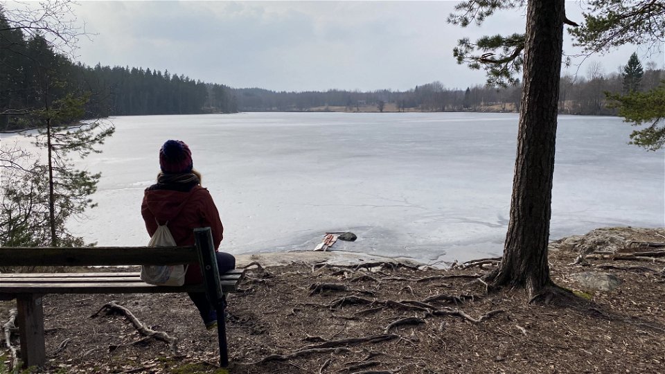
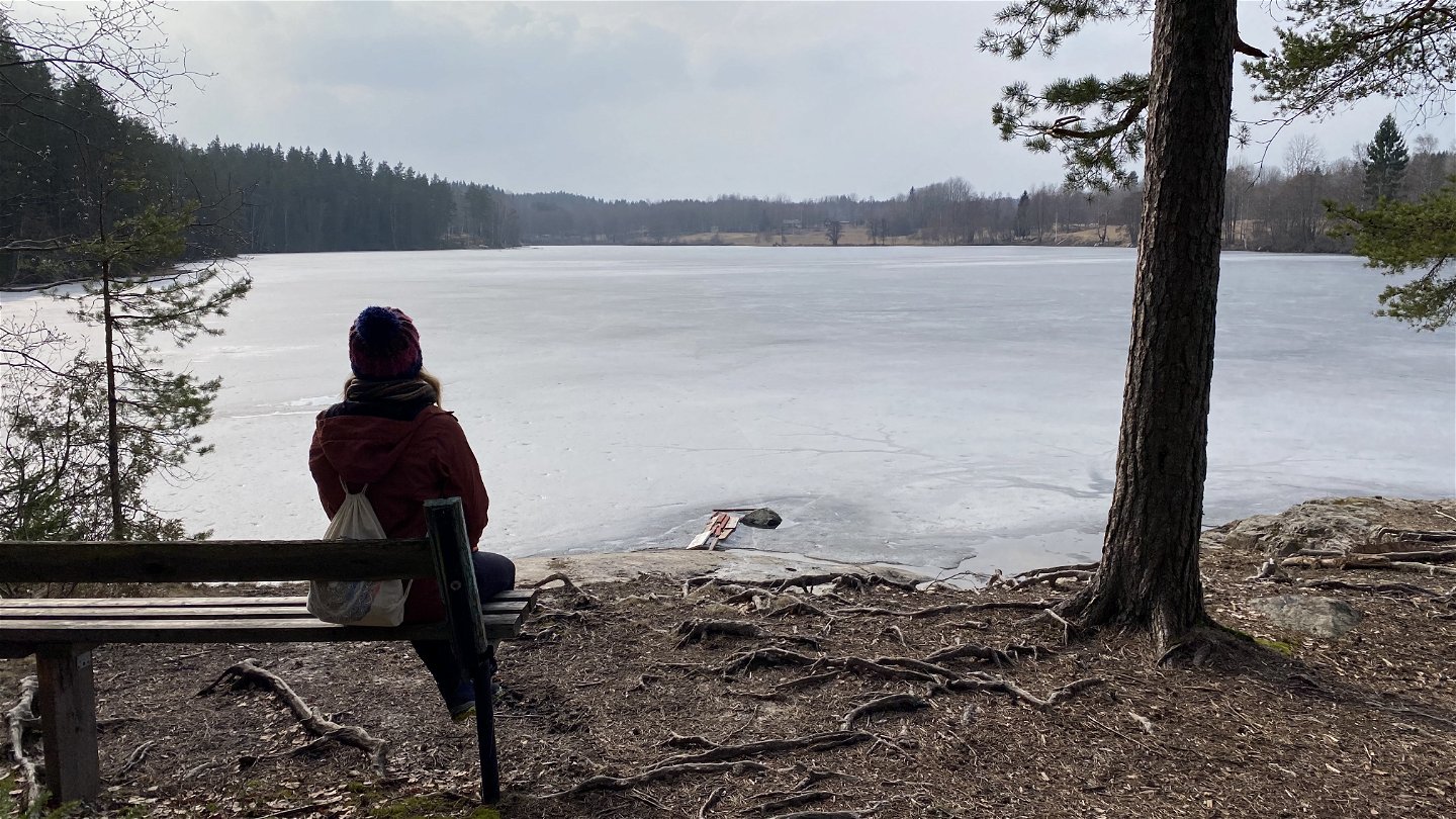
Vacker vy över sjön Kalven -
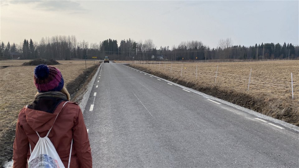
Landsväg i Norbergs utkanter


Norberg - Norbergsleden
Wandern
- Landkreis: Västmanlands län
- 6818.17 km von Ihnen entfernt
Details zum Weg
- Länge 12.0 km
- Zeit 2 Std. 30 Min.
- Schwierigkeit Grün - einfach
Aktionen
Beschreibung
Experience Norberg and its fascinating history on foot
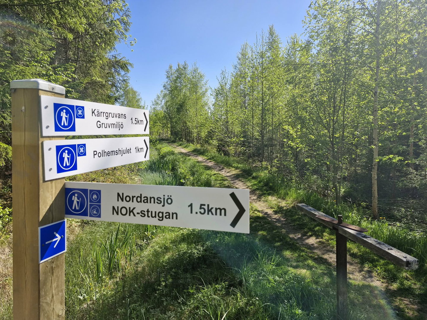
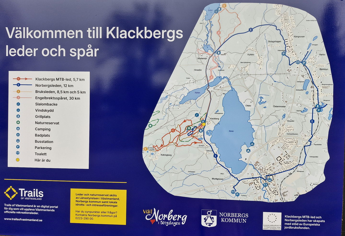
The area around Norberg is filled with beautiful nature, enchanting countryside, and intriguing traces of centuries of mining. The Norbergsleden trail offers an inspiring and varied experience of nature, culture, and history. On foot, you can explore all the highlights of Norberg, such as the Blue Cave at Klackberg's mining field, the Polhem Wheel, Svinryggen mines, Mossgruveparken, Nya Lapphyttan, and Norberg's charming town center. The entire Norbergsleden is 12 km long and circles Lake Noren.
Markings
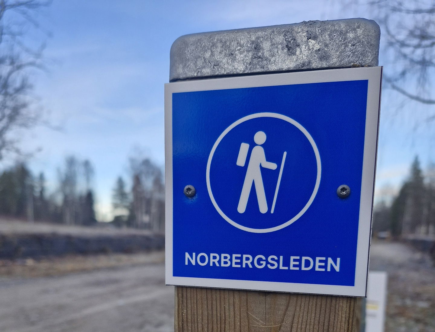
Norbergsleden is marked with blue signs. The terrain along the trail is mostly flat, with some hilly sections primarily at Klackberg, Svinryggen, and Mossgruvan. The surface varies from asphalt to gravel paths and natural forest trails. The effective walking time for the entire Norbergsleden is 5-6 hours, but this does not include longer stops at attractions or cozy cafes. A bicycle is a good companion for those comfortable with occasionally cycling on trails.
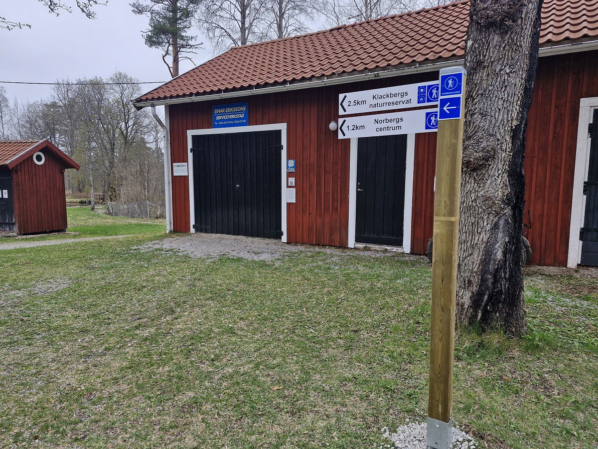
The starting point for Norbergsleden is at Klackberg Nature Reserve, but you can also start the trail in Norberg's town center or at the Nya Lapphyttan visitor site. Parking is available at all three locations. Trail maps and information are available at Klackberg Nature Reserve, near Vinterstadion.
Circular Route
At Klackberg, you can wander around for a long time and be fascinated by both the beautiful nature and the breathtakingly deep mine holes. The "Blue Cave" at Klackberg is a clear highlight. After that, you will enjoy a pleasant walk through forests, countryside, and old canals until you reach the impressive Polhem Wheel. The Polhem Wheel is a large water wheel that, since the 1770s, drove rod systems and pumps in the nearby mines. Shortly thereafter, you will reach Svinryggen mines, offering stunning views of large mine holes. After Svinryggen, the trail passes the Veteran Railway and Kärrgruveparken. Mossgruveparken, with its associated Mining Museum, follows shortly and deserves time for exploration. Then you continue towards Norberg's town center via the mighty Mimerlaven - the latest link in the town's thousand-year chain of iron handling. From Norberg's town center, it is not far to Nya Lapphyttan, a reconstruction of a medieval iron production site. After that, you can easily follow the pedestrian and cycle path back to Klackberg.
Norbergsleden is a trail filled with attractions. The entire trail can be walked in one day, but it is strongly recommended to experience Norberg and its surroundings as a multi-day activity. Norberg is a beautiful lakeside town offering many cozy cafes and restaurants as well as attractive accommodations. For more information on how to plan your stay in Norberg, visit the website visitnorberg.se.
Other trails in the area
For those who want to explore more, both the trail Bruksleden and Klackberg's MTB trail are nearby. In winter, the area transforms into a paradise for cross-country skiers with Engelbrektsspåret and downhill skiing slopes at Klackbergsbacken.
Aktivitäten und Einrichtungen
-
Wandern
-
 Trailrunning
-
 Rundslinga
-
 Kulturstig
Zugänglichkeit
-
 Nähe von Nahverkehr
Fakten
Public toilets at the Visitor Center Nya Lapphyttan, Storkiosken in Kärrgruvan and Tips & Tobak in the center during opening hours.
Oberfläche
The surface varies from asphalt, to graveled walking paths and natural forest trails. The terrain is mostly flat with the exception of some hilly areas mainly at Klackberg, Svinryggen and Mossgruvan.
Parking
Free parking is available at the Nya Lapphyttan Visitor Center (at the start of the trail), at the Frida Hansdotter Arena in the city center or at the Klackberg minefield and nature reserve.
Kommunikation
Anleitung
From the bus station in the town centre, it is about a 15-minute walk or 4 minutes by car (just over 1 km) to the Besökscentrum (the Visitor Centre) in Norberg, which is the starting point of the trail. Follow Malmgatan road over the Norbersgån river, then turn left and follow Västanforsvägen road (signs towards Nya Lapphyttan) for approx. 900 m. Turn right at the sign for Nya Lapphyttan and drive the gravel road approx. 200 m. Parking is available at both the Visitor Centre and Nya Lapphyttan.
Downloads
Kontakt
E-Mail-Adresse
Logotyp der Organisation
![]()
Bitte beachten Sie, dass einige dieser Texte automatisch übersetzt worden sind.
Fragen & Antworten
Stellen Sie eine Frage an andere Naturkartan-Nutzer.
