


-
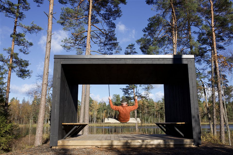
Vindskydd med gunga vid Sörsjön.
Photo: Joakim Norgren -
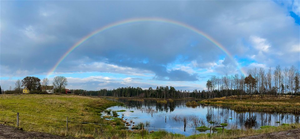
Stomsjö våtmark
Photo: Joakim Norgren -

Stomsjö våtmark -
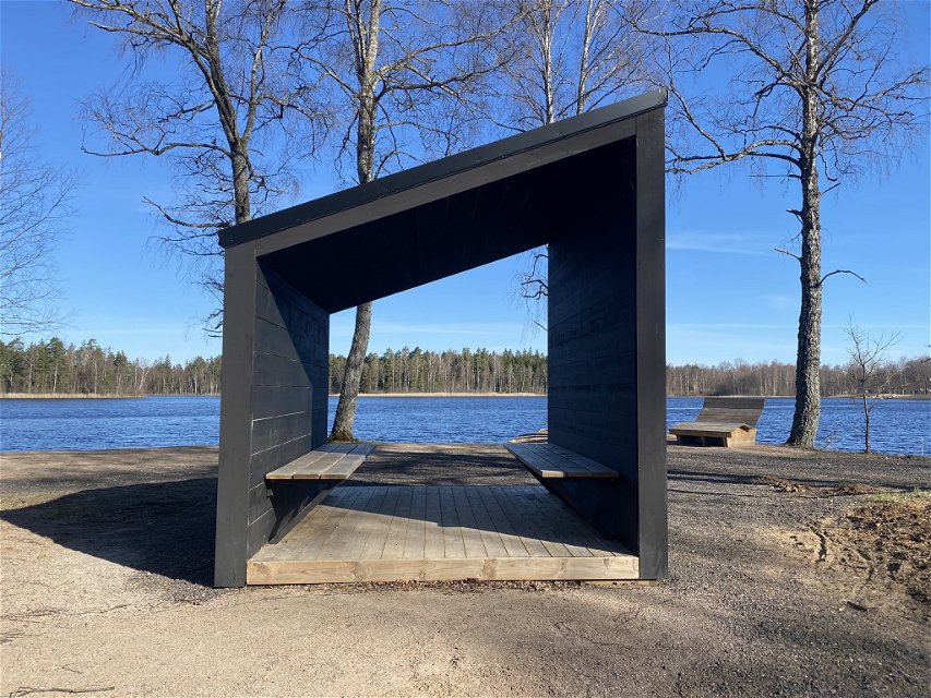
Vindskydd vid Sörsjön
Photo: Amelie Marklind -
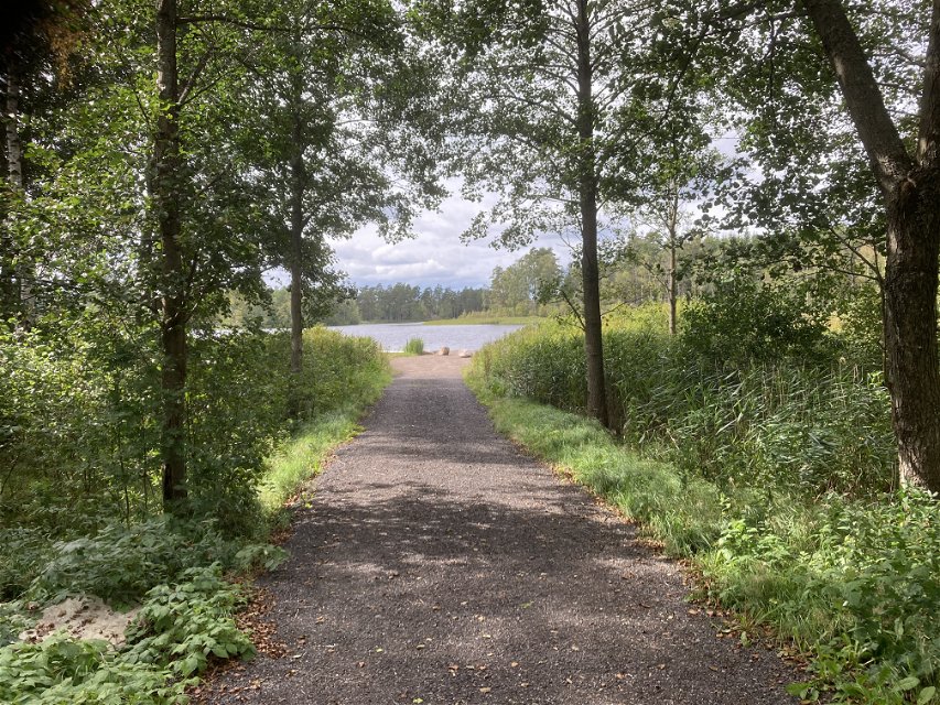
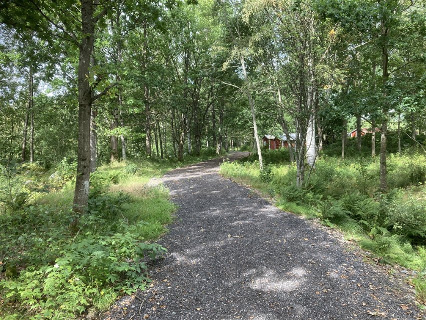
Vägen ner mot Sörsjön sett från Entré Sörsjön -
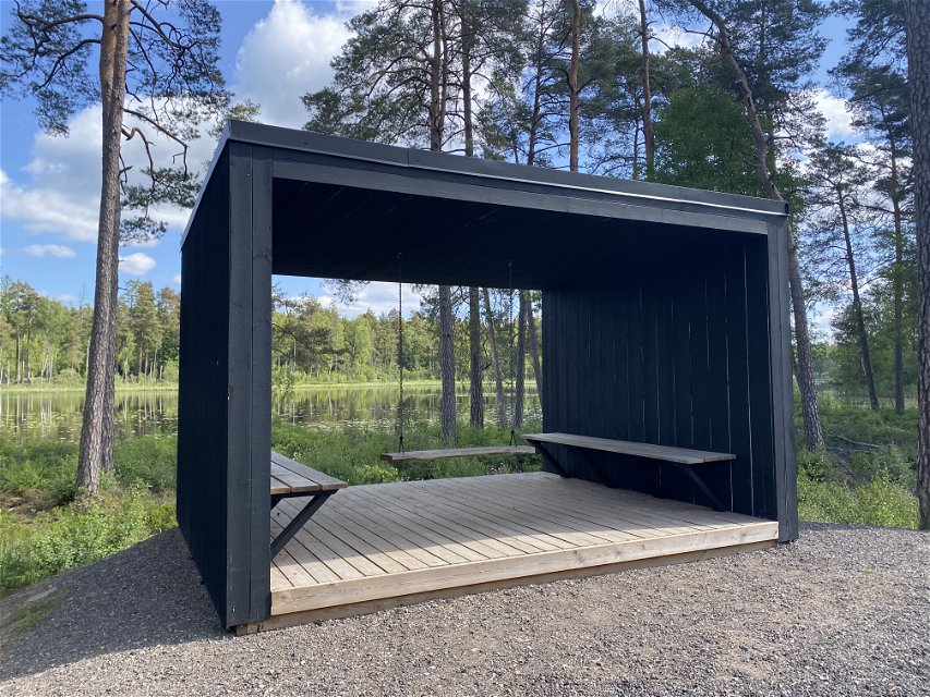
Vindskydd med gunga vis Sörsjön -

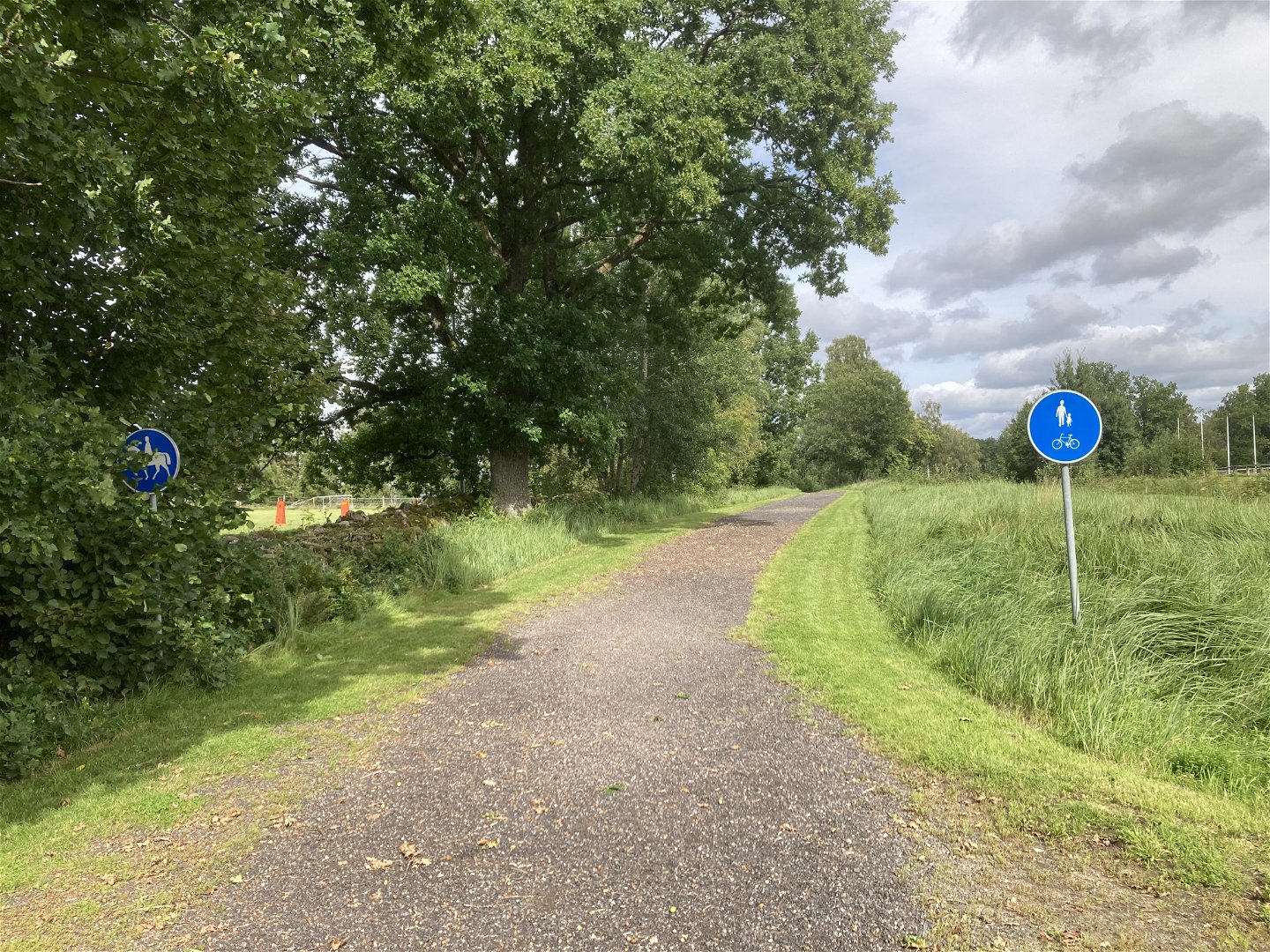
Leden mellan Brukshundsklubben och Sörsjö stall -
Leden runt Sörsjön -
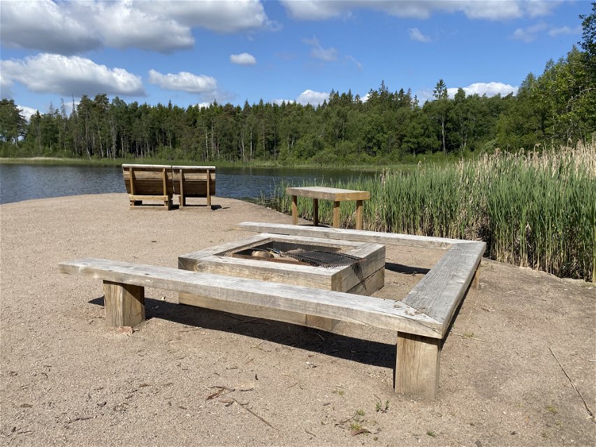
Grillplats med solstolar vid Sörsjön -
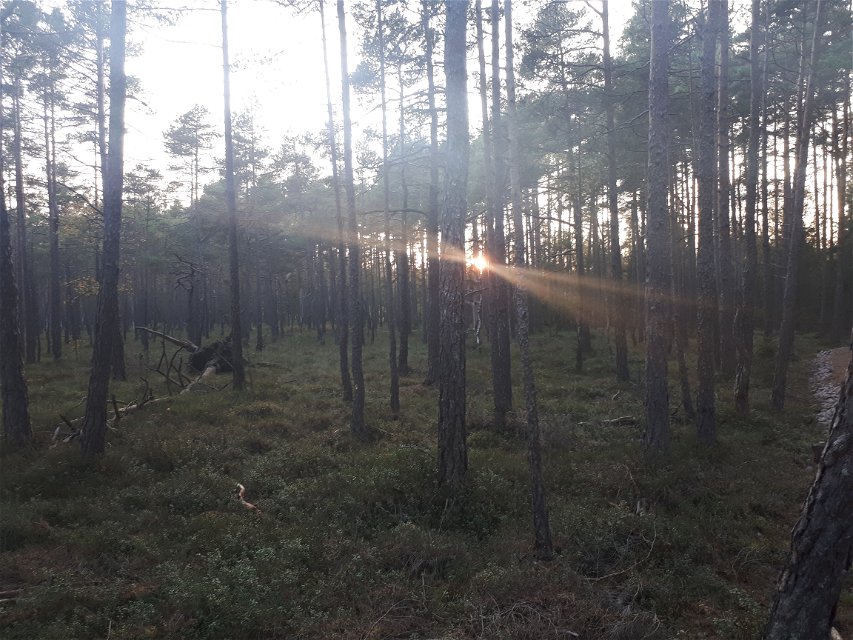
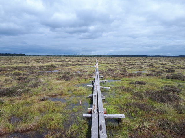
Högmossen

Värnaro open-air recreation area
Hiking
- County: Jönköpings län
- 6750.41 km away from you
Trail details
- Length 18.0 km
- Difficulty Green - simple
Actions
Description
Welcome to the Värnaro recreation area! You can walk, run, cycle or ride here on some 20 km of trails divided into a number of loops. All of them take you through picturesque, varying landscapes, including Lake Sörsjön, the Stomsjö wetland, an old heritage landscape, a pine-clad raised bog, hardwood forest, enchanting spruce forest and an open agricultural landscape overlooking Lake Vidöstern. Along the way are plenty of spots to sit down and rest on benches and sun chairs. There are several wind shelters with titillating designs, barbecue areas and three separate bathing areas for people, dogs and horses. Keep your eyes peeled for birds in the Stomsjö wetland in the western part of the area.
The Smålandsleden Trail passes through Värnaro, connecting the recreation area with Osudden and Värnamo in the east, and Kärda and Store Mosse National Park in the west.
These are the trails in Värnaro:
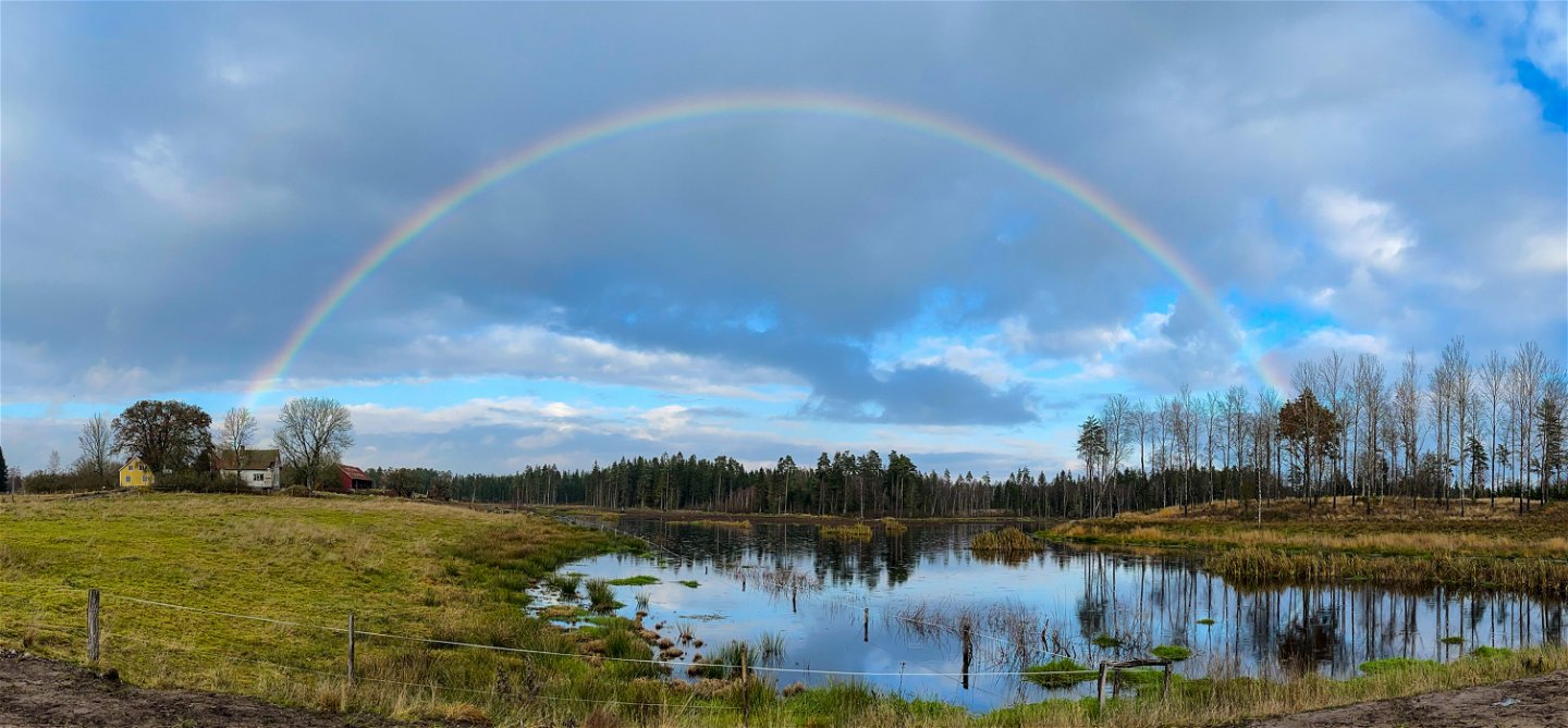
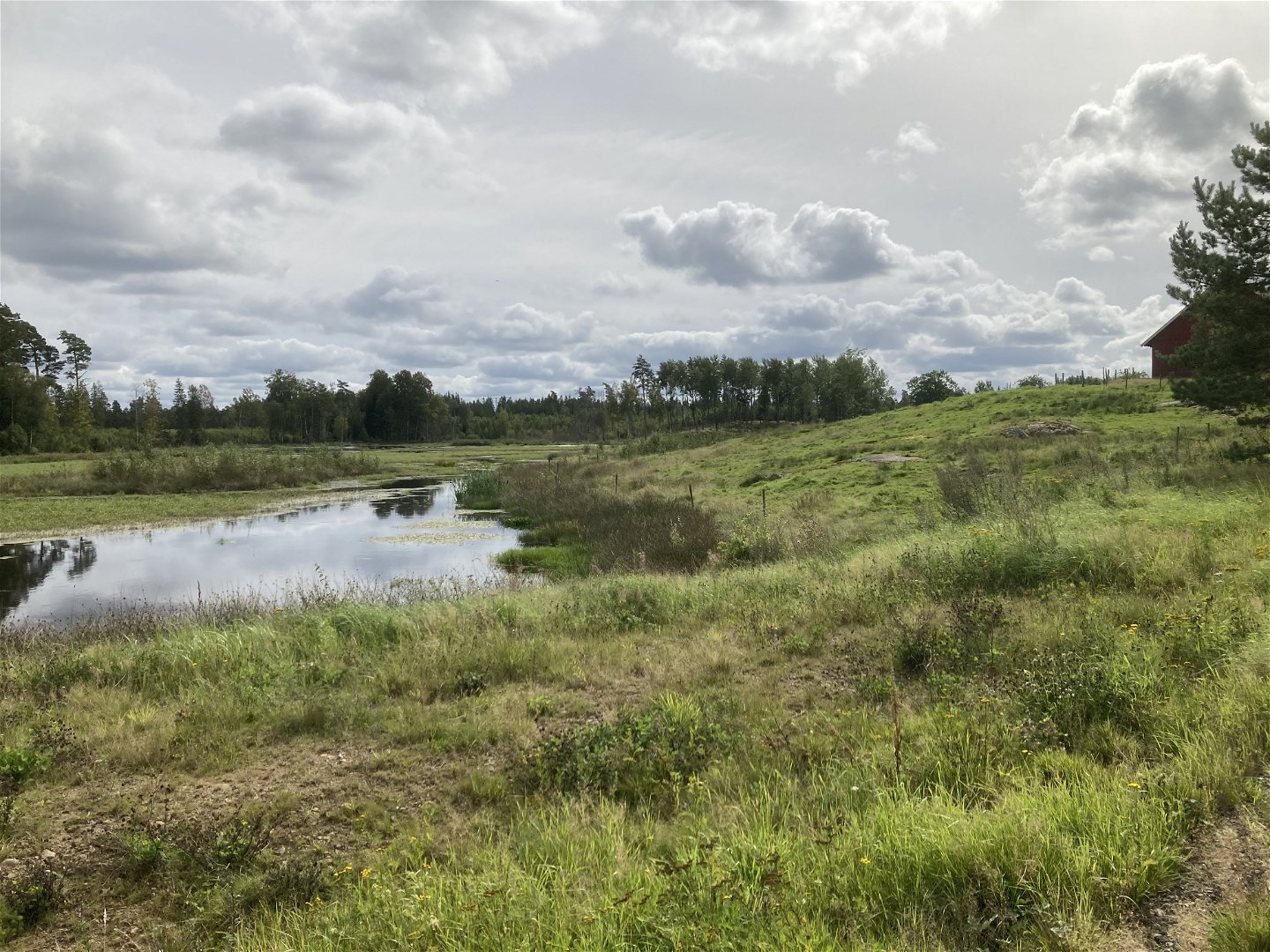
Stomsjörundan/The Stomsjö Loop: 2 km. Discover the Stomsjö wetland with its rich bird life. Along the trail are several beautiful views of the wetland, and you’re welcome to use the Fågelro wind shelter at Stomsjö Farm to watch for birds. Some of the loop follows the Smålandsleden Trail, which connects the recreation area with Kärda and Store Mosse National Park. The whole loop is adapted for accessibility. You’ll find a map of the Stomsjö Loop on the Stomsjö Loop page.
The Stomsjö wetland
Koloniträdgårdsrundan/The Allotment Garden Loop: 2.8 km. This loop passes through the Sörsjö allotment garden area, which has lots of lovely little cottages and gardens. Most of the trail goes through coniferous forest with elements of broadleaf forest, and you have lovely views of Lake Sörsjön. The Björkfriden wind shelter is available along the way, and near the Sörsjön entrance to the area is a rest area with swimming, sun chairs, tables and a barbecue. The whole loop is adapted for accessibility. You’ll find a map of the Allotment Garden Loop on the Koloniträdgårdsrundan page.
Björkfriden wind shelter
Sörsjörundan/Lake Sörsjö Loop: 3.2 km. Make a circuit of Lake Sörsjön and look out over the water from every direction. The loop goes close to the water in several places and there are three wind shelters, two rest areas with barbecues, swimming and dog beaches along the way. You’ll pass two of the recreation area’s entrances, and some stretches follow the Smålandsleden Trail. On this loop you might meet the nice horses that belong to the Värnamobygden Riding Association. The whole loop is adapted for accessibility, but there is one hill that is a bit steep. There are plans to fix that shortly. You’ll find a map of the Lake Sörsjön Loop on the Sörsjörundan page.
Rest area at the Sörsjön entrance to the area
Brukshundsrundan/The Working Dog Club Loop: 2.4 km. This loop starts at Brukshundsklubben (the working dog club) and goes through spruce forest and picturesque hardwood forest. Much of the loop is on pleasant trails. You can make easy detours to the two wind shelters at Lake Sörsjön – Zenit and Chillet. This loop is not adapted for accessibility. You’ll find a map of the Working Dog Club Loop on the Brukshundsrundan page.
Brukshundsrundan next to Brukshundsklubben
Skogsstigen/Forest path: 1.6 km. As the name suggests, this loop goes partly on smaller paths, but there are also some wider gravel paths. You’ll pass an area of ancient monuments in the form of ancient field systems. Along the way is the Skogsrasten wind shelter, which has a barbecue area. Part of the loop follows the Smålandsleden Trail. This loop is not adapted for accessibility. You’ll find a map of the Forest Path on the Skogsstigen page.
The Skogsrasten wind shelter
Högmosserundan/The Raised Bog Loop: 3.2 km. On this loop you’ll see open pasture lands, spruce forest and a pine-clad raised bog. The Stillheten wind shelter is located next to the raised bog. Along the way you’ll pass several ancient monuments in the form of ancient field systems. Much of this loop follows the Smålandsleden Trail, and it passes the Brukshundsklubben entrance to the area. The loop crosses Halmstadsvägen in two places, so remember to pay extra attention there. The loop is adapted for accessibility. You’ll find a map of the Raised Bog Loop on the Högmosserundan page.
The raised bog
Mosslerundan/The Mossle Loop: 4.7 km. The newly built district Mossleplatån has easy access to nature; the northern part of the Mossle Loop passes the Mossleplatån entrance to the recreation area and through the residential district. In the eastern part of the loop you have a lovely view of Lake Vidöstern, and you can choose to continue along the Smålandsleden Trail towards Osudden, Apladalen and Värnamo town centre. In the southern part of the loop you pass a charming rest area, which you can also get to directly via a connecting trail from the Mossleplatån entrance. In the western part of the loop you pass ancient field systems, and through the Hornaryd industrial area. In the more forested part of the loop, you can take an easy detour to the Skogsrasten wind shelter. Part of this loop follows the Smålandsleden Trail. The loop is adapted for accessibility. You’ll find a map of the Mossle Loop on the Mosslerundan page.
Inside the Skogsrasten wind shelter
Smålandsleden/The Smålandsleden Trail: About 900 km. Experience the whole province of Småland on foot. Nearly 900 km of trails through every possible habitat type you can find in our beautiful Småland. Part of the Smålandsleden Trail passes through the Sörsjö recreation area, connecting it with the rest of Småland. You’ll find a map of the Smålandsleden Trail on the Smålandsleden website.
The Zenit wind shelter alongside the Smålandsleden Trail
Come and discover mother nature!
There are currently no signs in place in the area, but they will be up soon!
More information about Värnamo
Visit varnamo.se for more tips on things to do and experience in the municipality of Värnamo year round – big, small, local, international, traditional and unexpected.
Activities And Facilities
-
Hiking
-
 Mountainbiking
-
 Riding
-
 Running
-
 Walking
Accessibility
-
 Near parking
-
 Stroller accessible
Surface
The surface is hard-packed gravel.
Parking
Parking is available near the eastern edge of Lake Sörsjön, between Värnamobygdens Ryttarförening (riders association) and the allotment area in Sörsjö. There is also a parking area level with Värnamo Brukshundsklubb (working dogs club), but on the opposite side of Halmstadsvägen road
Directions
The open-air recreation area is located southwest of Värnamo on the outskirts of the town. If you come by car, turn off from road 27 southwards onto Halmstadsvägen road and continue for 1 km. You can also get here by bike. Cycleways run from the centre.
Contact
Address
Kontaktcenter Värnamo kommun Kyrktorget 1, 331 83 Värnamo Telefon 0370-37 70 00 www.varnamo.se
Email address
Kontaktcenter Värnamo kommun
Organization logotype
![]()
Questions & Answers
Ask a question to other Naturkartan users.
Reviews
You might also be interested in
