
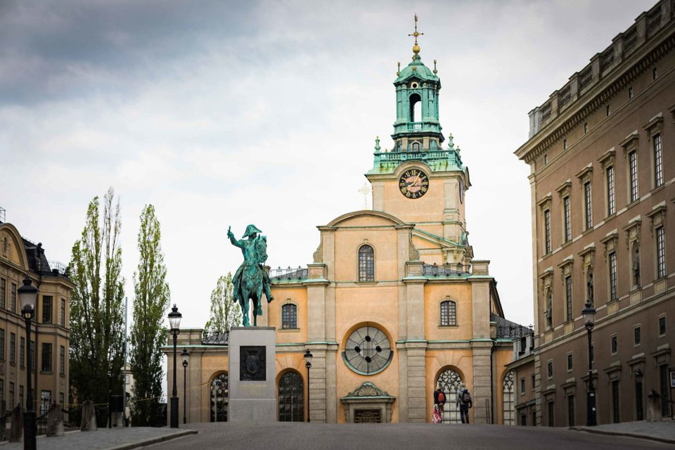
Ingegerdsleden. Etapp 1, (1/2). Storkyrkan Stockholm - Solna kyrka
- Pilgrim Trail
- Hiking
- County: Stockholms län
- 6833.64 km away from you
Trail details
- Length 7.9 km
- Difficulty Green - simple
Actions
Currently
The book "Ingegerdsleden" by Claes Göran Guinchard and Bo Lundkvist is a factual and good guide together with this app.
The book can be purchased through the Church of Sweden but can also be downloaded as a pdf via the Church of Sweden website. Follow the link below to download.
Description
The Ingegerdsleden trail starts at Storkyrkan. A pilgrimage trail that stretches between Storkyrkan via Sigtuna to Uppsala Cathedral. This stage in the app is part of stage 1 as described in the book.

Activities And Facilities
- Hiking
- Pilgrim Trail
Facts
The Ingegerdsleden trail starts at Storkyrkan. A pilgrimage trail that stretches between Storkyrkan via Sigtuna to Uppsala Cathedral. This stage in the app is part of stage 1 as described in the book.
How to use this guide
With this guide you can walk shorter or longer distances between Stockholm and Uppsala or vice versa.
It is not a general guide to outdoor life, "pilgrim technique" or pilgrim theology.
What distinguishes Ingegerdsleden from many other trails is that it is not marked in the terrain. In the urban areas around Stockholm and Uppsala there are cycling and walking paths, in between the trail follows forest paths or old, crooked country roads and sometimes follows another trail such as Upplandsleden. It is of course easiest if you walk in a group with an experienced "pathfinder", but it should not be necessary.
Bus and train connections are good in these parts. You can therefore use the signpost in many ways:
- Settle for one stage
- Go to Sigtuna, the central destination of the trail, from the south or from the north
(signs are available in both directions)
- Walk the whole route, maybe also a day trip from Sigtuna
- Walk the trail as part of a life project. The idea is that the trail will eventually be part of the European network of pilgrimage routes to Canterbury, Nidaros (Trondheim), Rome and Santiago de Compostela.
Surface
The first section is mainly on paved roads and footpaths.
Hills
This first stretch is not very hilly.
Please be aware that some of these texts have been automatically translated.
I’ve been here 10


I want to go here 13
Questions & Answers
Ask a question to other Naturkartan users.
Reviews
1 review
- 5 :
- 4 :
- 3 :
- 2 :
- 1 :
Users images
No user images yet. Be the first to share!

Vissa delar av promenaden, särskilt runt Pampaslänken, är lite för industriella.