Vandra i Kristinehamn
Det som utmärker Kristinehamn när det kommer till vandring är läget – här behöver du…


Hiking
Medium 5 km, 1.5-2 hours
This is an easy trail with gravel and forest paths. It takes you along the old freight route of the iron, along the canal of Norsbäcken (built 1630). The canal runs into Lake Bergsjön and the trail follows the lake. The hill at Varrvikshöjden requires some energy but after that the terrain flattens out again. At Bergsjötorpet you pass some magnificent old oak trees. You can combine this section with northbound Järnsjöleden 2 which starts at Hytte, see page 10-11.
Medium 5 km, 1.5-2 hours
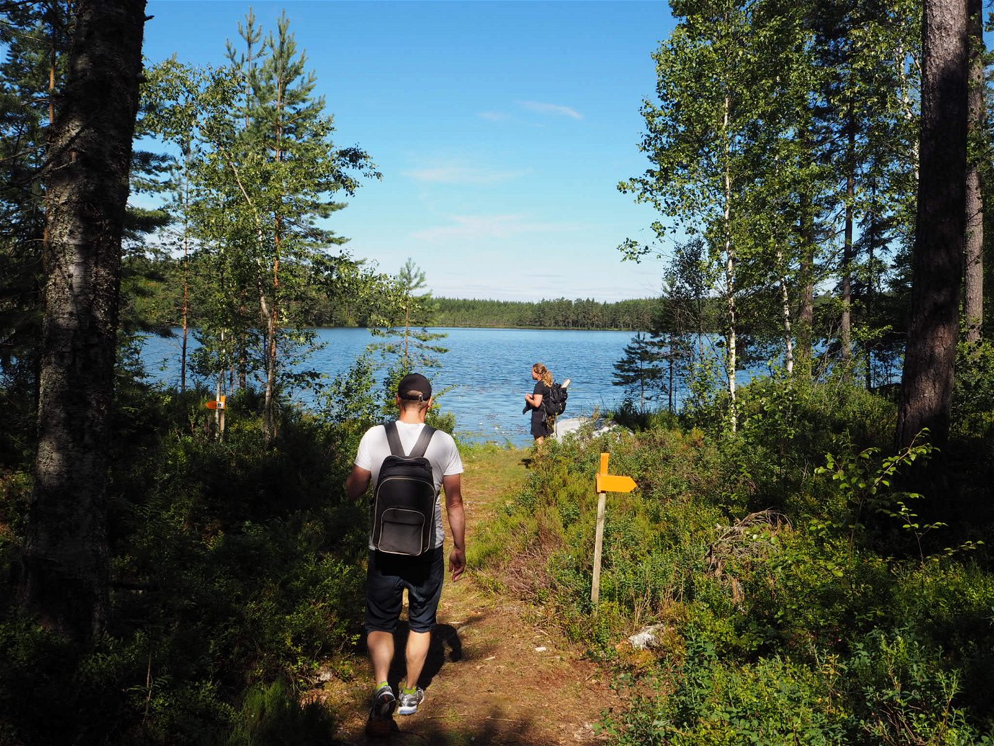
From Bergsjötorp the trail starts with a forest path. After a few kilometers you reach a rest area by a lake. It has wind shelter, a campfire pit, a flat area for a tent and a nearby outdoor toilet. You then pass a 200 m long footbridge at Bromossen and the remains of an old charcoal burner’s hut. The trail continues along a gravel road and then turns into an old park, past a pond and into what once was an old English garden. At Niklasdamm there’s a café (open in summer) and a geranium museum. The manor house is a private home, please show respect. Fresh water all year.
Medium 4 km, 1.5-2 hours
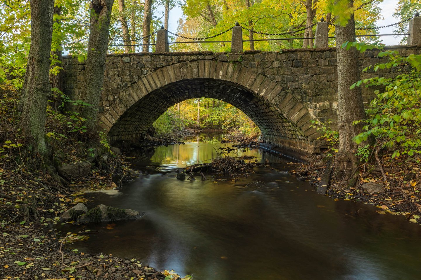
The trail starts along a gravel road which turns into a path that is also used for riding. You pass fields and woodlands and finally reach the river of Varnan. Sit on one of the benches to enjoy the rippling water. In case of rainy weather this part can be wet. If wet follow instead the gravel road until Älvbron were there is a rest area with benches and a table. Right next to the old stone bridge of Älvbron you can see stone remnants from an old iron mill.
Medium (up to the ancient fort - difficult)
9 km, 3-4 hours
The trail continues through a wonderful forest. You’ll pass a quarry where there is an outdoor toilet before you reach a smaller hill. The trail climbs up and the reward is remnants of an ancient fort from the Iron Age. Take a break and enjoy the view. Continue under E18 and head toward Gustafsviks herrgårdspark. Felling of trees along this section has been performed in 2021.
Easy 7 km, 1,5-2 hours
Easy part along a combined trail for cycling and hiking. You have a view of Varnumsviken which is a part of Lake Vänern and an important bird sanctuary. You also pass the unique chapel of Östervik (open in summer). The animal farm next to it has a café which is open on weekdays all year round. In the small area of trees just before the rural area starts there is a rest area. Continue to the area of Marieberg, an old hospital rebuilt into apartments and a business park. The art museum, Kristinehamns konstmuseum, is located here. They have a restaurant and café open all year round. Close by is a bed & breakfast and a hotel. The trail leaves the lake and continues through the harbour area and ends at the guest marina where a replica of an old sailing ship, Christine af Bro, is moored. This type of boat was used to ship iron across the lake and further out into the world. Summertime both young and old can enjoy a trip on the ship. The guest marina offers motor home parking, miniature golf, showers, and toilets (for a fee) and a Thai restaurant.
Hiking
 Riding
 Running
 Near parking
 Near Public Transport
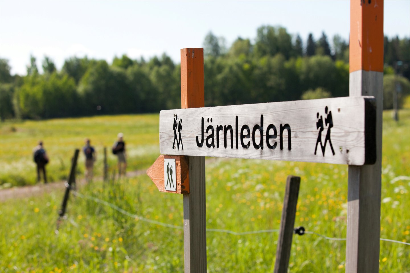
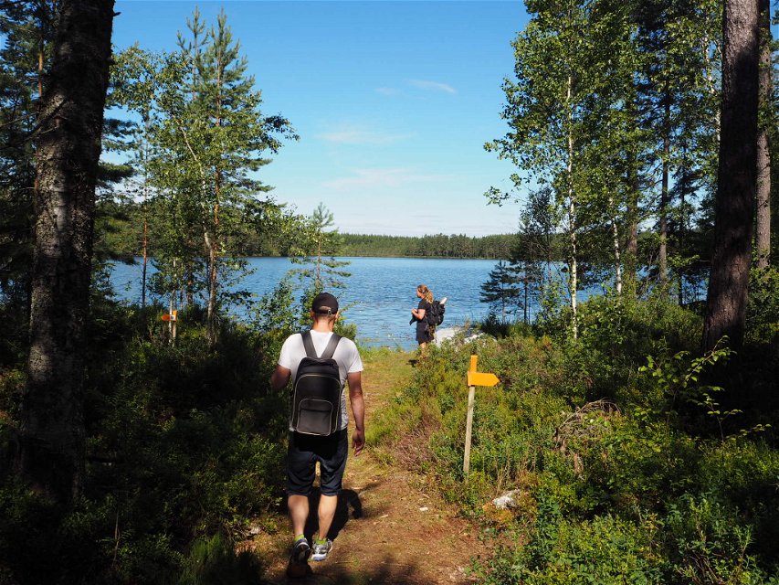
The Iron Trail is a quality assured Värmland trail and takes you through historical terrain between Hytte and the guest marina in Kristinehamn. You can choose to hike shorter sections or the whole way. The trail is marked and can be hiked without a map, but we do recommend a map for more details and an easier hike.
QUALITY ASSURED VÄRMLAND TRAIL
The Iron Trail (Järnleden) is one of many quality assured trails in Värmland. It fills listed requirements such as maintenance, information in English, Swedish and German, easy to follow trail markings and contracts with landowners.
Easy: The trail goes on land that is generally flat or with gentle rises only. Trail surface is even, without
steps or rocky areas. Footbridges are passable with prams.
Moderate: Good accessibility. All or parts of the walk are on nature trails. Gradients are not a problem for a person with normal fitness.
Difficult: Limited accessibility due to steep sections
and higher gradients that require good fitness.
The trail passes through a varied landscape past lakes and bogs, through woodland, grazing pastures and along old gravel pathways. You’ll pass through forests with pine trees and deciduous forests, both old and young, remnants of iron mills, charcoal huts, an ancient fort and a manor house and chapel – still existing. You’ll see birds, butterflies, deer, squirrels and probably signs of beaver, fox, moose, and other animals. You are allowed to pick flowers, berries, and mushrooms along the way.
You walk in a varied landscape with small lakes, ponds, marshes, streams, forests, pastures and roads.
The forest consists mostly of coniferous forest with some deciduous trees, both tall forest and young forest.
Parkering finns vid Kristinehamns gästhamn, Kristinehamns konstmuseum, Gustafsviks herrgårdspark, GoKarten, Niklasdamm, Bergsjötorp och Hytte.
Ta buss 400 till/från Kristinehamns resecentrum från/till busshållplatsena Spjutbäcken, Hedbotten, Sjöändan eller Södra Nässundet.
Från Spjutbäcken kan du ta dig till etappen Älvbron, från Hedbotten kan du ta dig till etappen Niklasdamm, Från Sjöändan kan du ta dig till etappen Bergsjötorp och från Södra Nässundet kan du ta dig till etappen Hytte.
Du kan också ta taxi till och från Järnleden, i Kristinehamn är det Svergietaxi.
There is bus service on RV26 that can take you to a stop close to the starting points Hytte, Bergsjötorp and Älvbron. Hiking south you can get off the trail and catch a bus from Bergsjötorpet, Niklasdamm or Älvbron.
You can also use a taxi.
Or start from Kristinehamn and hike north. At Älvbron, Niklasdamm, Bergsjötorpet and Hytte you can take the bus or a taxi back to town.
Bus 400 from Kristinehamn to the Iron Trail: the bus starts at Kristinehamns resecentrum (busand train station) bus stops are Spjutbäcken, Hedbotten, Sjöändan or Södra Nässundet.
Bus 400 from the Iron Trail to Kristinehamn: bus stops Spjutbäcken, Hedbotten, Sjöändan or Södra Nässundet to Kristinehamns resecentrum (bus- and train). Payment with credit card or an app: varmlandstrafik.se
Your own car: park at any of the parking spots
Taxi: Sverigetaxi +46 (0) 550 - 150 45
Södra Nässundet - Hytte: Walk back along RV26, take right, follow signs. (200 m)
Sjöändan - Bersjötorpet: Cross the RV26. Follow the signs. (1,4 km)
Hedbotten - Niklasdamm: Cross the RV26. Follow the paved road and signs for Niklasdams café. (3,3
km)
Spjutbäcken - Älvbron: Cross the RV26. Walk along gravel road and follow signs. (1 km)
+46 (0)550 88187
Kristinehamns turistbyrå
![]()
Please be aware that some of these texts have been automatically translated.
Ask a question to other Naturkartan users.
Det som utmärker Kristinehamn när det kommer till vandring är läget – här behöver du…
