Granbergets fäbod - Siljansnäs, Romboleden Etapp 13
Pilgrimsled
- Kunta: Dalarnas län
- 6602.67 km päässä sinusta
Polun yksityiskohdat
- Pituus 11.0 km
- Aika 3 h 40 min
- Vaikeuksia Sininen - keskikokoinen
Toiminnot
Tällä hetkellä
The trail is unmarked in the ski slopes of Granberget.
Tha last part to Siljansnäs church are partly not marked in the terrain.
Kuvaus
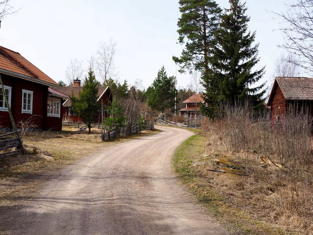
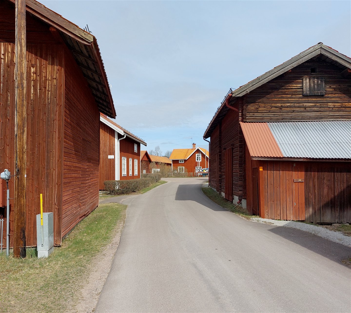
A walk where you mostly wander along on narrow roads between hamlets. Siljansnäs consists of many villages where the red houses are packed tightly together. Almo is one of the oldest, with several old wooden outhouses now classified as historical buildings.
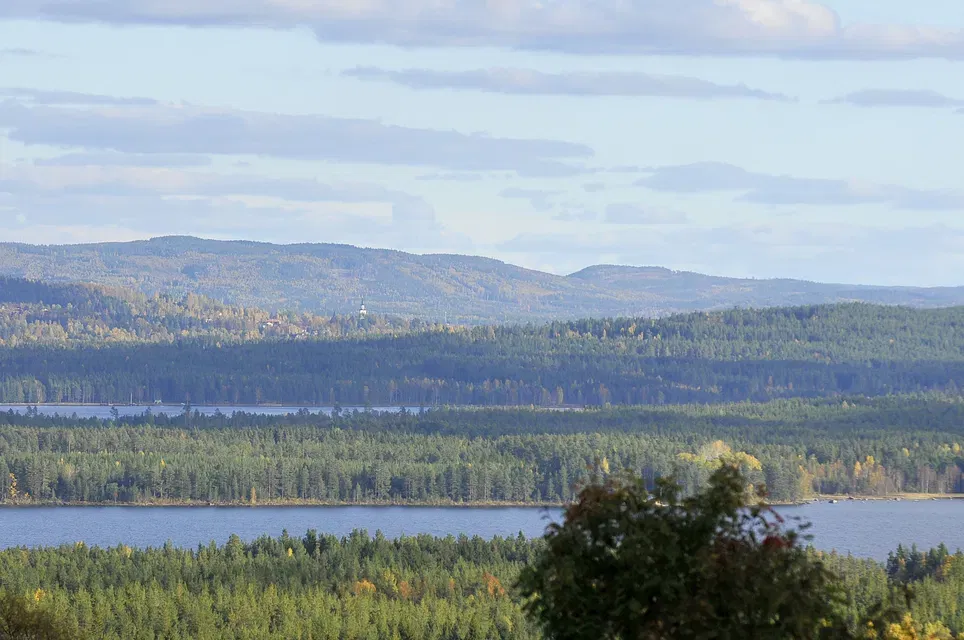
From the top of Granberget you get a great view over Siljan. In the steep slalom slope the trail is not marked. This is the only tough climb on this stage.
A short detour of a couple of hundred metres is worth the effort. Granberget’s chalets is an old one with a beautiful view and a wonderful setting where Kronstugan offers simple accommodation. For more information, see romboleden.se.
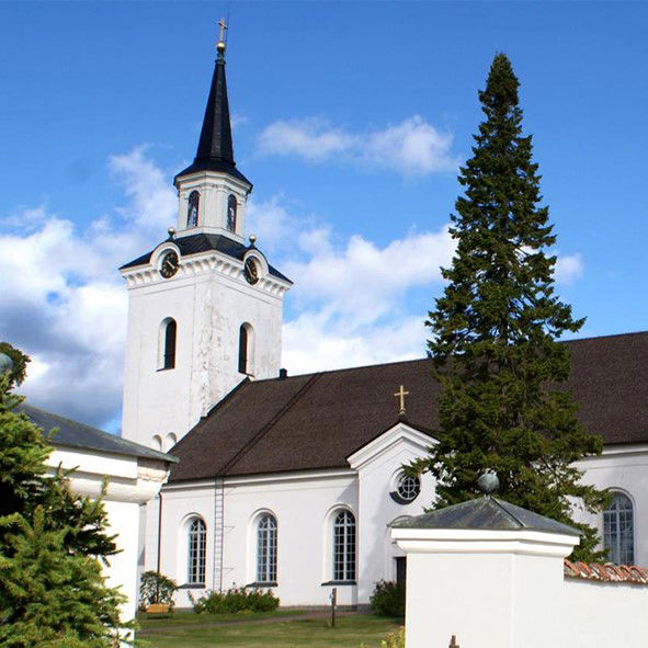
This stage finish at Siljansnäs church.
Read more about the stage
From Granberg's chalets, the path leads towards the top of Granberget's ski slope. There you have a breathtaking view of the neid with Byrviken and Siljansnäs in the foreground and the lake Storsiljan further away. You go down the ski slope and then follow a longer stretch of gravel road around Mackberget before the trail turns off onto paths towards the village of Almo.
From Almo, you can choose to take an alternative and shorter route to Olsnäsgården, where you can spend the night. The route goes along small roads through the agricultural landscape to Åkmyran. From there, the trail follows a small forest path along Åbäcken towards Olsnäs. The last part towards Olsnäsgården you follow the promenade along Olsnäsviken.
The last part to Siljansnäs church is not yet marked and signposted in the terrain.
Walk in the footsteps of the pilgrims
Romboleden (Rombo Way) is a pilgrimage route that people began using in the 11th century. The Romboleden is Sweden’s longest pilgrimage route at 900 kilometres long. It starts in Köping in Västmanland and finishes in Trondheim on the Norwegian Atlantic coast. If you walk the entire trail, you will experience a beautiful and varied landscape. You will walk on old chalet paths, over mountains with magnificent vistas and along narrow country gravel roads. You will find easy one-day walks with cafés along the way, and long treks that take several days. The route often passes through small villages.
Would you like to walk with a Pilgrim’s Passport and collect stamps from each stage? The medieval Pilgrim’s Passport allowed a pilgrim to walk in the whole of Europe without being stopped by rules or boundaries. These days it is just a nice memento. The Pilgrim’s Passport can be collected at several stage starting points and from the web page of Rombo Way.
Toimintaa ja tilat
-
Vaellusreitit
-
Pilgrimsled
Faktat
Privy at Granberget's chalets.
Toilet and drinking water at Siljansnäs Church.
Pinta
Mostly gravel and asphalt roads as well as shorter trails and trailless hiking on Granberget's ski slope.
Hills
Steep climb in Granberget's ski slope.
Pysäköinti
To Granberg, the road barrier is usually closed, park by the lake Yxen instead.
Parking is available at Siljansnäs church.
There is parking available at Olsnäsgården, a few kilometers into stage 14.
Viestintä
Public transport Dalatrafik
Reittiohjeet
The nearest bus station for the start of the stage is Västanviksbadet, just over 5 kilometers of hiking on a hilly trail to Granberget's shack.
The nearest bus station for the end of the stage is Siljansnäs school, 3 minutes' walk from the church.
Asetukset
As a hiker, you are responsible for finding out about any local regulations, paying attention to traffic and showing consideration for others who share the trail with you.
Whenever you visit Swedish nature you have a Right to public access. Read more about it here.
As a hiker you are sometimes walking in protected nature with specific rules and regulations. You are responsible for making sure you are following the rules. You can read more about it at the Swedish Environmental Protection Agency and the County Administrative Board.
Remember to only start camp fires in established barbecue areas and ensure that there is no fire ban in your area.
Remember that you are hiking on someone else's land and that rational agriculture or forestry may occur along the trail.
Lataukset
Huomaa, että osa näistä teksteistä on käännetty automaattisesti.
Kysymykset & vastaukset (Q&A)
Esitä kysymys muille Naturkartan-käyttäjille.


