-

-

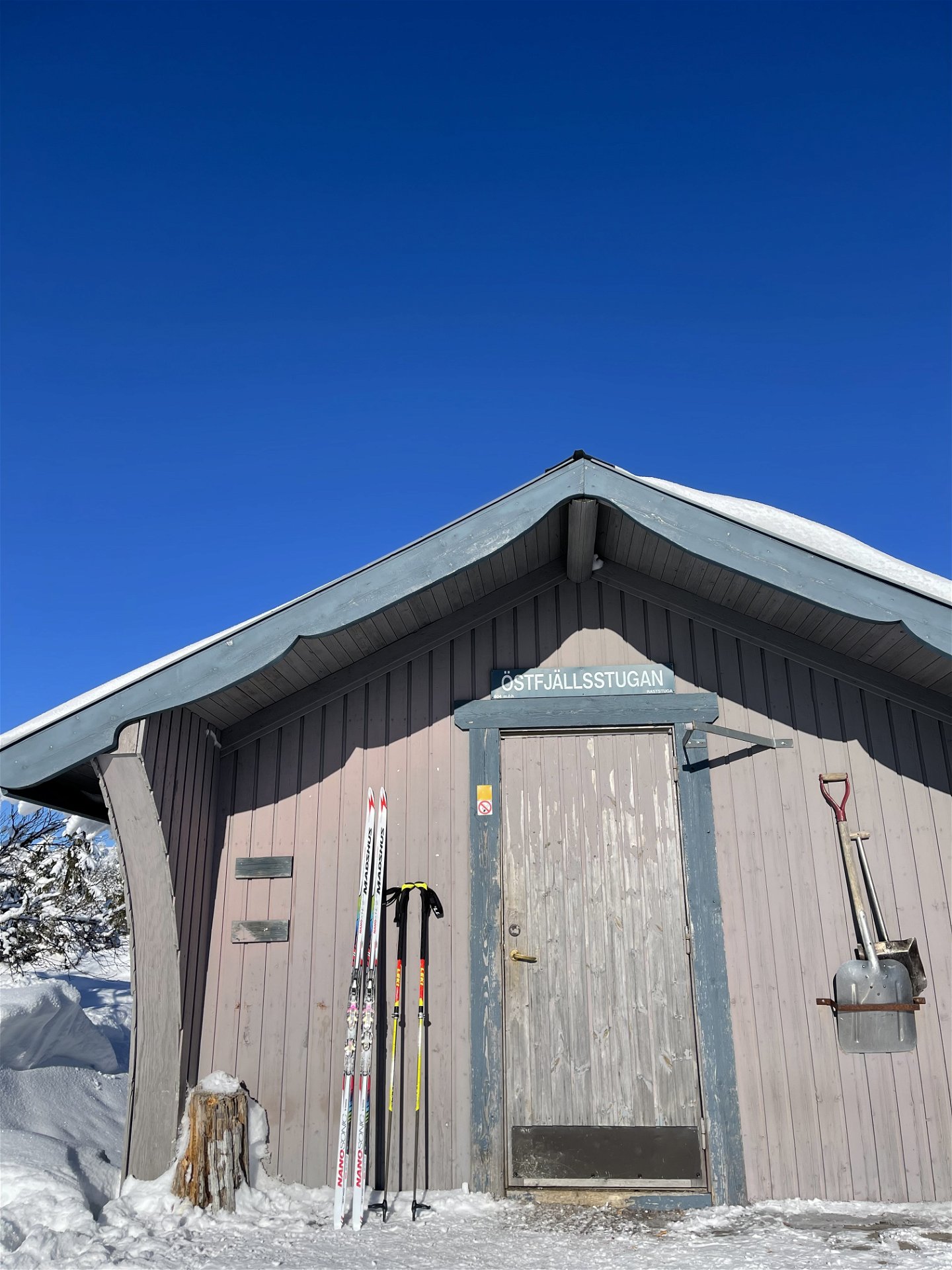
Östfjällsstugan
Kuva: Maria Mattsson -

Kuva: Maria Mattsson

Östfjällsrundan
Vaellusreitit
- Kunta: Dalarnas län
- 6497.64 km päässä sinusta
Polun yksityiskohdat
- Pituus 9.0 km
- Aika 2 h 30 min
- Vaikeuksia Vihreä - yksinkertainen
Toiminnot
Kuvaus
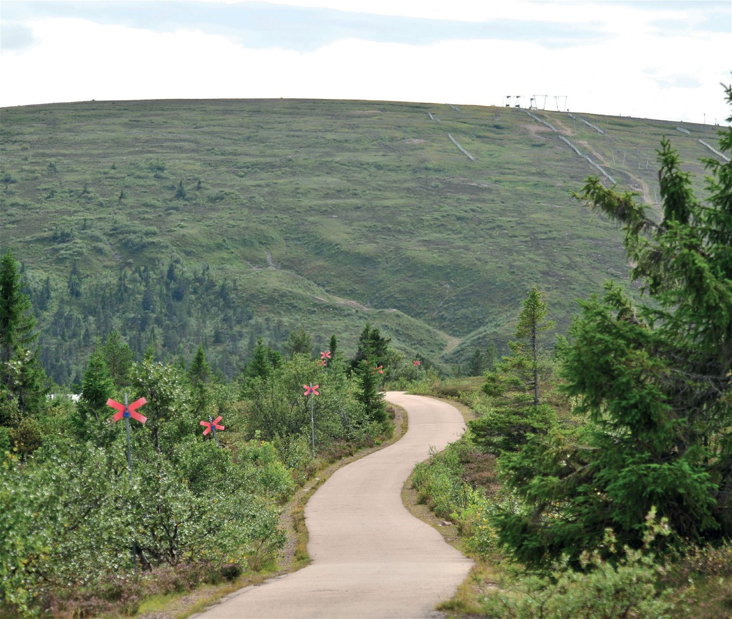
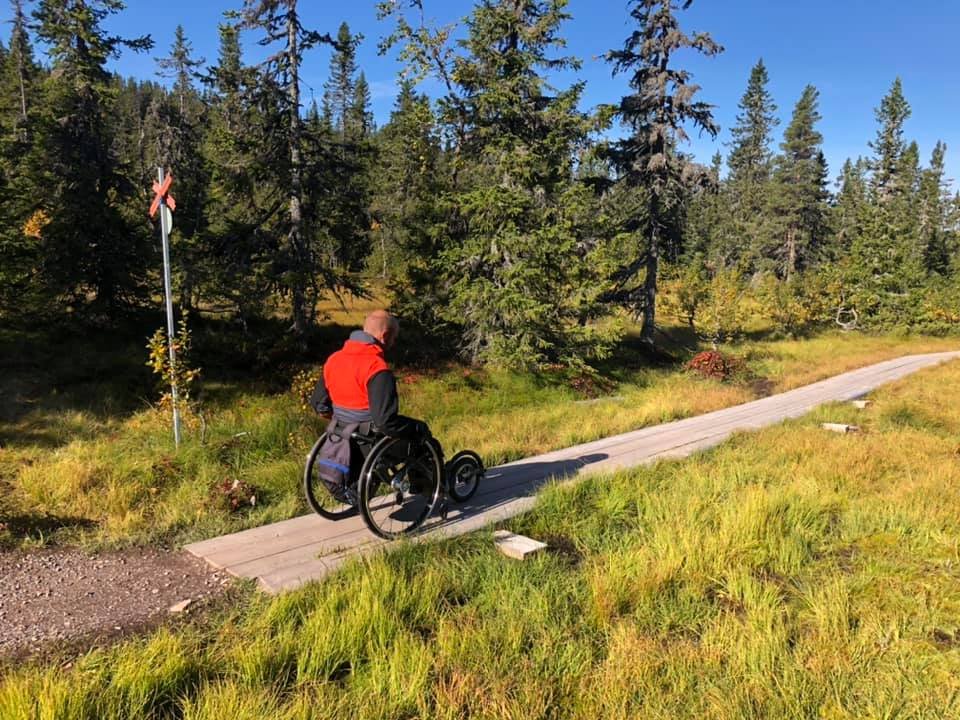
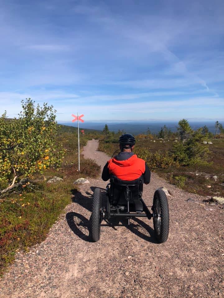
This hiking trail starts just opposite Högfjällshotellet and is marked with red crosses. Go through the portal, and you have started your hike on Södra Kungsleden. The hiking trail begins with a very gentle climb up the southern side of Östfjället. This part of the trail is asphalted and easy. It is excellent not only for guests with prams but also for our guests with wheelchairs who wish to get out into the highlands. The asphalted section is around 2.5 km long, and along this part, there are benches for those who want some rest or just want to enjoy the beautiful view. At the end of the asphalt, the surface is gravel, so it's still an easy hike up to the Östfjällsstugan.
From here, the hiking trail continues westward, and you walk on footbridges. Where the trail splits after about 1 km, follow the south towards Gruven/Högfjället. Here, you also walk on footbridges. After about 3 km, you are down by road 66, where it will be a walk along the road for about 1 km before you reach the Högfjällshotellet and the starting point.
Toimintaa ja tilat
-
 Turskidåkning
-
Vaellusreitit
-
 Promenad
Saavutettavuus
-
 Rullstolsvänligt
Testattu pyörätuolilla


Ota yhteyttä
Osoite
Destination Sälenfjällen är det gemensamma bolaget för utveckling av besöksnäringen i Sälenfjällen. Bolaget arbetar strategiskt med övergripande frågor för att skapa goda förutsättningar för besöksnäringen och därigenom bidra till ett ökat antal besökare året runt i Sälenfjällen. Läs mer på salenfjallen.se
Organisaation logotyyppi
![]()
Kysymykset & vastaukset (Q&A)
Esitä kysymys muille Naturkartan-käyttäjille.
