


Hjörneredssjöarna - Grön lång
Trailrunning
- Kunta: Hallands län
- 6745.52 km päässä sinusta
Polun yksityiskohdat
- Pituus 7.0 km
- Vaikeuksia Sininen - keskikokoinen
Toiminnot
Kuvaus
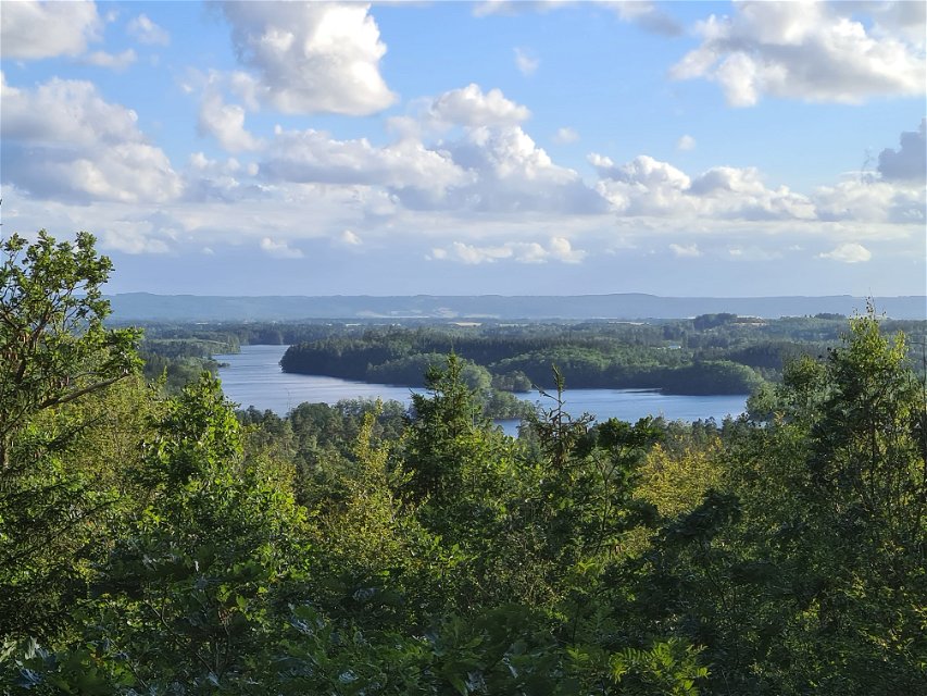
We run outer laps on the marked loops starting with the green one from Hjörneredssjöarna.
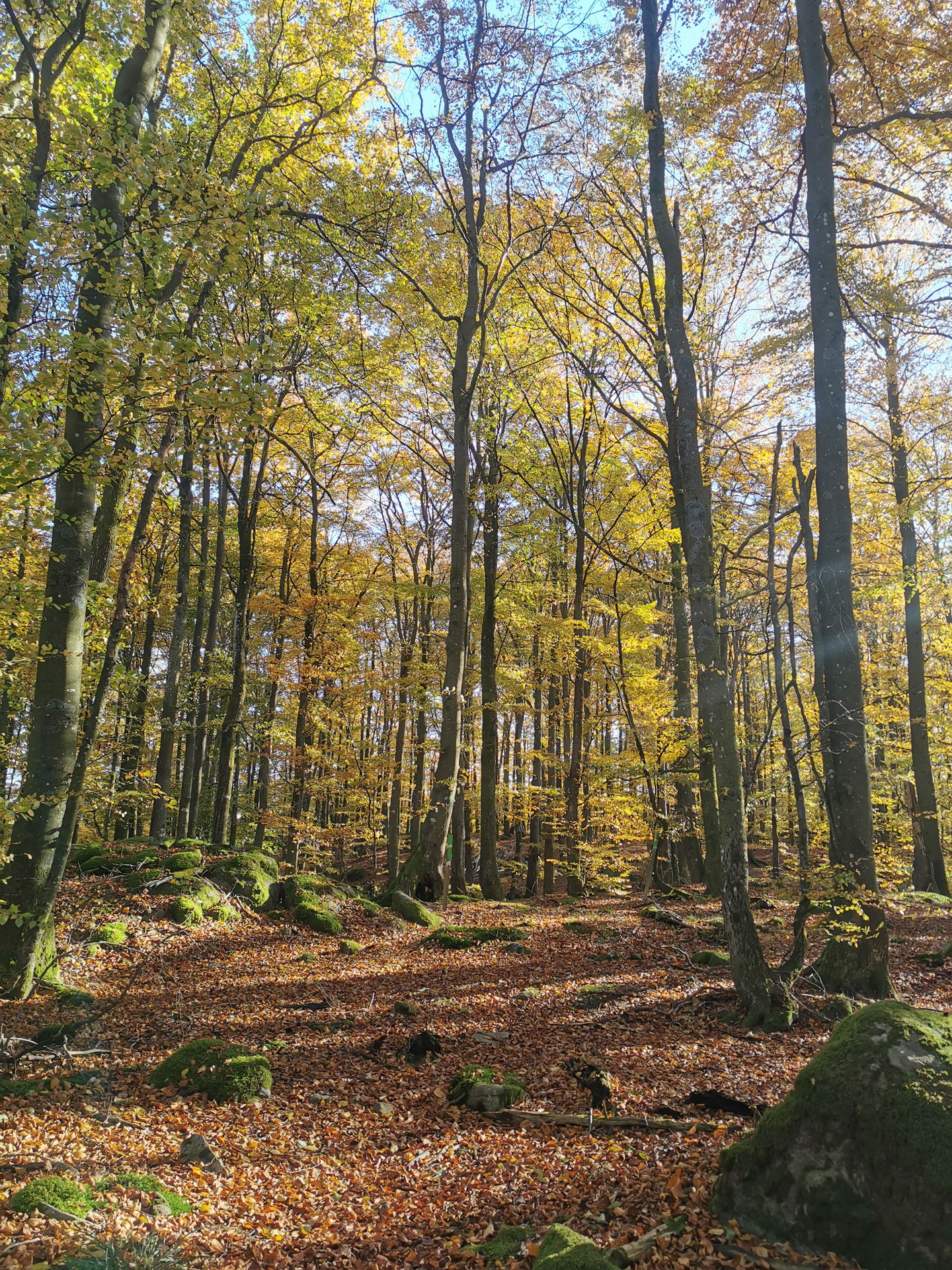
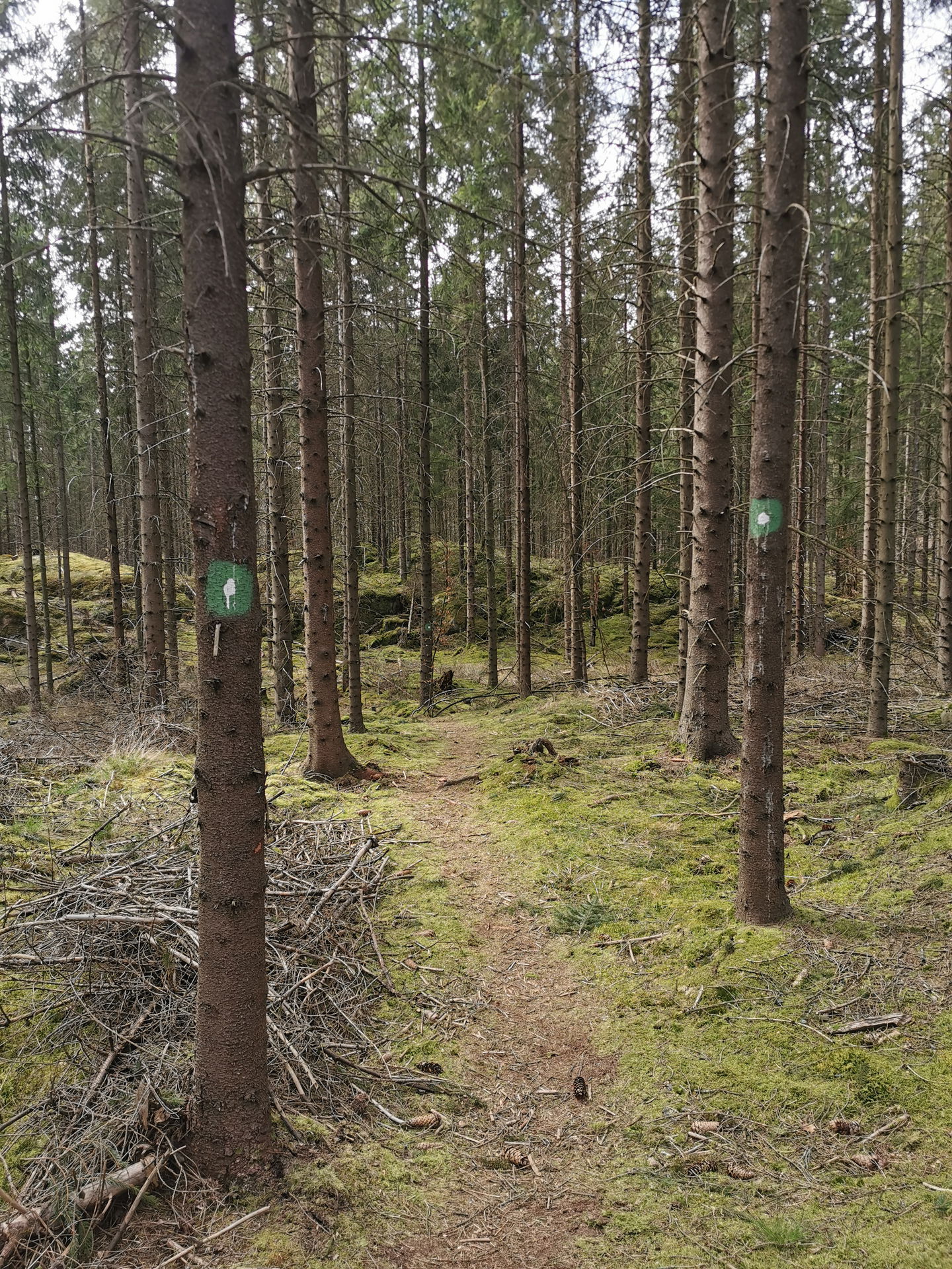
Hjörneredssjöarna was created when Lagan was dammed up to build power plants. We run along the almost surprisingly steep edge down to the river. Parts of the area are protected and the forest has been left to look after itself for a long time. Beech and oak dominate in a hilly landscape with steep slopes. The highest point is Spishall, which is said to have been named after a Danish king who spent the night here. There are nice views in any case. Along the small soft path we also meet a lot of spruce forest, but also larch - and traces of the Ice Age in the form of, among other things, the Midsummer Cave. You get to the cave by taking a detour (see the gpx file) which is definitely worth it!
Medium technical trail and moderate hills.
Toimintaa ja tilat
-
 Vaellusreitit
-
 Tysta platser
-
 Löpning
-
Trailrunning
-
 Promenad
-
 Rundslinga
Saavutettavuus
-
 Nära parkering
-
 Nära toalett
Pinta
Mixed, nature trail, road, loop
Hills
Hillside
Kasvillisuus
Mixed forest
Pysäköinti
Parking at Hjörneredssjöarna or at Vippentorpet in Timmershult.
Reittiohjeet
From Laholm. Drive towards Ysby, further towards Skogaby, follow signs towards Hjörnared. In Hjörnared, over the bridge, on the left side there is a sign how the loops go.
Ota yhteyttä
Osoite
0430-15000
Sähköpostiosoite
Medborgarservice
Organisaation logotyyppi
![]()
Huomaa, että osa näistä teksteistä on käännetty automaattisesti.
Kysymykset & vastaukset (Q&A)
Esitä kysymys muille Naturkartan-käyttäjille.
