Bröstsockerkläppen
Natuurgebied
- Regio: Norrbottens län
- 6615.59 km van u vandaan
Acties
Omschrijving
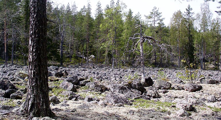
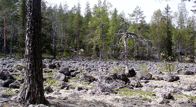
If you hike up at the summit of Bröstsockerkläppen you may wonder why there is so much exposed bedrock and areas of shingle. It is because the whole mountain lay under water a few thousand years ago. Earth and other fine-grained material were then washed away by the waves. The earth instead ended up in the more low-lying areas of the reserve. Today a tall forest grows thereon land rich in herbaceous plants. Mezereon and Herb-paris are two beautiful, but poisonous, plants you can find here. The noisy Black Woodpecker, Sweden’s largest, can be heard here as it pecks deep holes in its search for ants in tree trunks. The area is 1.1 square kilometres in size.
Activiteiten en faciliteiten
-
Natuurgebied
Feiten
Municipality: Soil
Year of formation: 2016
Size: 0.9 square kilometers
Administrator: County Administrative Board
Form of protection: Nature reserve
Communicatie
The reserve lies in a roadless place, about 3.5 kilometres north of the village of Vittjärv in Boden Municipality. Arriving from the direction of Boden on road 97 you pass Vittjärv and can then reach the reserve via the road running west of the nature reserve, through the Armed Forces firing range. The road can be closed during exercises. If instead you turn right where the road divides, your reach the road’s end after about 600 metres. From there, it is about 300 metres’ walk to the north part of the reserve. If the road is closed, you can instead drive to Lake Vittjärvsträsket and walk 1.4 kilometres to the south part of the reserve.
Routebeschrijving
The reserve is located without roads, about 3.5 kilometers north of Vittjärv in Boden municipality. If you come from Boden on road 97, you pass Vittjärv and you can reach the reserve via the road that goes west of the nature reserve through the Armed Forces shooting range. The road may be closed during exercises. If you follow the road and turn right where it splits, the road then ends after about 600 meters. From there it is about 300 meters to walk to the northern part of the reserve. If the road is closed, you can instead drive to Vittjärvsträsket and walk to the southern part of the reserve. It is longer, about 1.4 kilometers to walk before you get to the nature reserve.
Regelingen
All regulations can be found in the reserve decision. It is allowed to:
- camping
- hike
- make a fire, remember to bring your own wood!
- pick berries and edible mushrooms
- drive snowmobiles on snow-covered ground
- fish and hunt in accordance with the laws in force
It is not allowed to harm plant and animal life. Remember the right of public access and protect nature!
Contact
E-mailadres
Länsstyrelsen Norrbotten
Organisatie-logotype

Houd er rekening mee dat sommige teksten automatisch zijn vertaald.
Vragen en antwoorden
Stel een vraag aan andere Naturkartan gebruikers.


