


-
-
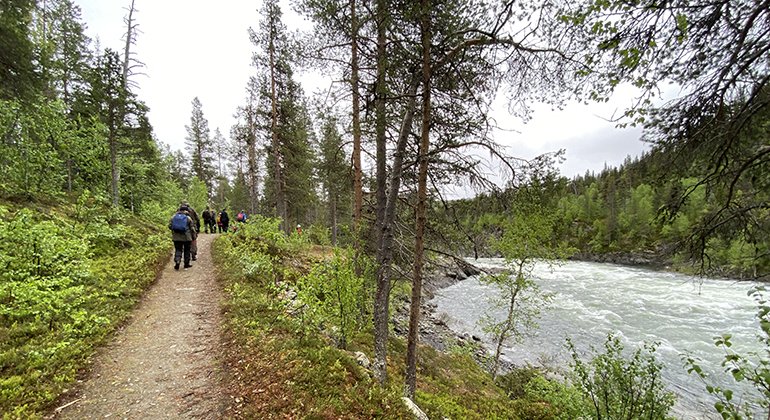
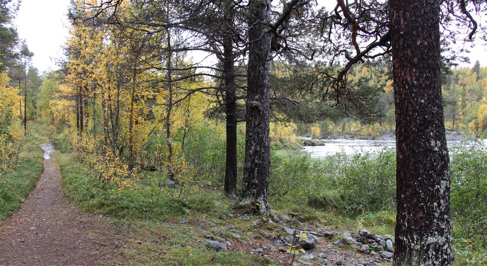
Leden går längs Märkforsen och fram till en rastplats vid Sikselet.
Omschrijving
Märkberget Nature Reserve includes Märkberget mountain and the white-water Märkforsen rapids on the Lais river. Here you can hike alongside the rapids or upload the mountain, you can hike along the rapids or up on the mountain, through pine forest interspersed with mountain birch. In the eastern part of the reserve there are tarns, fertile fens and a ravine. Why not go on an excursion with friends or family? Walk the trail by the rapids – roughly 1 ½ km – and enjoy your packed lunch at the wind shelter and fire place, with a view of the water! The area is 2.9 square kilometres in size. Snowmobiling is only allowed on designated snowmobile trails.
Activiteiten en faciliteiten
-
 Natuurgebied
Feiten
Municipality: Arjeplog
Year of formation: 1983
Size: 2.9 square kilometers
Administrator: County Administrative Board
Form of protection: Nature reserve, Natura 2000
Parkeren
There is a little car park by the road north of the reserve, where the trail to the wind shelter begins.
Communicatie
Märkberget lies about 55 kilometres northwest of Arjeplog and about 10 kilometres east of Adolfström. From road 95, 30 km west of Arjeplog, turn off to the left (southwards) towards Laisvall and Adolfström.
Routebeschrijving
Märkberget is located about 55 kilometers northwest of Arjeplog and about 10 kilometers east of Adolfström. From road 95, three miles west of Arjeplog, turn left (south) towards Laisvall and Adolfström.
Regelingen
All regulations can be found in the reserve decision. It is allowed to:
- camping
- hiking
- picking berries and edible mushrooms
- drive snowmobiles along snowmobile trails
- fishing and hunting in accordance with applicable laws
In winter, you can make fires wherever you want, but in summer this is only allowed near waterways.
It is not allowed to damage plant and animal life. Remember the right of public access and protect nature!
Contact
E-mailadres
Länsstyrelsen Norrbotten
Organisatie-logotype
![]()
Houd er rekening mee dat sommige teksten automatisch zijn vertaald.
Vragen en antwoorden
Stel een vraag aan andere Naturkartan gebruikers.
Beoordelingen
Misschien bent u ook geïnteresseerd in
