


Gallbergsleden
Hiking
- Regio: Värmlands län
- 6551.83 km van u vandaan
Pad details
- Lengte 5.0 km
- Moeilijkheidsgraad Blauw - medium
Acties
Omschrijving
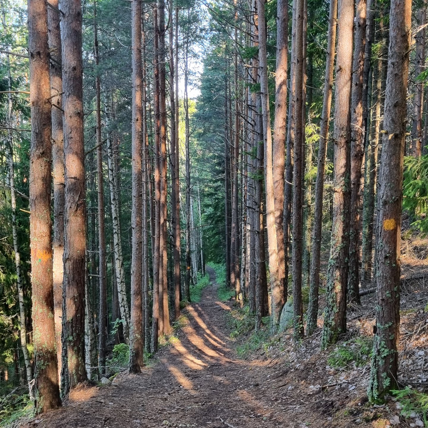
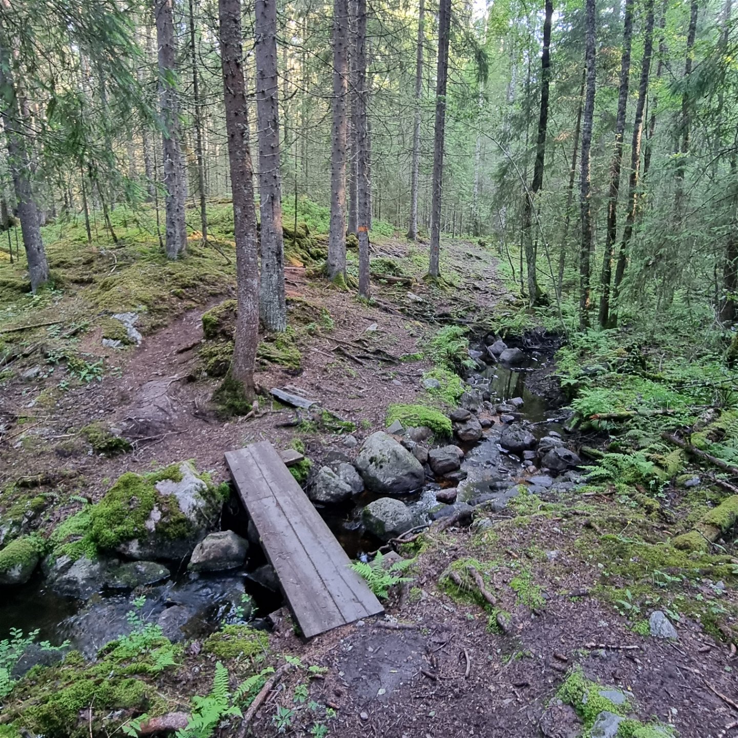
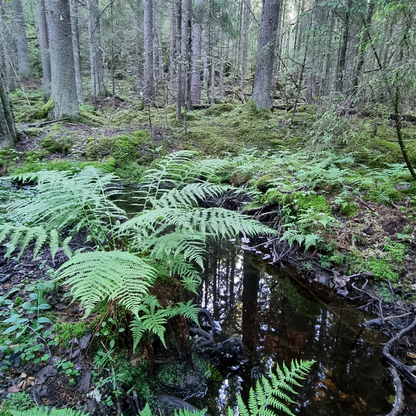
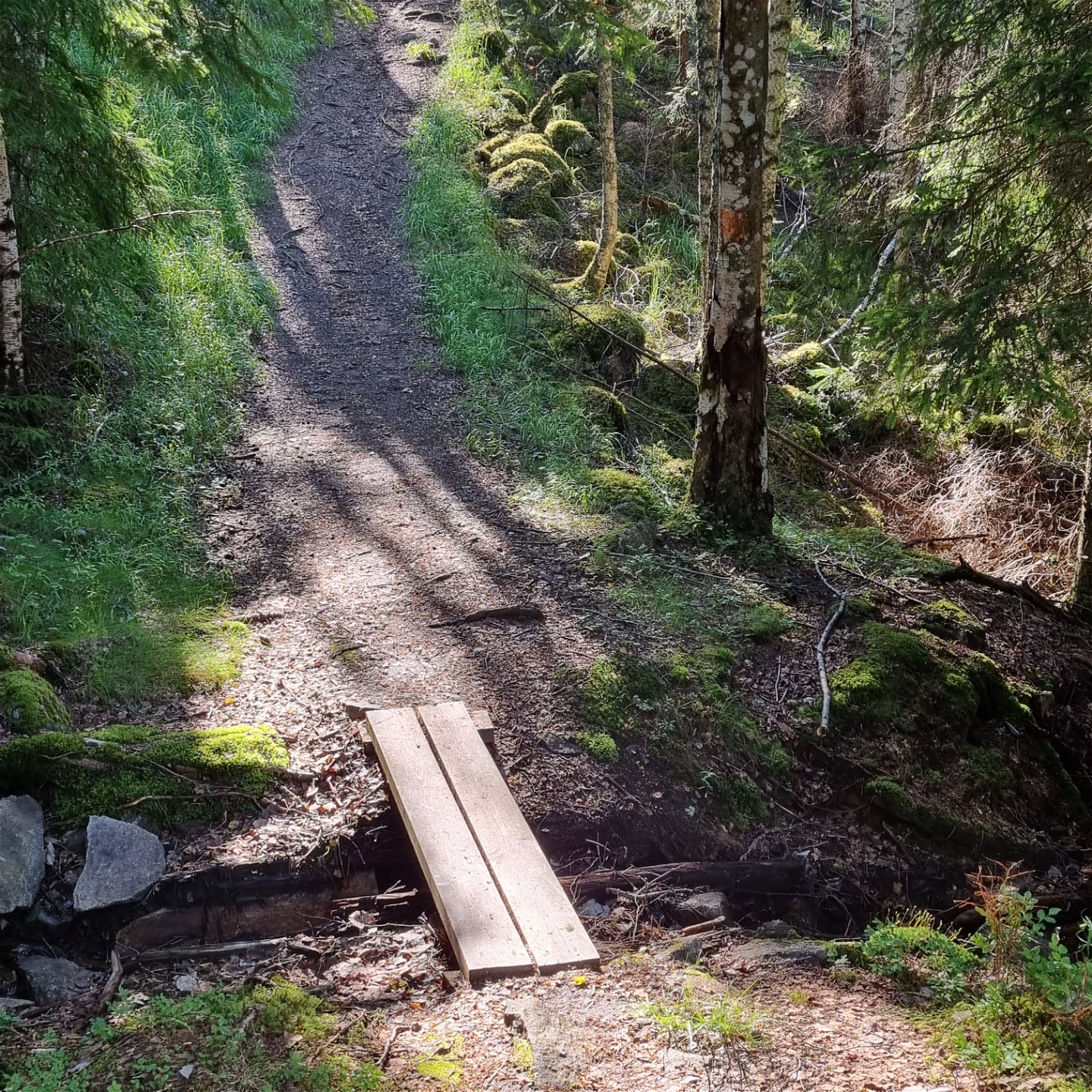
A 5 km circular hiking trail which starts at the Jösse Cabin (Jössestugan) in Rackstad. The trail passes through coniferous forests, partly old pine forest, and along streams and a tarn. The climb to the top of Gallberget has some steep parts, but is overall gradual. The terrain is mostly forest paths with some duck boards across small streams. In the lower areas there are a good deal of rocks and roots. The path is well visible and marked with orange on trees or signs.
Mobile phone coverage is normally available throughout the trail.
Activiteiten en faciliteiten
-
Hiking
-
 Rond pad
Feiten
Description for counter-clockwise directionFrom the parking lot there is a common start for the three trails Gallbergsleden, Djupdalsleden and Sotar Blixtleden. After the first hill up past the cottage, the signage begins to show the route choices. The color marking for Gallbergsleden is clearly visible. The signs show counterclockwise direction and starts to the southeast with a slightly rocky path, with some roots. The tall spruce forest does not let much light through to the ground and gives a sense of space to the babbling of the small streams. Footbridges facilitate passage over wet areas and streams. As the altitude increases, the terrain changes to more pine and coniferous paths.
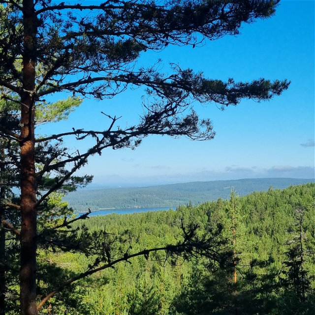
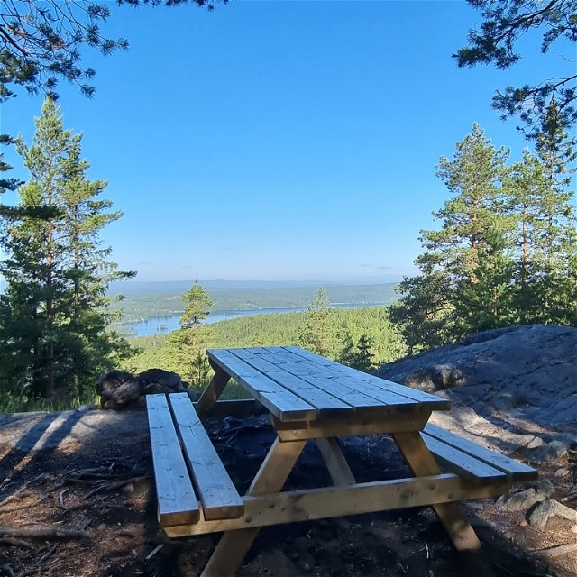
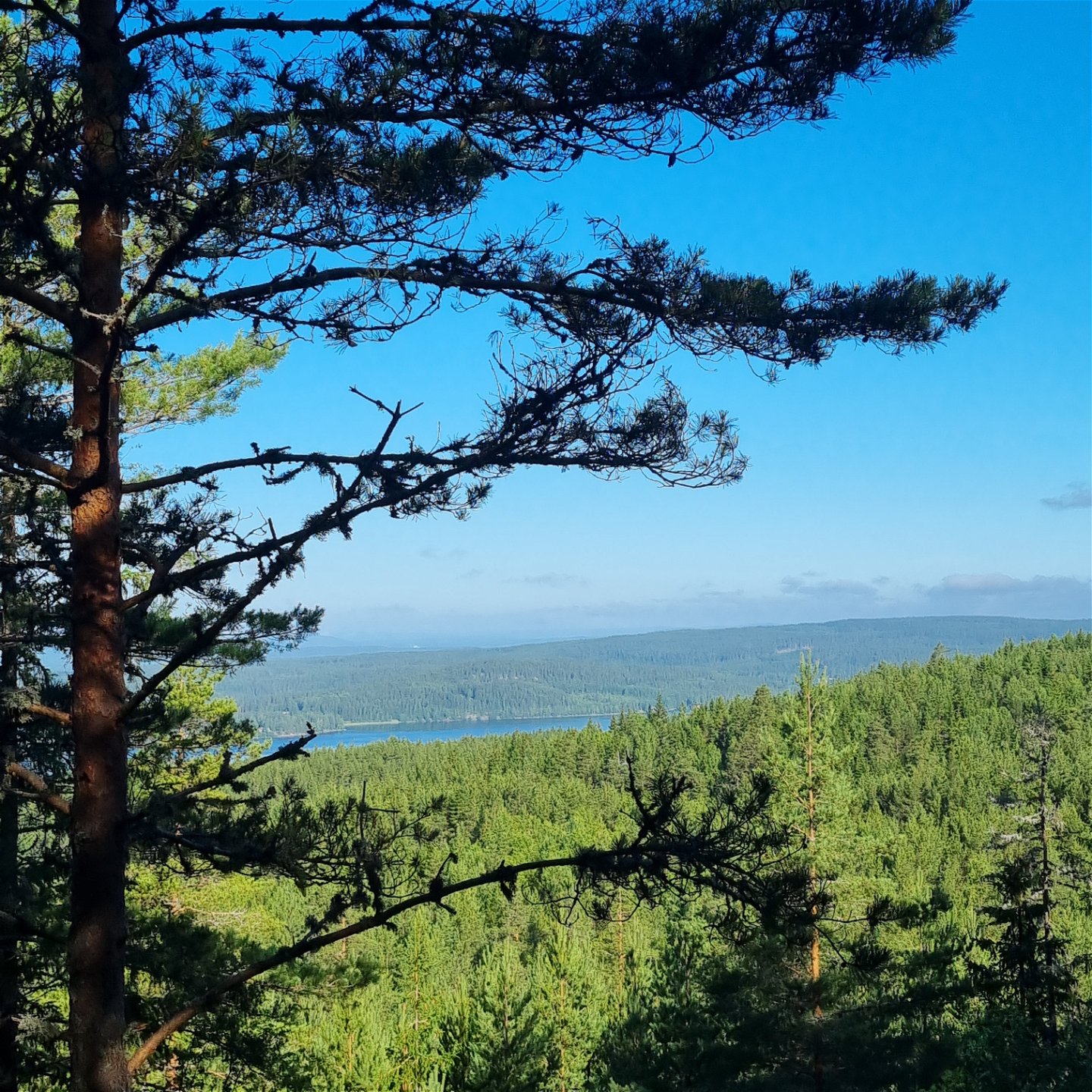
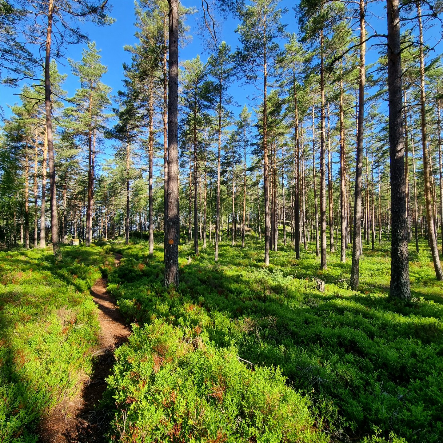
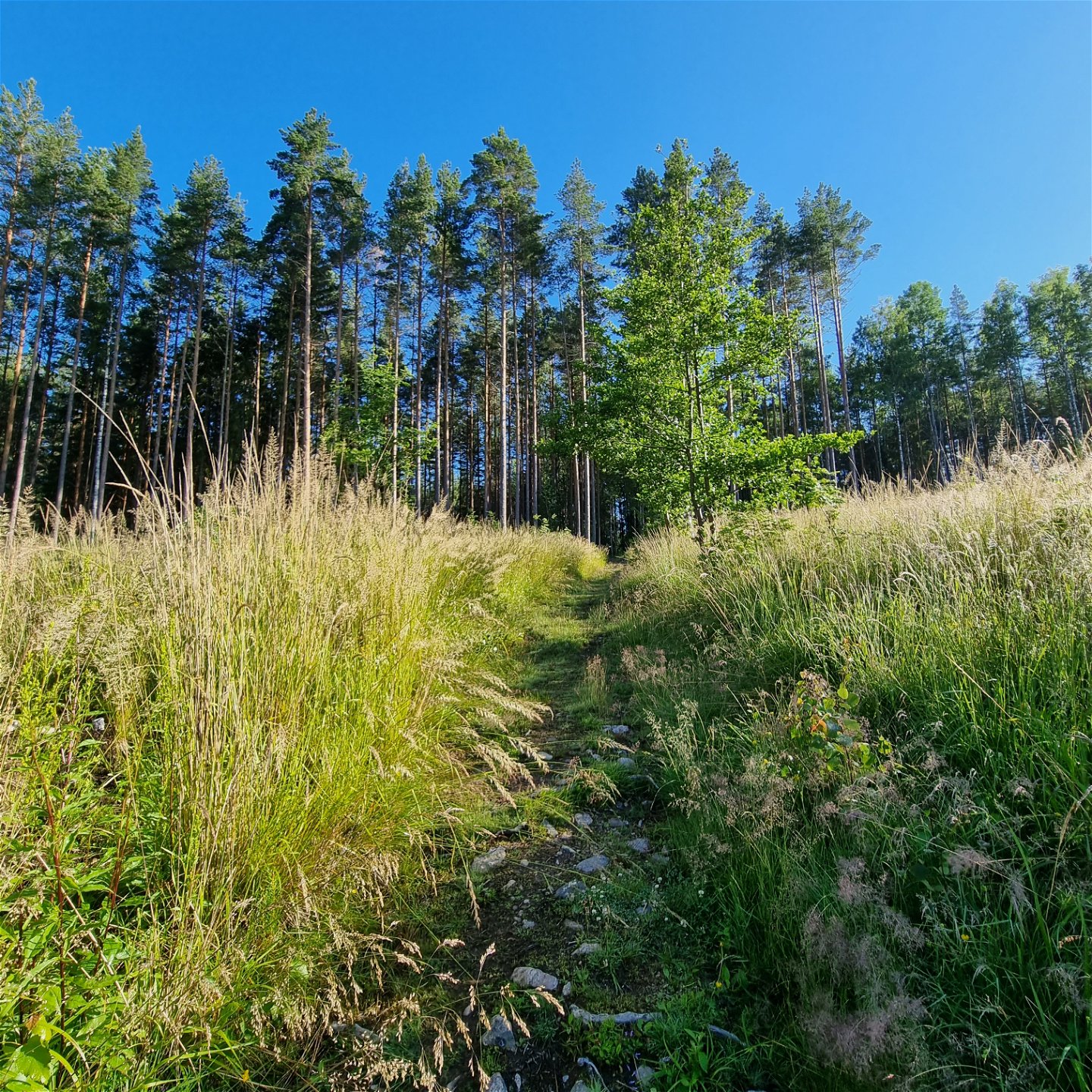
After a z-shaped stage to the east, the path turns to the northeast. Near the top of Gallberget, the ground under the old, tall pine trees is covered with blueberry bushes. At the highest points there is a picnic area with views of Lake Racken and the surroundings.
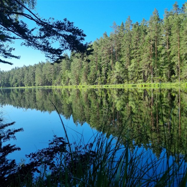
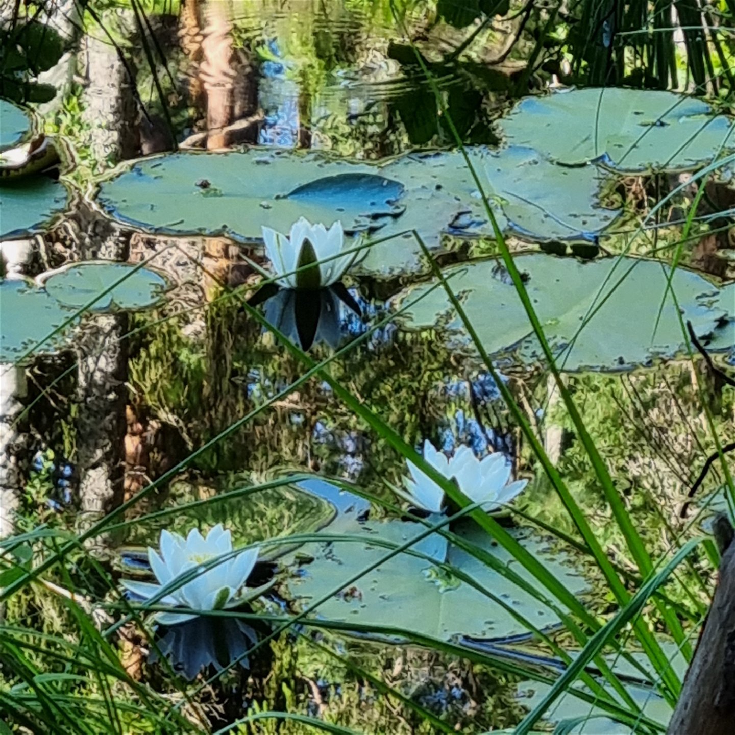
The path winds westwards, down the mountain towards Hartjärnet, where white water lilies bloom in June/July. The path continues down towards Jössestugan, on partly stony ground, among lush vegetation.
Oppervlakte
The terrain is mostly forest paths with some duck boards across small streams. In the lower areas there are a good deal of rocks and roots.
Heuvels
Steep climb to the Gallberget top.
Parkeren
Spacious parking lot for around 20 cars.
Communicatie
Suggested starting point Jössestugan, latitud 59.692706, longitud 12.679481 There is a spacious parking space. The bus connection 111 Arvika-Perserud passes the stop ”Myren/Rackstadskogens naturreservat” after approximately 8 km from Arvika. For time tables, visit Värmlandstrafik (varmlandstrafik.se).
Routebeschrijving
Suggested starting point Jössestugan, latitud 59.692706, longitud 12.679481 There is a spacious parking space. The bus connection 111 Arvika-Perserud passes the stop ”Myren/Rackstadskogens naturreservat” after approximately 8 km from Arvika. For time tables, visit Värmlandstrafik (varmlandstrafik.se).
Regelingen
Some areas of the trails coincide with the Rackstad Nature Reserve, which means that it is prohibited to:
- harm living or dead trees and bushes,
- pick or dig up plants, including moss, lichen, or mushrooms,
- interfere with animal wild life by going too close to their resting place or making fires,
- bring dogs unleashed,
- drive motor vehicles,
-
put up tents
For more information visit: www.lansstyrelsen.se/varmland/besoksmal/naturreservat/rackstadskogen.
Contact
Adres
Besöksadress:
Visit Arvika
Arvika Turistbyrå, Storgatan 22
671 31 Arvika
www.visitarvika.se
E-mailadres
Visit Arvika
Houd er rekening mee dat sommige teksten automatisch zijn vertaald.
Vragen en antwoorden
Stel een vraag aan andere Naturkartan gebruikers.
