48 timmar guide för dig som vill uppleva naturen
För den här 48 timmars resan behöver du riktigt bekväma skor, och kanske en kikare,…
Wędrówki piesze
Difficulty level: The trail is mostly easy to walk, with no steep climbs. There are a few shorter sections with boardwalks. On the western side of Årnarpagölen, the trail follows a ridge (goat’s back) that can be somewhat demanding to climb up and down.
Accessibility: No
Jälluntoftaleden is 12 km long and passes through beautiful and varied countryside, offering a peaceful and scenic hiking experience. The trail is well-marked with signs and orange markings, making it easy to follow. The hike begins at Chalanderska Museum in Jälluntofta, where you’ll find parking and toilet facilities. Along the route, there are five rest areas, one of which includes a wind shelter, barbecue area, and toilet, offering a perfect place to relax and enjoy the surroundings.
Jälluntofta – A Picture-Perfect Småland Village
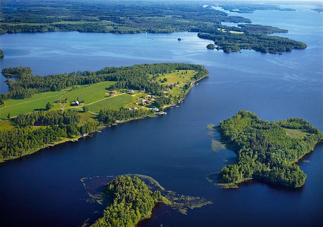
Jälluntofta is a picturesque village with a genuine Småland atmosphere. The village is centered around its beautiful 19th-century church, surrounded by traditional Småland fencing and several older houses. The landscape is open and beautiful, with Lake Jällunden stretching about 10 km southward, offering several coves and islands that are perfect for canoeing, swimming, or simply relaxing by the water. There’s also a campsite by the lake, where you can rent cabins and enjoy a variety of nature-based activities.
In addition to its natural beauty, Jälluntofta is home to several interesting places, including the Charlanderska Museum, the neoclassical church from the 1860s, and a century-old shooting pavilion. Although Jälluntofta is part of Halland County, it belongs to the historical region of Småland. Since 1974, it has been part of Hylte Municipality. Once Halland’s smallest parish, Jälluntofta is now part of Unnaryd Parish. The area is also home to Ölmesberg, the highest point in Halland County, a beautiful spot well worth a visit (GPS coordinates: 57°3′29″N 13°32′9″E).
Connecting Nature and Culture
Jälluntoftaleden is part of the regional trail network in Halland, and the nearby Hylteleden bike trail also passes through Jälluntofta, offering more ways to explore the region. Whether hiking along the Jälluntoftaleden or cycling the Hylteleden, visitors can enjoy the mix of outdoor adventures and cultural sites that make Jälluntofta so special.
To learn more about what to do, see, and visit in the area, check out Woods of Halland at www.woodsofhalland.se.
Woods of Halland
Telefon: 0345-182 14 Kontaktcenter: 0345-180 00
Lena Hagman Bogren

Należy pamiętać, że niektóre z tych tekstów zostały przetłumaczone automatycznie.
Zadaj pytanie innym użytkownikom Naturkartan.