-
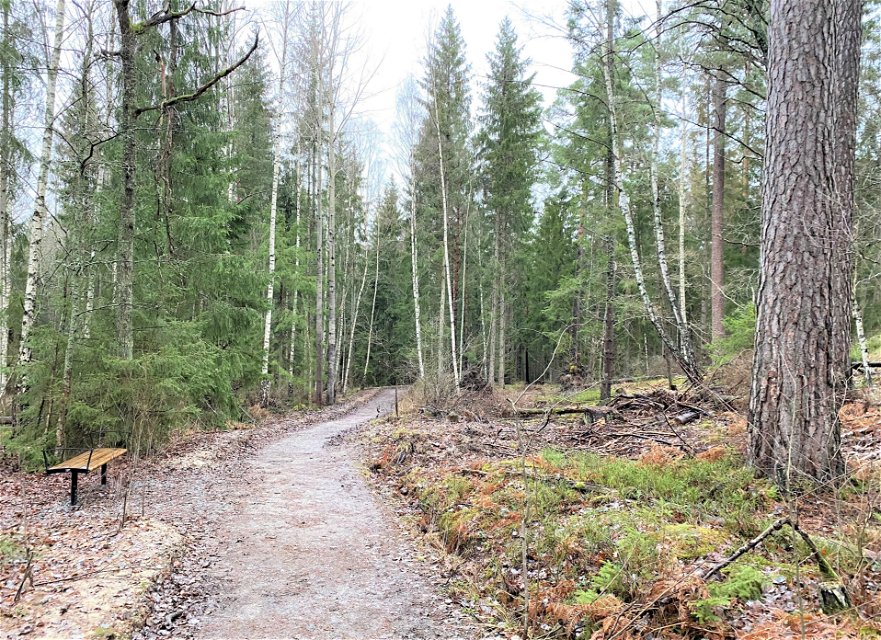
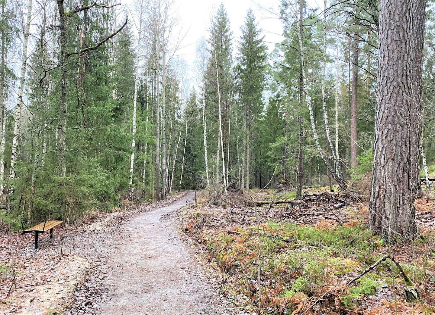
Promenadslinga på Kärsön.
Zdjęcie: Mats Larshagen -

Lovö Kärsö - Promenadslinga
Wędrówki piesze
- Województwo: Stockholms län
- 6777.51 km od Ciebie
Szczegóły dotyczące szlaku
- Długość 1.9 km
Akcje
Opis
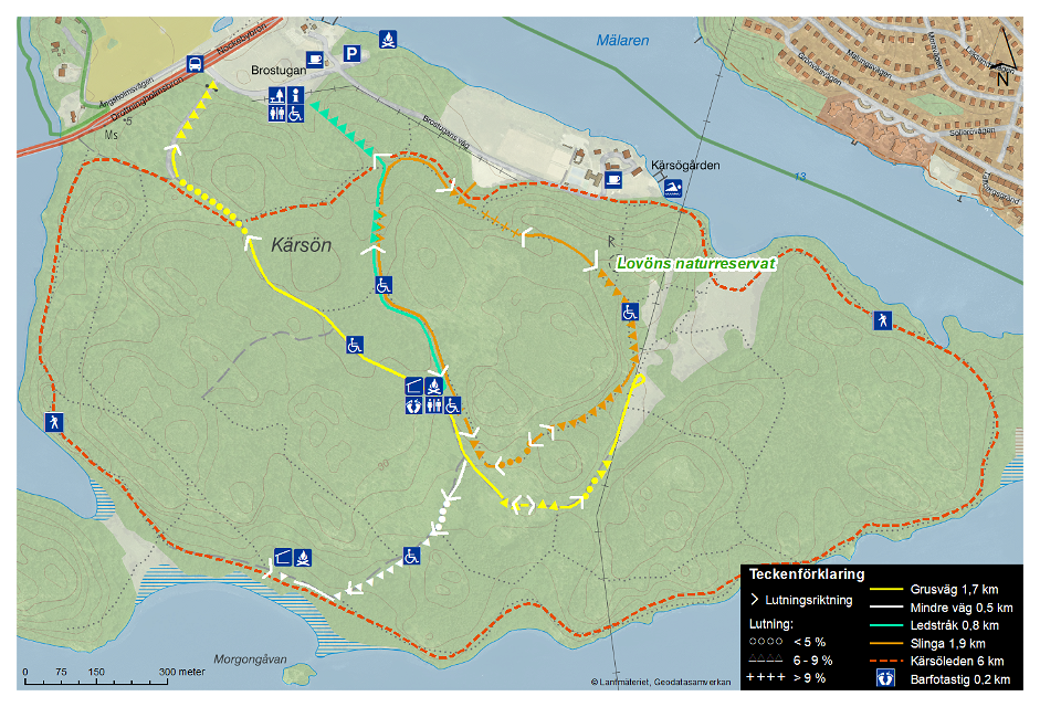
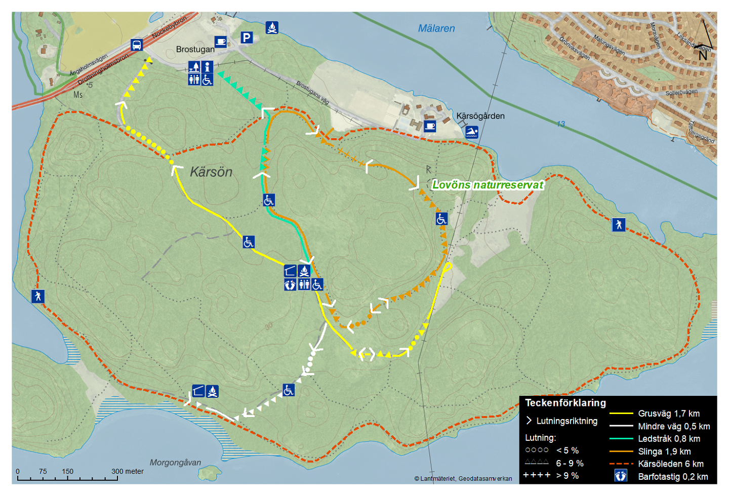
The trail is 1.9 km long and goes through the centre of Kärsön (marked orange on the map). Along the way, you will pass a picnic area with a covered shelter, a fire pit and a wheelchair-accessible outdoor dry toilet. You will even pass an old burial site used during the cholera epidemic.
This
nature reserve is managed by the National Property Board (Statens
fastighetsverk, SFV), skogsbruk@sfv.se.
Działania i udogodnienia
-
Wędrówki piesze
-
 Promenad
Dostępność
-
 Dostęp dla wózków dziecięcych
-
 Dostęp dla wózków inwalidzkich
Wzgórza
The sign at the information point at Brostugan shows the slope of the trail in the terrain. The trail has a gradient of 0-9% except for a section near Kärsögården's parking lot where it slopes sharply (over 9%).
Wskazówki dojazdu
You can get to the trail from the parking lots at Brostugan and Kärsögården. The closest bus stop is Brostugan, which is located by the Nockebybron bridge. For current timetables, see www.sl.se.
Regulamin
In order to protect the Lovö nature reserve, please respect the following rules.
Within the reserve, it is forbidden to:
- dig, cut, drill or in any other way damage bedrock, soil or stone,
- fell or damage living or dead trees or bushes,
- damage vegetation by digging up plants,
- bring unleashed dogs,
- ride horses on designated hiking trails,
- camp for more than two consecutive nights in a tent, motorhome, caravan or similar,
- moor a boat for more than two consecutive nights at the same beach (this rule does not apply to piers and marinas),
- put up permanent posters, signs or similar.
Kontakt
Adres e-mail
Länsstyrelsen i Stockholm
Logotyp organizacji
![]()
Należy pamiętać, że niektóre z tych tekstów zostały przetłumaczone automatycznie.
Pytania i Odpowiedzi
Zadaj pytanie innym użytkownikom Naturkartan.
