


Vandring längs ARK56 i Blekinge - upptäck enastående naturskatter och dig själv
Oavsett om du är hardcore-hiker och vill vandra i en vecka, eller om du vill…


Hiking
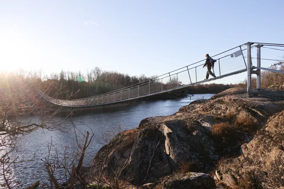
The Eriksberg bridges have now been completed and the new Eriksberg Trail was opened on 5 April.
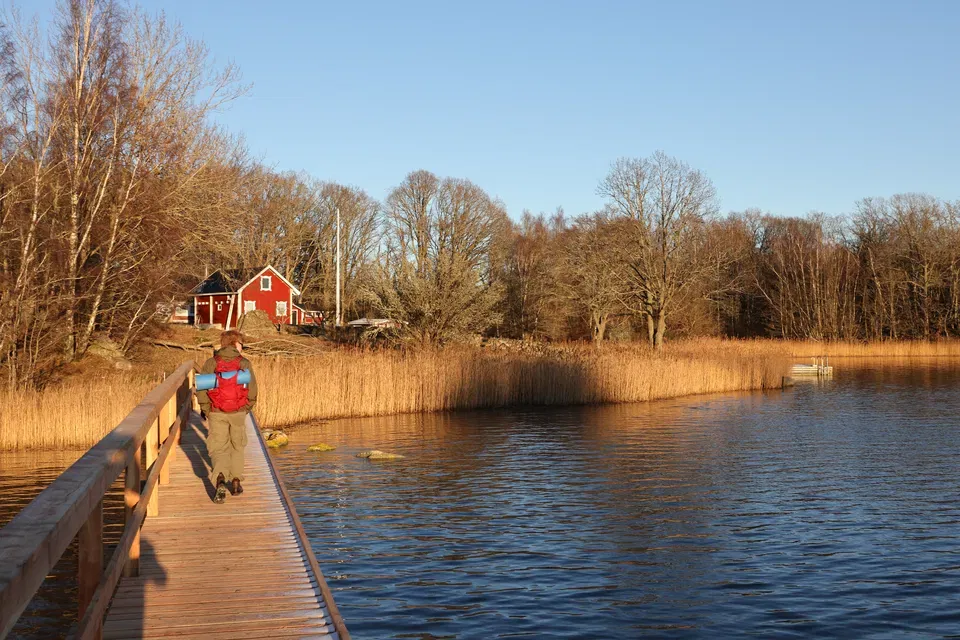
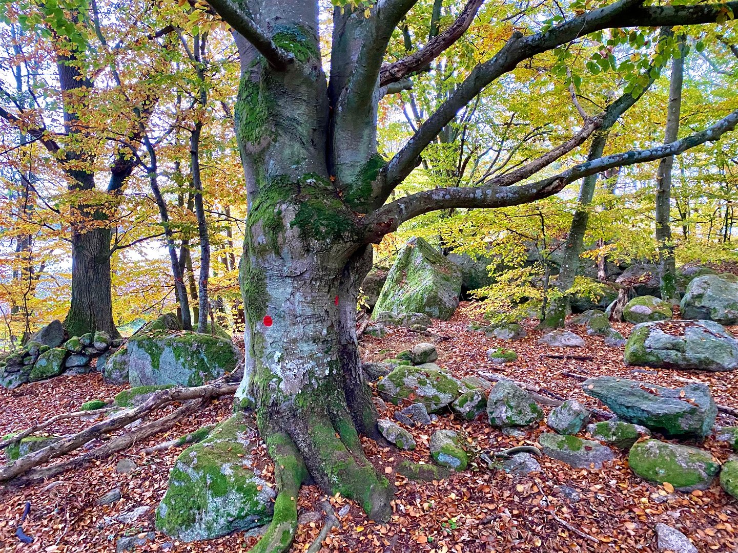
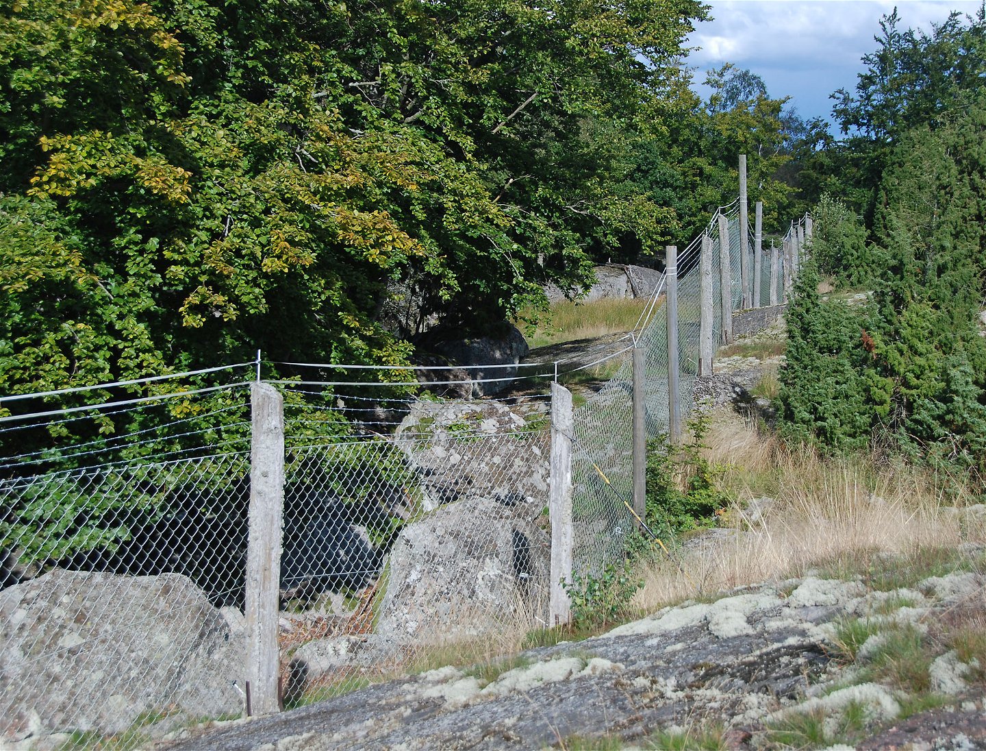
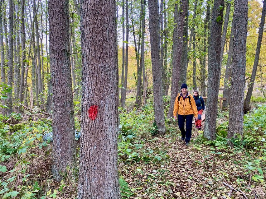
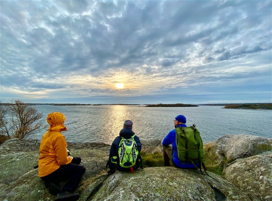
Eriksbergsleden is one of the most beautiful and challenging trails in Blekinge. It offers many stunning views over the water along the coast. You’ll encounter oak, beech, pine, and various trees along the way. It’s a coastal trail close to the Eriksberg Wildlife and Nature Park. Since the trail runs along the fence of the wildlife park, you might be lucky enough to spot some of the animals. The trail is marked with orange markers on posts and trees.
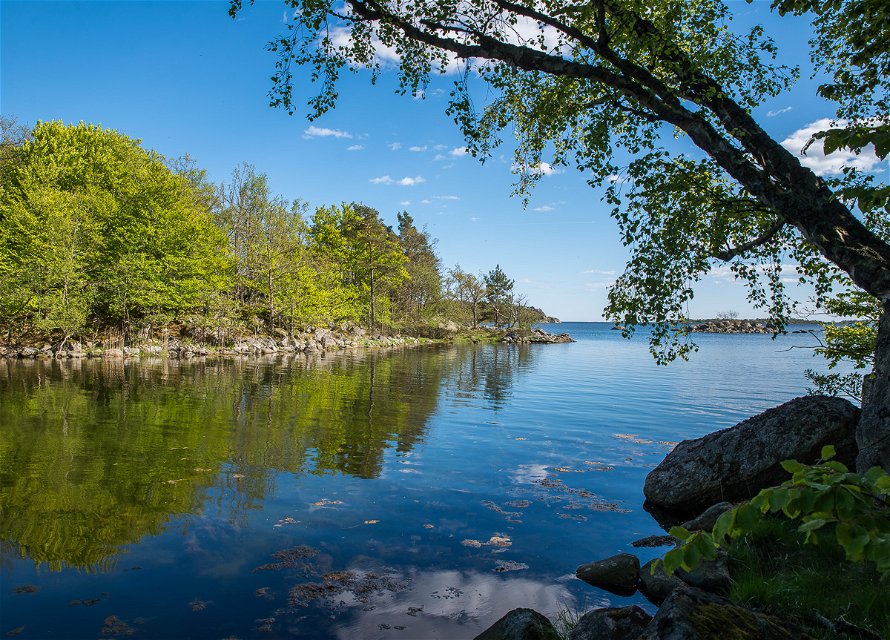
Eriksberg’s shores are mainly made up of rocks. In crevices and areas with deeper soil, there is denser tree cover, ranging from alder swamps to heath beech forests.
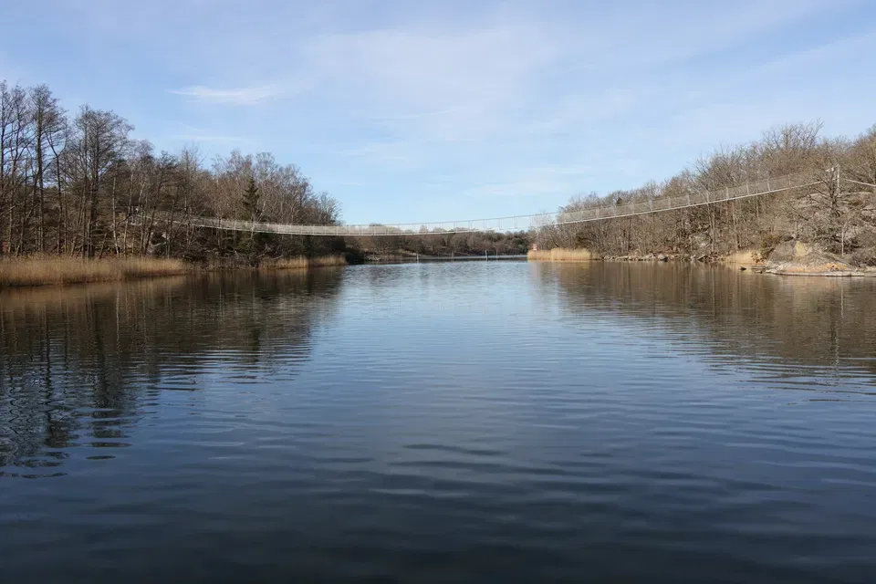
Eriksbergsleden is a combination of the old Kohageleden, which started at the entrance to Eriksberg in the northeast, and the Allböleleden, which started from Björnahemmet in the southwest. The two trails were connected by a couple of spectacular bridges that link Dragsö with the mainland.
Kohageleden passes through beautiful beech forests down to the water’s edge and climbs high up the cliffs with fantastic views. The trail starts at the entrance to Eriksberg and goes to the cottage Kohagen.
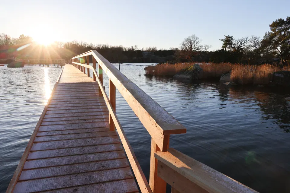
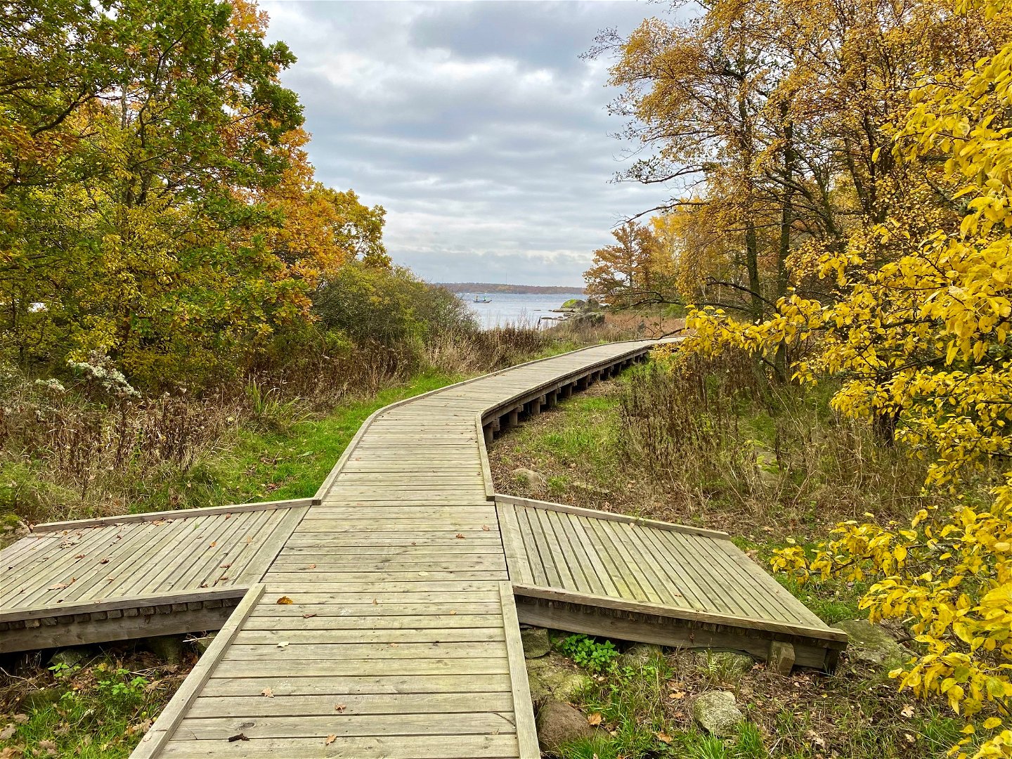
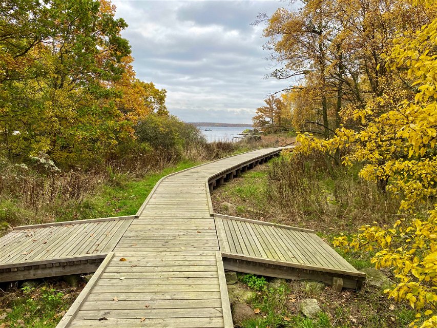
Allböleleden starts at the entrance to the Eriksberg nature reserve at Björnahemmet and heads out to Allböle, where you can enjoy views over Hanö and an uninterrupted horizon. On the way, you’ll pass a spectacular resting spot by the new boardwalk over Bruksviken. Along the trail, you’ll also experience industrial history, military heritage, remains from the cottage era, natural phenomena, and the Blekinge archipelago.
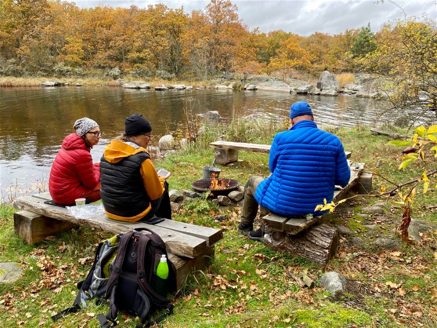
The hike between the starting points is quite demanding in parts from both directions but offers breathtaking views of the sea. The total length of the trail is about 12.2 km. The trail is marked with orange markers on posts and trees, and there are several barbecue and resting spots along the way.
Currently, the trail is not a circular route, so if you park your car at one of the two starting points, you will need to retrace your steps or come with two cars. Alternatively you can take the train to Bräkne-Hoby and book the public transport service "Närtrafik". More information in this article.
During the summer, you can take the archipelago boat from Karlshamn or Matvik to Bruksviken’s dock.
Please note that the trail is not accessible for people with mobility challenges and includes many steep and hilly sections that can be slippery when wet. Some parts of the trail run along narrow boardwalks.
For a shorter hike with a feel of Eriksbergsleden, you can start at Björnahemmet and walk to Tegelbruket, where there is a barbecue area. Along the way, you’ll pass the new, beautiful bridge over Bruksviken. The distance is 1.5 km one way and is suitable for families with children (although the trail is not accessible for people with mobility challenges).
Hiking
The first part up to the Allböleleden trail itself is a gravel road, then a small path.
Länsstyrelsen Blekinge
![]()
Houd er rekening mee dat sommige teksten automatisch zijn vertaald.
Stel een vraag aan andere Naturkartan gebruikers.
Oavsett om du är hardcore-hiker och vill vandra i en vecka, eller om du vill…
