Evertsberg - Älvdalen, Romboleden Etapp 19
Pelgrimspad
- Regio: Dalarnas län
- 6540.01 km van u vandaan
Pad details
- Lengte 13.0 km
- Tijd 3 uur 15 min
- Moeilijkheidsgraad Blauw - medium
Acties
Omschrijving
This section takes you along trails and small roads through the forest, connecting two historic locations. Evertsberg probably had a chapel as far back as the Middle Ages, and outside Älvdalen's church stands a storage building from the 13th century. Along the way, you pass Kungskällan, where King Karl XI is said to have rested in 1686.
Expect some uphill climbs, especially if you begin your walk in Älvdalen. Both Evertsberg and the old mountain pasture Sovaldberg are located high up, offering expansive views over the forested landscape.
The hard stone porphyry has been polished in Älvdalen for centuries. You will pass Älvdalens Nya Porfyrverk, which was founded in 1897. The buildings, complete with preserved machinery and tools, now function as a museum.
Read more about the stage
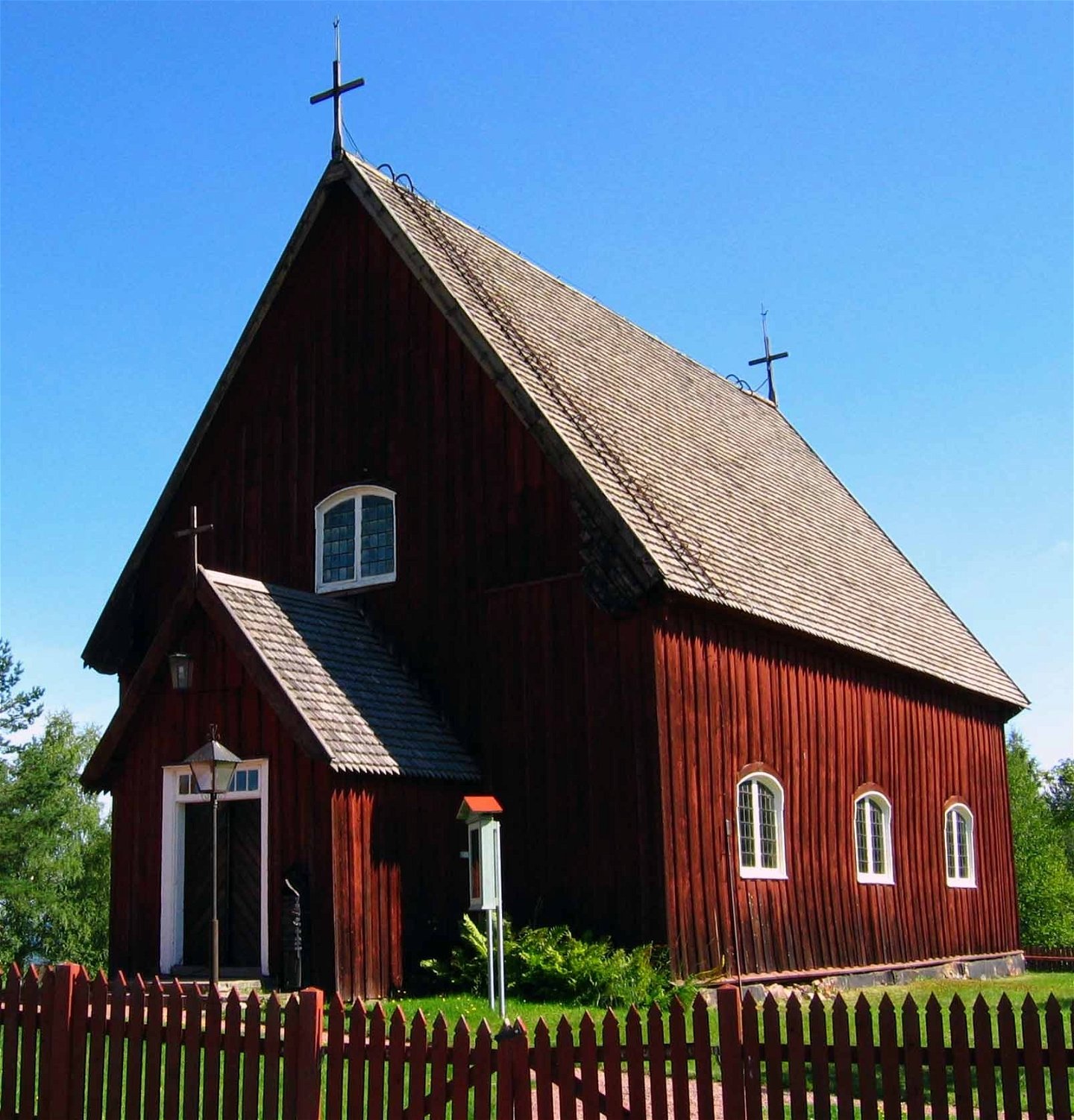
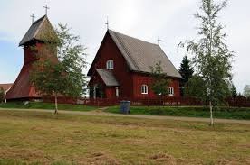
According to old tradition, the chapel existed in Evertsberg (formerly Aeffuersberg) as early as the 13th century, before the Mora church was founded. According to tradition, the origin of the chapel is a severe accident. A rider on his way with scythes in his hoof bags seems to have accidentialy startled the horse to run away. The man fell off and cut himself so badly on the scythes that he died. A sacrificial log was set up at the scene of the accident. People came from far and wide and eventually put so much money into it that a chapel could be built. The processional crucifix above the altar is probably a Swedish work from the end of the 14th century or the beginning of the 15th century.
Evertsberg's chapel is said to have belonged to Ål's church (located south of lake Siljan), which has long been the district church for the people in Österdalarne and the first church built in this part of the country. The current chapel, the third in the order, was probably rebuilt in 1750, a year which is carved into the wall above the door under the gallery and on the wall high above the altar. Another year is also incised, 1521, found on the outside of the outer wall, below the boarded surface. It is the year after Gustav Vasa skied from Mora to Sälen at Christmas time and, according to tradition, passed this village. These years may indicate that material from the old chapel has been used in the rebuilding. Remarkable fixtures from here have been preserved, all from the Middle Ages. A peculiar and very old custom, which still lives on, is that the bells are rung when someone in the chapel team has died. If it is a man, the big bell rings first for a while and then together with the little bell. For a woman, the order is reversed.
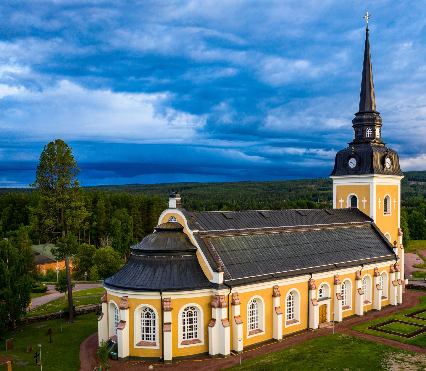
Evertsberg is and has been a large village, located high above the surrounding area, approx. 450 m above sea level, now known as one of the Vasaloppet controls. The local language, Älvdalska, is spoken here as in the other villages of Älvdalen parish. Älvdalska originates from around the 11th century. Many words and grammatical phenomena are the same or similar to Icelandic. The language varies a little between the villages. From Evertsberg or "Bjärre", as the village is called in Älvdalska, the Romboleden goes northeast down to Västermyckeläng (Mycklaingg). Here you pass Älvdalen's New Porphyry Works, established in 1897 with working machines from the old porphyry works. Then the trail goes over the river Österdalälven and further to Älvdalen's church village.
Walk in the footsteps of the pilgrims
Romboleden (Rombo Way) is a pilgrimage route that people began using in the 11th century. The Romboleden is Sweden’s longest pilgrimage route at 900 kilometres long. It starts in Köping in Västmanland and finishes in Trondheim on the Norwegian Atlantic coast. If you walk the entire trail, you will experience a beautiful and varied landscape. You will walk on old chalet paths, over mountains with magnificent vistas and along narrow country gravel roads. You will find easy one-day walks with cafés along the way, and long treks that take several days. The route often passes through small villages.
Would you like to walk with a Pilgrim’s Passport and collect stamps from each stage? The medieval Pilgrim’s Passport allowed a pilgrim to walk in the whole of Europe without being stopped by rules or boundaries. These days it is just a nice memento. The Pilgrim’s Passport can be collected at several stage starting points and from the web page of Rombo Way.
Gerelateerde evenementen
Activiteiten en faciliteiten
-
Hiking
-
Pelgrimspad
Feiten
Toilet and drinking water at the chapel and church.
Accommodation is booked via Visit Dalarna.
Oppervlakte
Gravel roads and forest paths.
Heuvels
Hilly terrain with some steeper sections.
Parkeren
Parking at Evertsberg's Chapel and Älvdalen Church.
Communicatie
Public transport Dalatrafik
Routebeschrijving
The nearest bus station for the start of the stage is the Evertsberg kapellet, 2 minutes' walk to the chapel.
The nearest bus station for the end of the stage is Älvdalen Älvdalsskolan, 1 minute's walk to the church.
Regelingen
As a hiker, you are responsible for finding out about any local regulations, paying attention to traffic and showing consideration for others who share the trail with you.
Whenever you visit Swedish nature you have a Right to public access. Read more about it here.
As a hiker you are sometimes walking in protected nature with specific rules and regulations. You are responsible for making sure you are following the rules. You can read more about it at the Swedish Environmental Protection Agency and the County Administrative Board.
Remember to only start camp fires in established barbecue areas and ensure that there is no fire ban in your area.
Remember that you are hiking on someone else's land and that rational agriculture or forestry may occur along the trail.
Downloads
Houd er rekening mee dat sommige teksten automatisch zijn vertaald.
Vragen en antwoorden
Stel een vraag aan andere Naturkartan gebruikers.


