

Rundslinga Göljestigen
Vaellusreitit
- Kunta: Örebro län
- 7587.37 km päässä sinusta
Polun yksityiskohdat
- Pituus 5.2 km
Toiminnot
Kuvaus
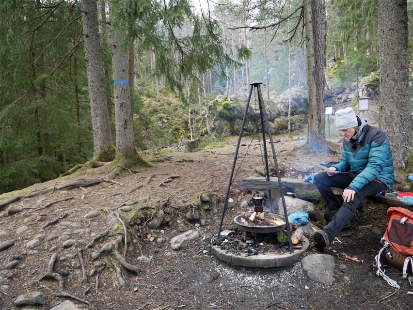
Along certain sections of the trail you follow the Göljebäcken stream, but also passing another stream, Per-Alriks bäck, and Lake Göljan. There are several resting places with fire places. The trail takes you past a distinctive pebble and boulder-strewn area formed during the Ice Age. Marked with blue symbols, the trail links up with Stage 9. A section of the trail accessible to less mobile visitors starts in the car park and has two resting places along the way.
Toimintaa ja tilat
-
Vaellusreitit
-
 Löpning
-
 Trailrunning
-
 Rundslinga
Saavutettavuus
-
 Nära parkering
-
 Nära toalett
-
 Barnvagnstillgängligt
-
 Rullstolsvänligt
Faktat
Accessible part of the trail
From the parking lot it is about 120 meters to an adapted picnic area where there are benches, a fireplace and firewood. Here you can cook over an open fire and enjoy the nature around the rest area.
If you want to go further, it's about 300 meters to a shingle field - an attraction and a natural phenomenon - created during the Ice Age. There is a place with benches to catch your breath and more information about how the shingle field was created and ended up right here, in Kilsbergen.
Reittiohjeet
Drive towards Närkes Kil. Turn off at sign "Frösvidal 8". In Frösvidal, turn right at the Y-junction towards Blackstahyttan/Gårdsjötorp/Lövbrickan. After approx. 200 m turn left up towards Göljestigen, then follow the signs to Göljestigen and P-Lövbrickan.
Lataukset
Ota yhteyttä
Sähköpostiosoite
Johan Karlström
Organisaation logotyyppi
![]()
Huomaa, että osa näistä teksteistä on käännetty automaattisesti.
Kysymykset & vastaukset (Q&A)
Esitä kysymys muille Naturkartan-käyttäjille.
