

Rundslinga Göljestigen
Wędrówki piesze
- Województwo: Örebro län
- 7587.37 km od Ciebie
Szczegóły dotyczące szlaku
- Długość 5.2 km
Akcje
Opis
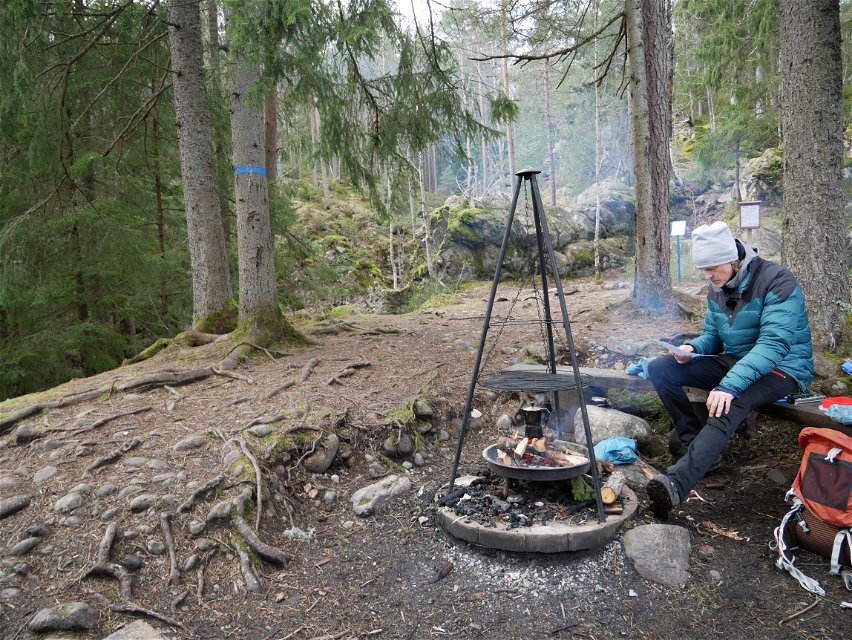
Along certain sections of the trail you follow the Göljebäcken stream, but also passing another stream, Per-Alriks bäck, and Lake Göljan. There are several resting places with fire places. The trail takes you past a distinctive pebble and boulder-strewn area formed during the Ice Age. Marked with blue symbols, the trail links up with Stage 9. A section of the trail accessible to less mobile visitors starts in the car park and has two resting places along the way.
Działania i udogodnienia
-
Wędrówki piesze
-
 Bieganie
-
 Bieganie szlakami
-
 Rundslinga
Dostępność
-
 Blisko parkingu
-
 Blisko toalet
-
 Dostęp dla wózków dziecięcych
-
 Dostęp dla wózków inwalidzkich
Fakty
Accessible part of the trail
From the parking lot it is about 120 meters to an adapted picnic area where there are benches, a fireplace and firewood. Here you can cook over an open fire and enjoy the nature around the rest area.
If you want to go further, it's about 300 meters to a shingle field - an attraction and a natural phenomenon - created during the Ice Age. There is a place with benches to catch your breath and more information about how the shingle field was created and ended up right here, in Kilsbergen.
Wskazówki dojazdu
Drive towards Närkes Kil. Turn off at sign "Frösvidal 8". In Frösvidal, turn right at the Y-junction towards Blackstahyttan/Gårdsjötorp/Lövbrickan. After approx. 200 m turn left up towards Göljestigen, then follow the signs to Göljestigen and P-Lövbrickan.
Pliki
Kontakt
Adres e-mail
Johan Karlström
Logotyp organizacji
![]()
Należy pamiętać, że niektóre z tych tekstów zostały przetłumaczone automatycznie.
Pytania i Odpowiedzi
Zadaj pytanie innym użytkownikom Naturkartan.
